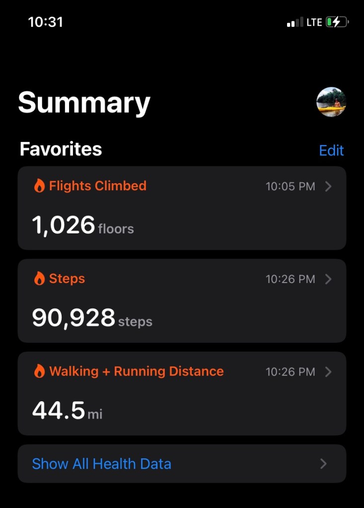
44.5m 10,788ft gain
Ancestral homelands of the: Cascades, Warm Springs, Grand Ronde & Siletz
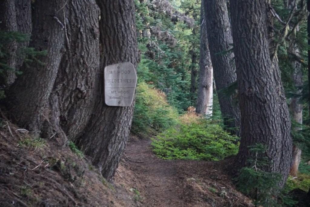
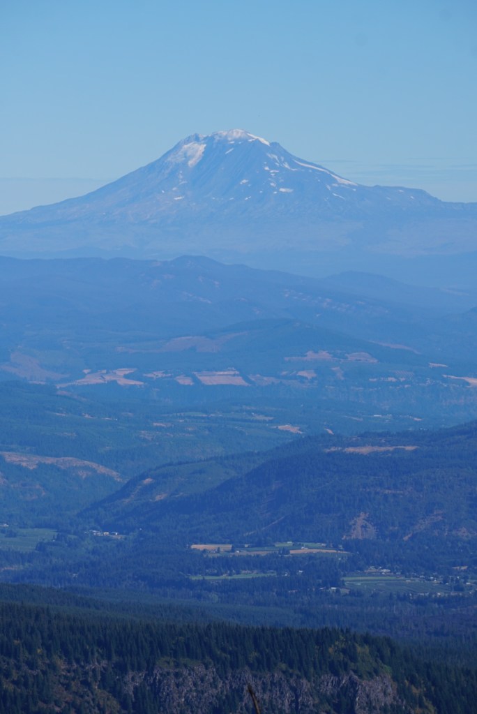
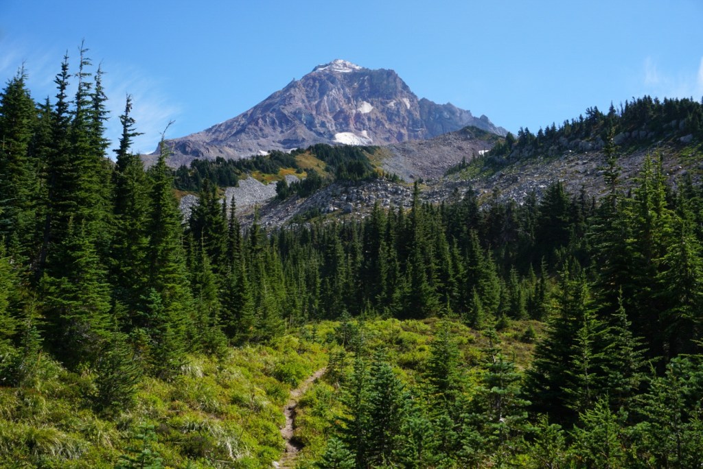
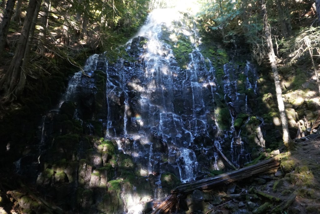
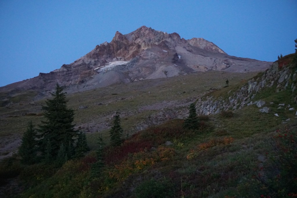
The Timberline Trail, like the Loowit Trail around Mount St. Helens, circumnavigates Mount Hood (Wy’east) at or near the tree line. The National Historic Trail was built in the 1930’s by the CCC. The loop covers 40+ miles while gaining and losing over 10,000ft. All that elevation change is spent climbing in and out of massive canyons carved by glaciers and their drainages. The hike can be completed in one ambitious day or across multiple days camping in designated spots. Summiting Hood and hiking around Hood are equally impressive feats. A summit bid requires more technical expertise and the loop requires more endurance. Both trips require precise preparation. On the Timberline the reward is ever changing views of Oregon’s highest peak (11,249ft) and an amazing sampling of the Cascade’s greatest hits! That includes lush old-growth forests, mesmerizing waterfalls and cascades, wildflower filled meadows, towering craggy glaciers, rough volcanic landscapes and views of big beautiful volcanic neighbors in Oregon and Washington.
1st Trip: 9/11/22
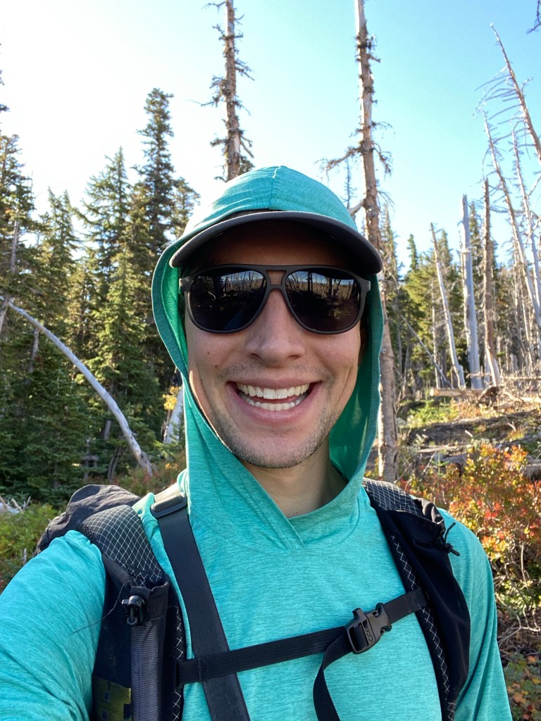
One month after hiking the Loowit trail in a day, achieving new daily personal records, I decided to go even bigger with a day hike of the Timberline Trail. Similar to that circumnavigation I packed as if I was camping one night but once again I was able to extend my daily PR’s and finish in one long day! Stats below:
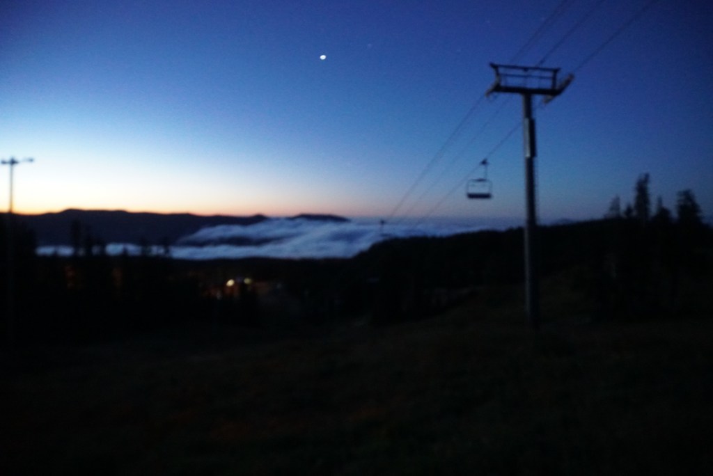
Friday night I drove up to the historic Timberline Lodge and slept in my truck until 4am. By 4:20am I was on the trail heading counterclockwise. The first mile descends 1,000ft along a sandy ridgeline to the White River. This is the most difficult crossing along the trail but even in the dark I was able to find a dry way across. You gain 1,000ft over the next 2 miles and pass through Hood Meadows ski resort. Above the lifts were a blanket of stars!
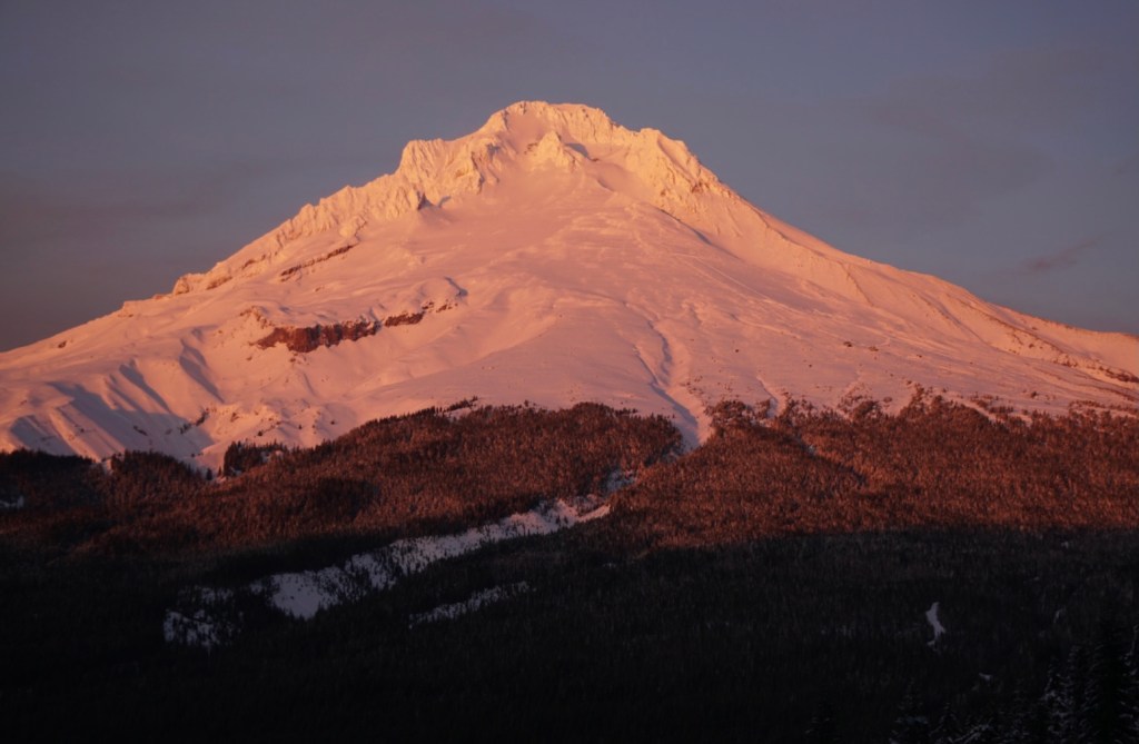
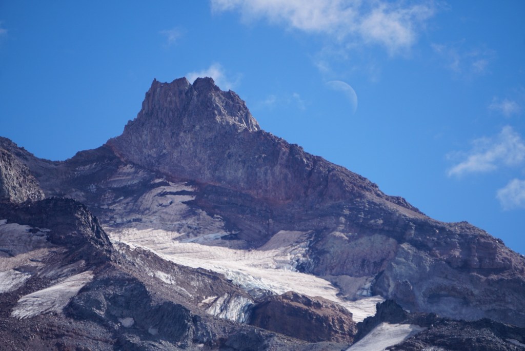
Thankfully there was no smoke today so Hood was as clear as can be!
The headlamp was off by 6am.
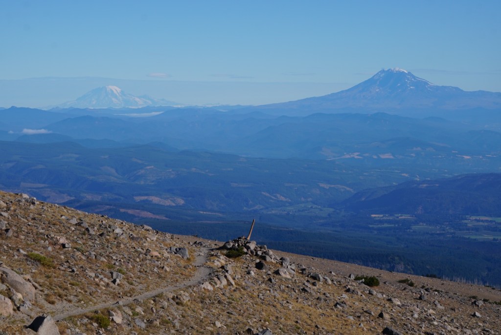
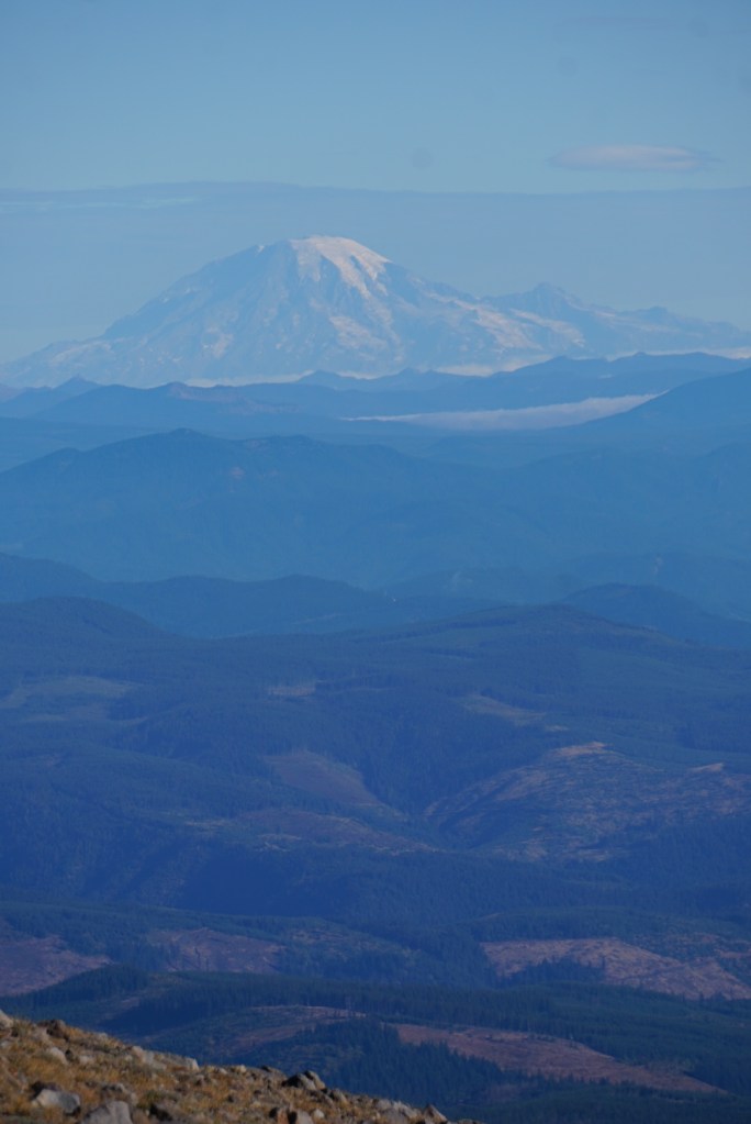
As I gained elevation Mount Jefferson, Oregon’s second tallest peak, appeared.

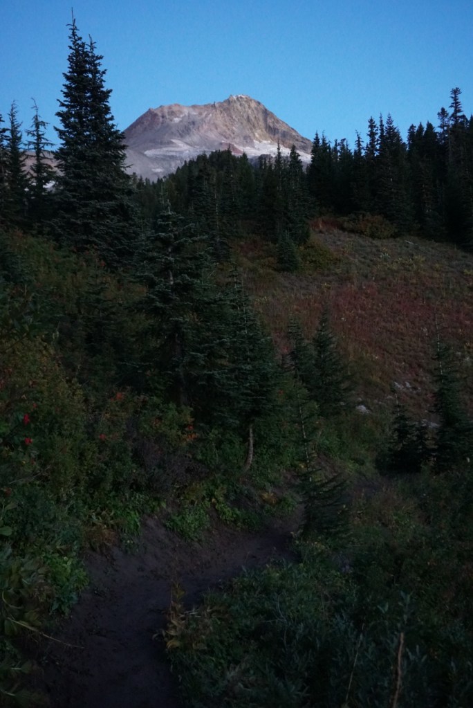
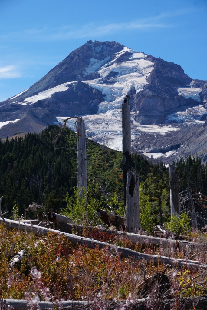
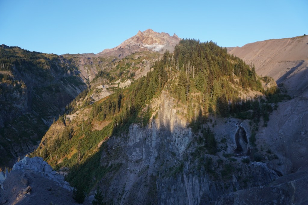
Crossed Clark Creek then Newton Creek while the sun blasted Mount Hood.
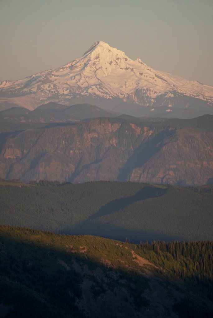
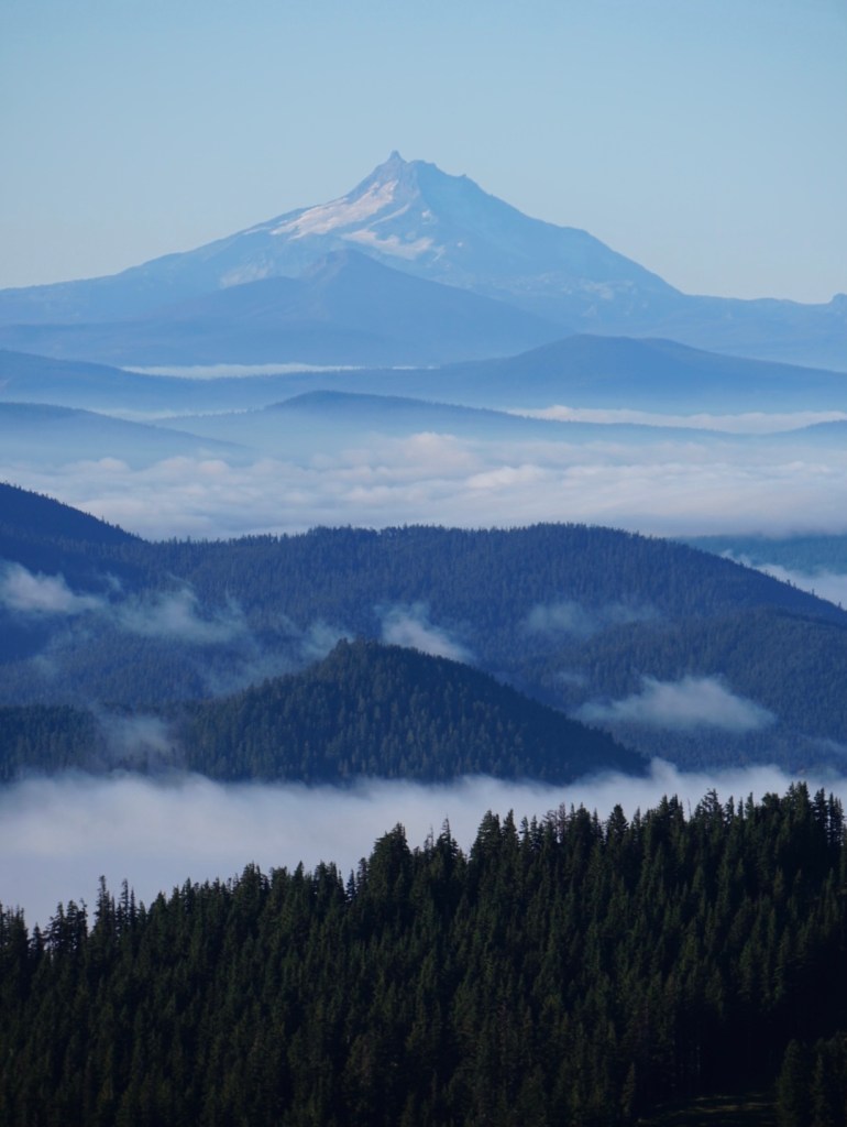
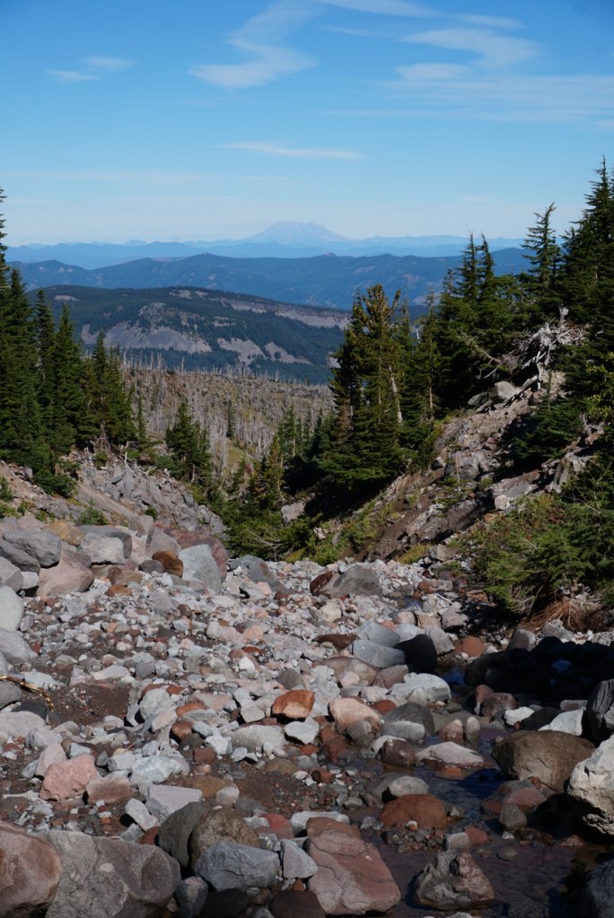
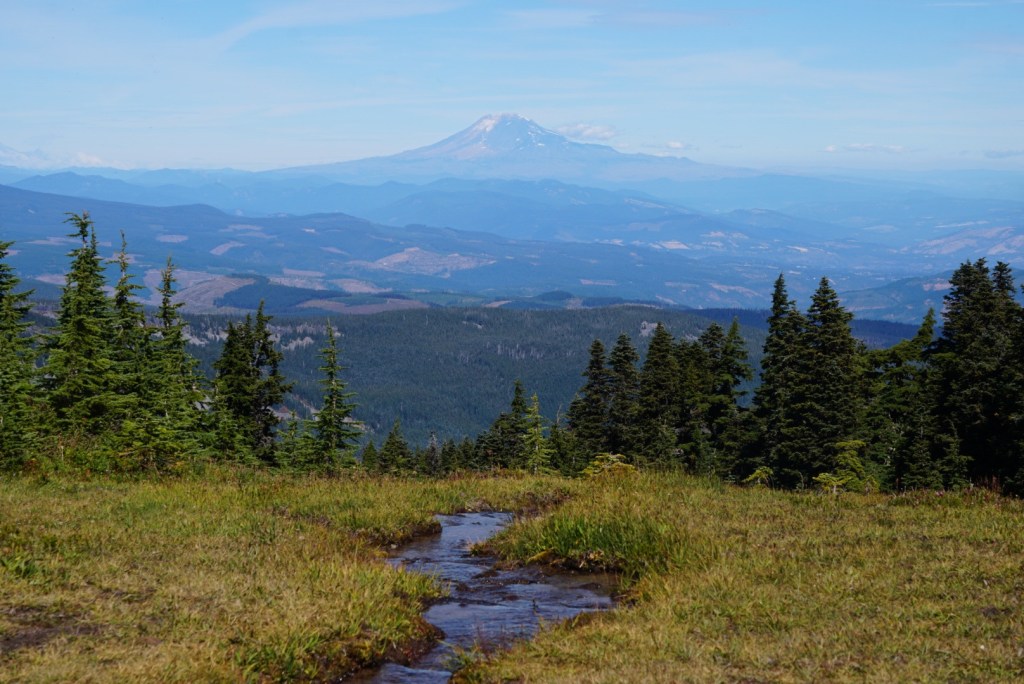
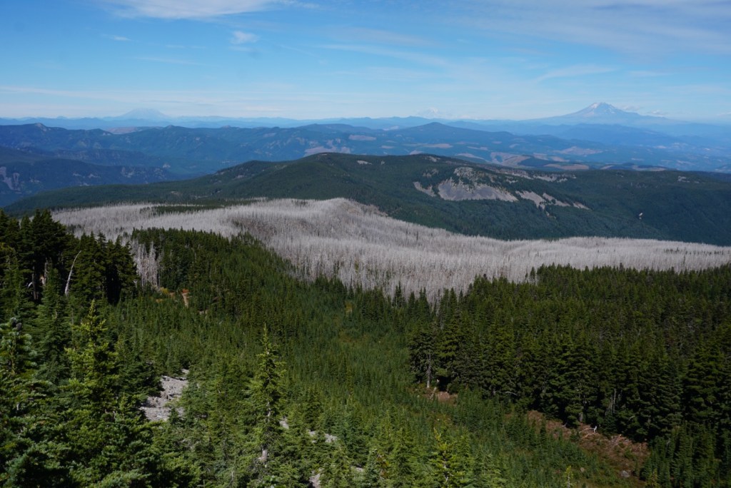
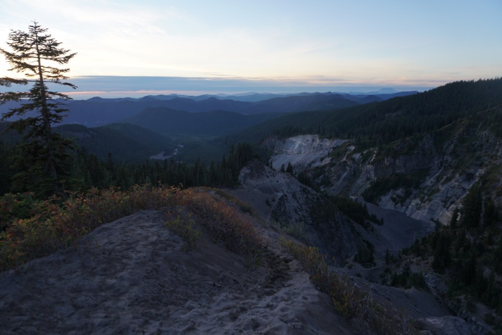
After hiking out of the Newton Creek Canyon there was a beautiful cloud inversion to the South with Jefferson and the Three Sisters towering above.
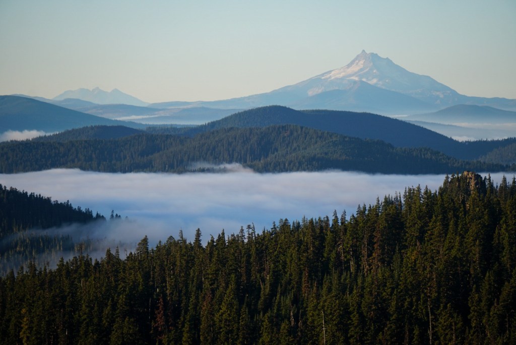
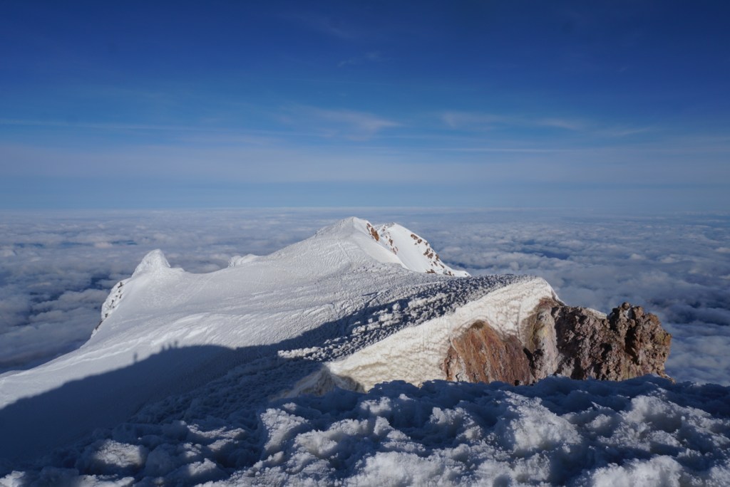
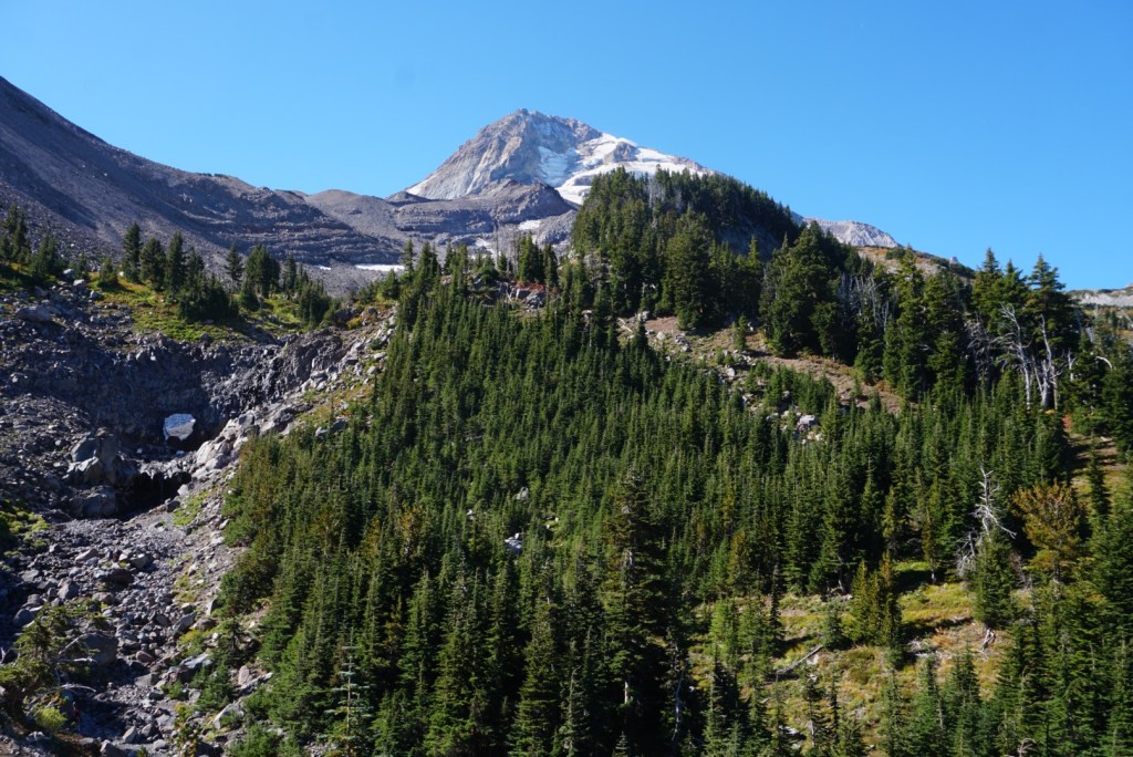
Big views of Mount Hood opened as I ascended Gnarl Ridge.
10 miles in I passed a group of runners and figured it was time to take my first break. I also took a short side trip up Lamberson Butte to make this a peakbagging endeavor!
From here to Cooper Spur is an amazing stretch of trail and the conditions couldn’t have been better!
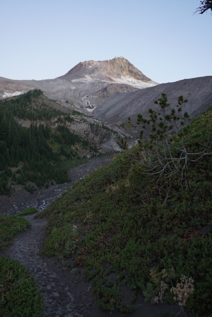
1 mile down from Copper Spur is the Cloud Cap Trailhead. From there I’d drop into a canyon to cross Elliot Creek. I watched a group wade through the water using the fixed rope but I found a mostly dry way to rock hop across only 20 yards upstream.
After 15 miles I already had sore hips but was feeling great overall!
The next 4 miles took me to the Elk Cove Camp on the north side of the mountain.
Filled up water at Compass Creek and had enough service to talk on the phone with my Mom!
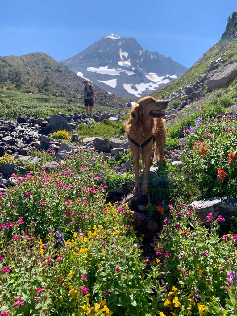
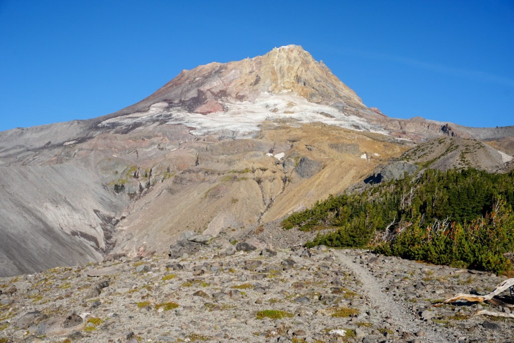
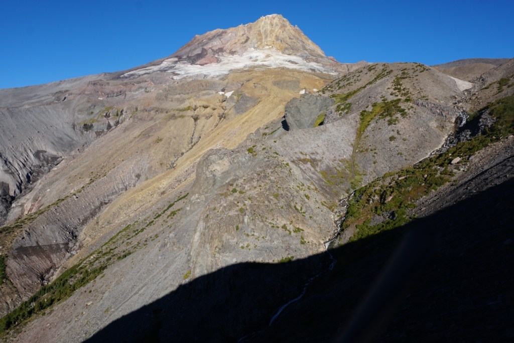
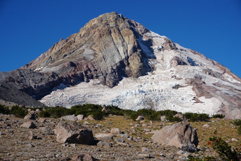
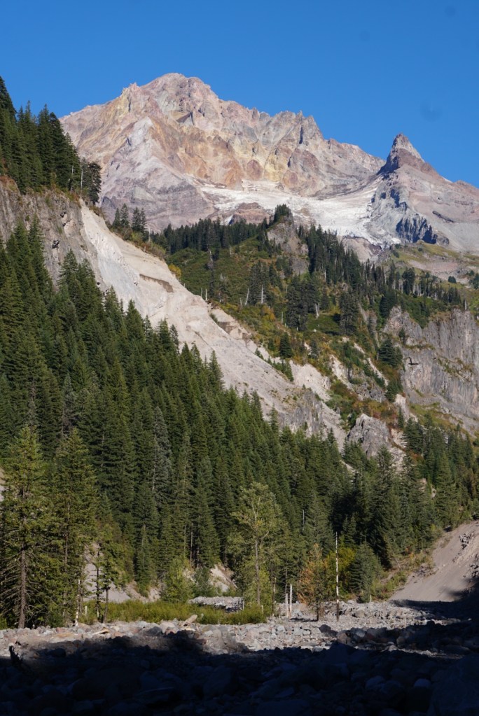
I loved the view of the Coe Glacier. Had a little lunch here and questioned whether I’d go the distance. The legs were barking and it was starting to get warm.
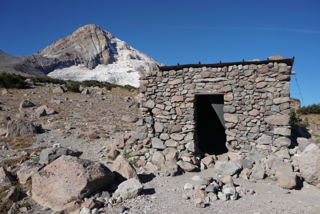
Past Elk Cove Camp was the Cairn Basin Shelter followed by the McNeil Point trail intersection.
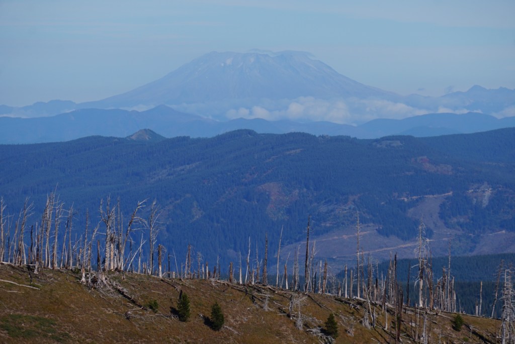
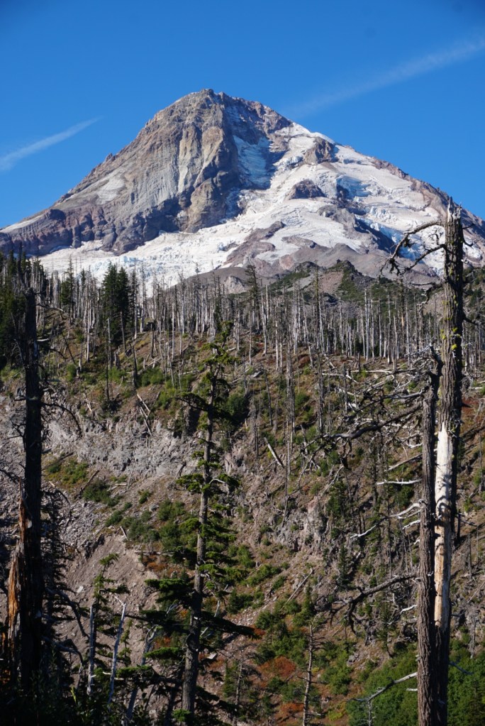
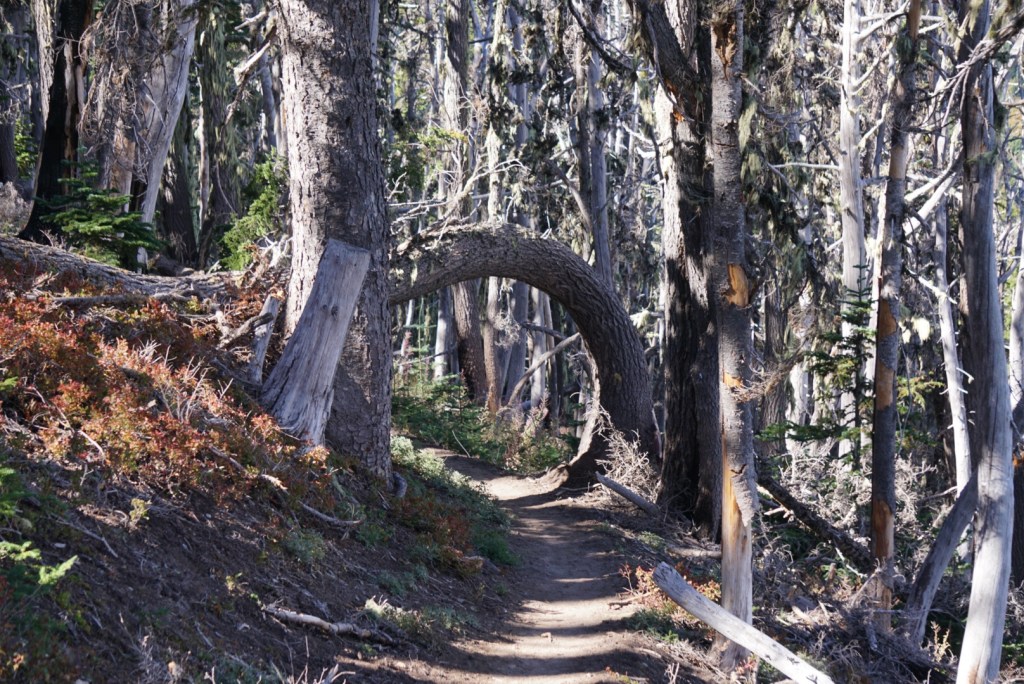
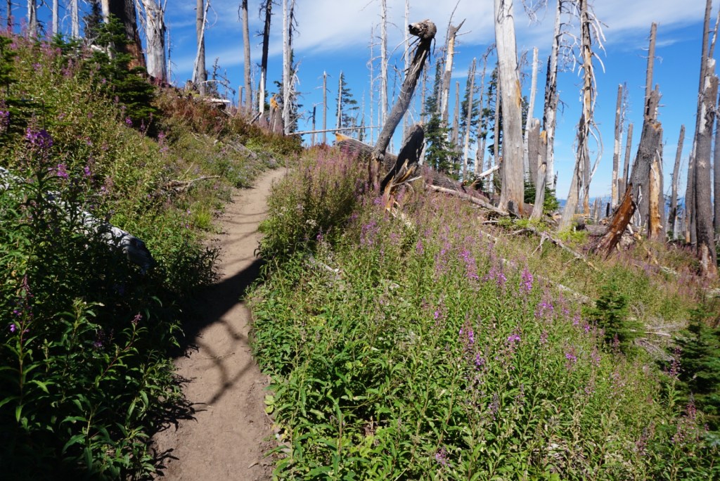
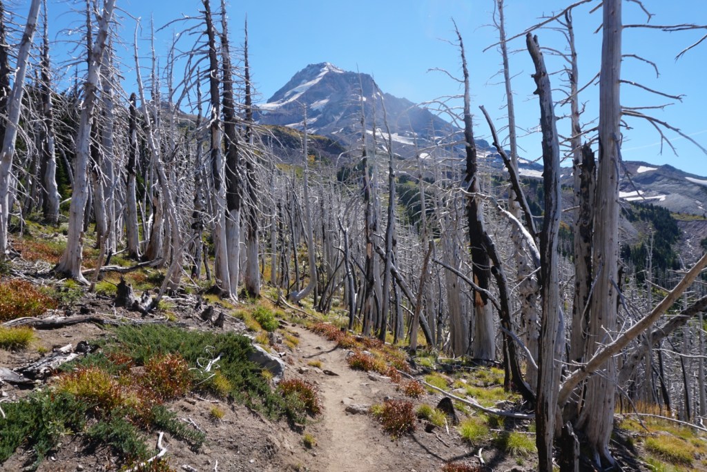
There are a lot of burned trees around here.
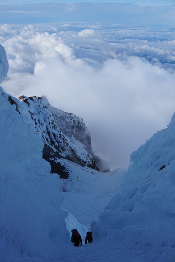
I hadn’t seen many people for a Saturday but the McNeil Point section made up for that. Luckily that also meant plenty of dogs to say hi to!

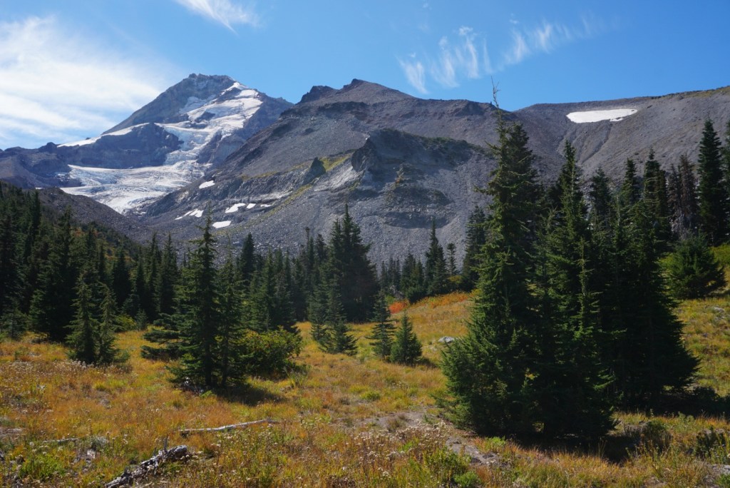
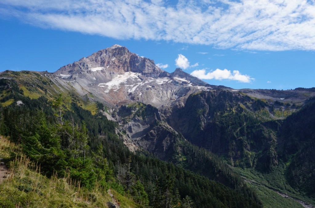
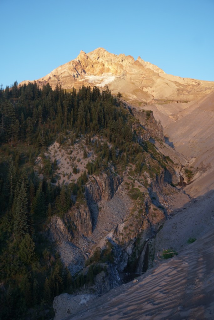
I was constantly looking back at Hood while descending Bald Mountain Ridge. This view including Illumination Rock, the Sandy Glacier and its headwall are amazing!
After 4.5 miles of downhill I reached Ramona Falls. A washout made this a slightly longer side trip. I’m always impressed by the reroute work the PCTA does. Almost half the trail coincides with the PCT so you know it’s properly maintained.
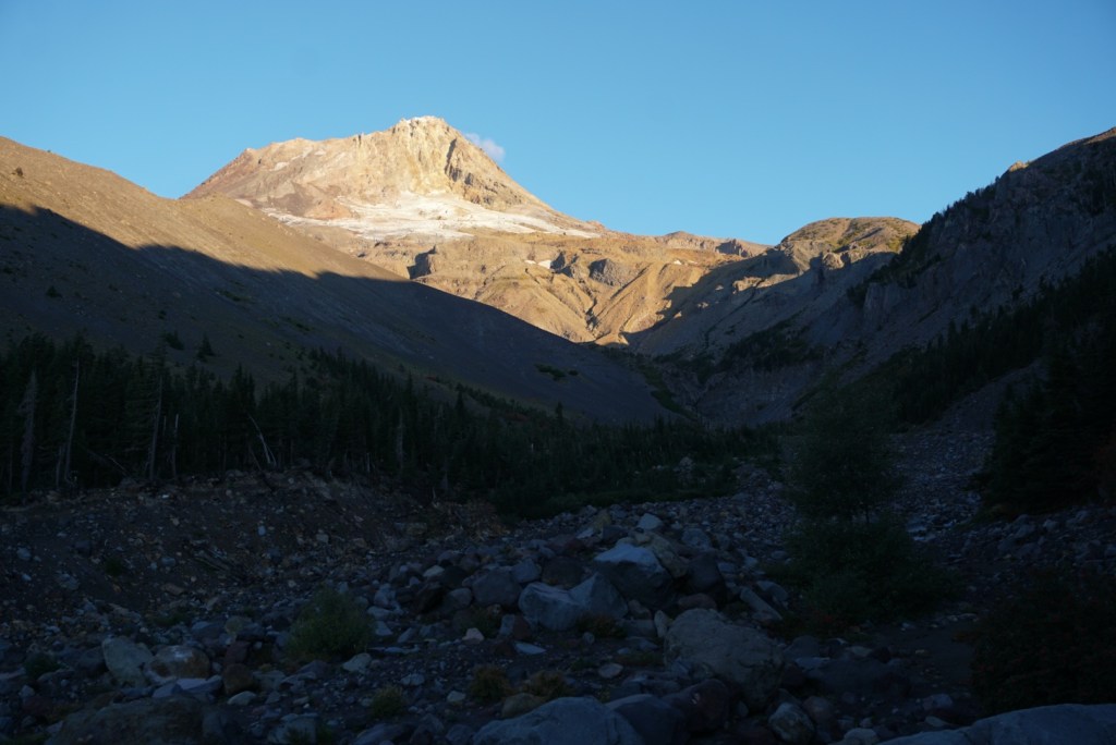
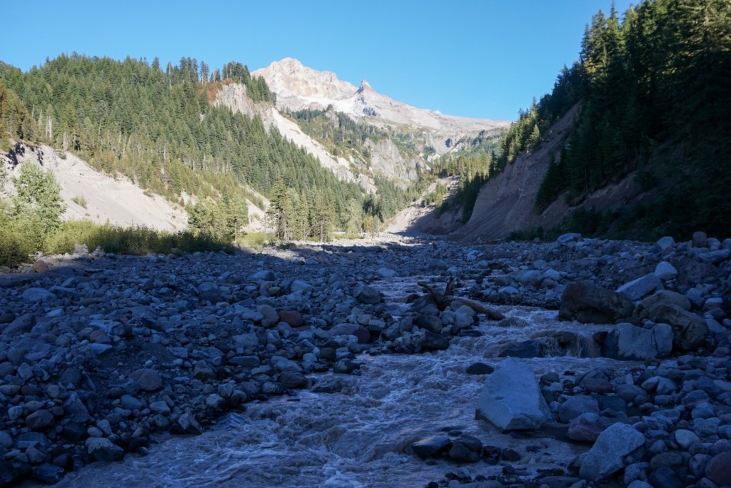
The flat and downhill sections of trail killed my legs but thankfully there was plenty of elevation gain ahead. I first had to hop over the Sandy River.
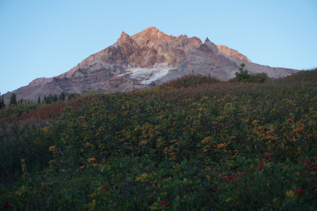
It was 5:30pm, 32 miles in, and the view was glorious so I took my longest break of the trip to stretch, fill up my water and have dinner. There were a few nice campsites close by.
The next 4 miles gradually gained 2,500ft to the Paradise Loop Trail junction. My feet, knees and thighs hurt but I enjoyed the uphill action because my shins and hips were given a moment of relief.
During the uphill stretch I took a shortcut through a low alpine meadow to the edge of the Paradise Branch Canyon for a sweeping view of Mount Hood, the Reid Glacier and the Paradise Branch waterfalls. All basking in the setting sunlight.
The shortcut took a lot out of me because of the sand but I continued up a few hundred feet to some awesome campsites where I’d make my final decision to camp or push through.
It’s always a good day when you can watch the sun rise and set.
By 8pm, at mile 37, I was 7 miles from completion so I figured I’d go for it. I’d be more sore the next day anyways.
The first 3 miles of night hiking took me to the Zigzag River, my last major river crossing and the last deep canyon to tangle with. I’ll have to come back to see the impressive view from the Zigzag Canyon rim. To my liking the final 3 miles to the Timberline Lodge gained 1,200ft but I thought my shins were going to snap during the last downhill steps to the truck. I may have been hurting but that was 18 hours well spent!! You never know how much your little feet can accomplish until you push yourself!

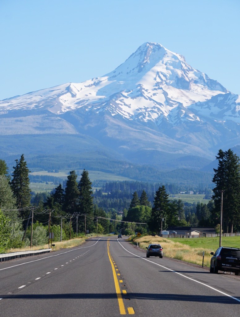
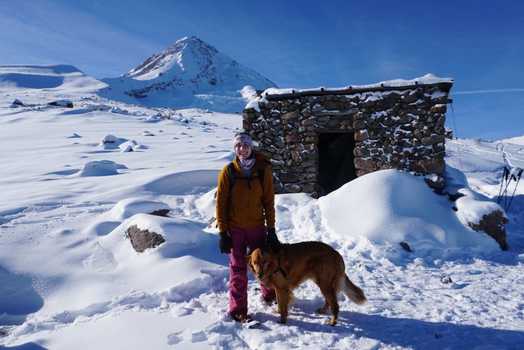
We enjoyed a leisure day around Mount Hood the following weekend! My next long distance hike will be the Mount Adams Circumambulation and then the Wonderland Trail around Mount Rainier!

GRANT, THIS HIKE WORE ME OUT. NEXT TIME KEEP THE TRIP TO JUST 8 HOURS WILL YOU?
>
LikeLiked by 1 person
I can’t make any promises!
LikeLike
Beautiful photography, especially the Sandy River. You are amazing Grant.
LikeLiked by 1 person
Thank you!
LikeLike