Summit: 2,797ft
12m 3,500ft gain
Ancestral homelands of the: Hohokam
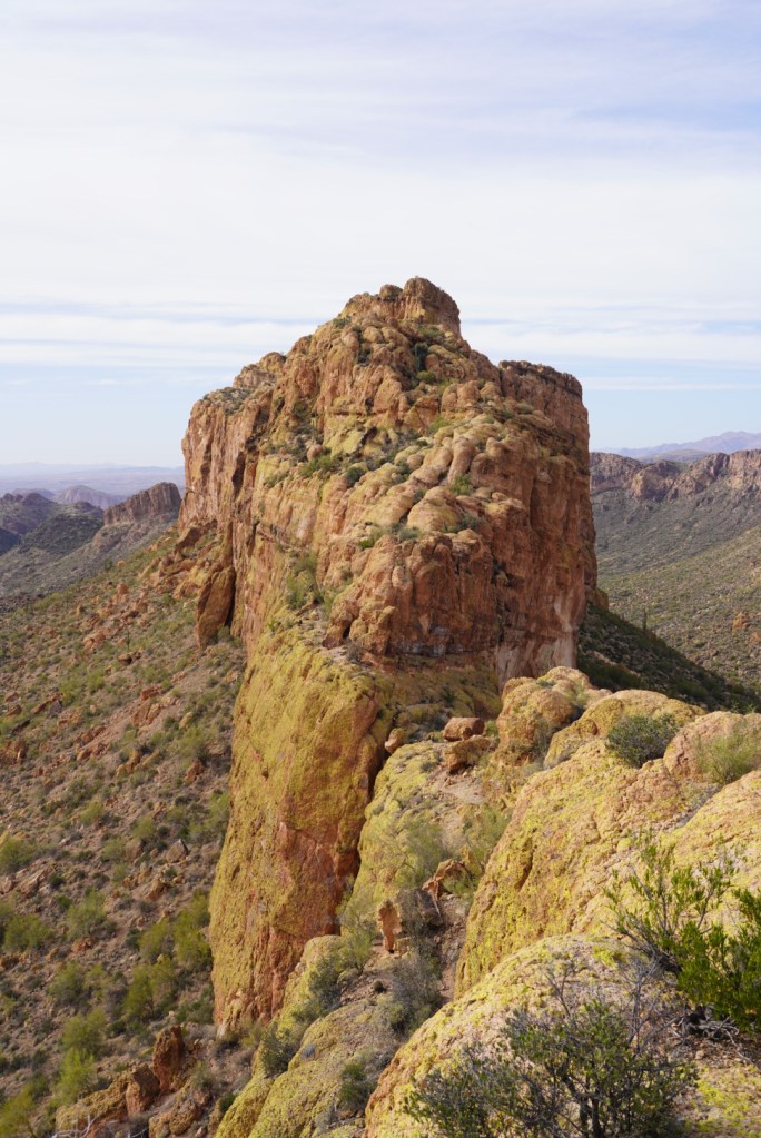
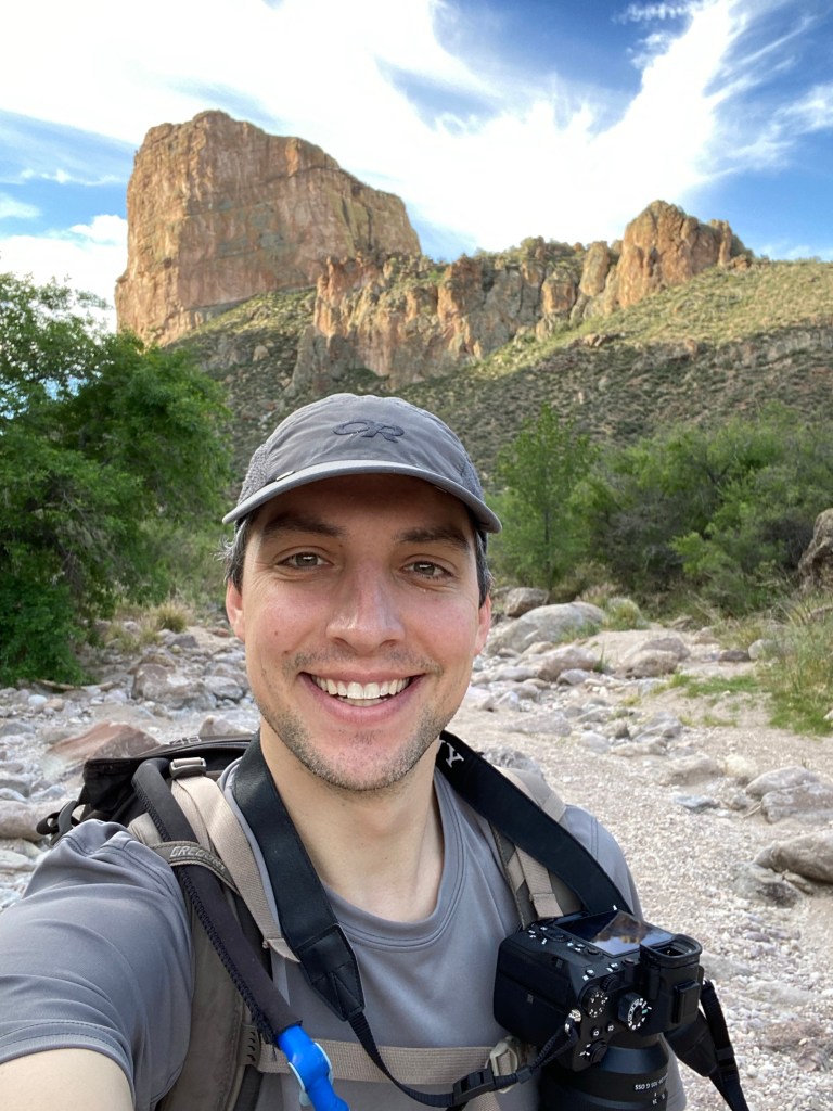
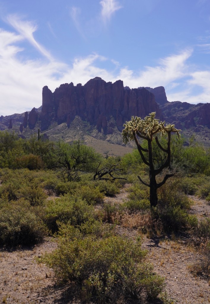
It’s easy to tell why Battleship Mountain was given its name. It really looks like a desert warship both from afar and from its summit. The small but imposing mountain is tucked away in the Superstition Wilderness, surrounded by a sea of dramatic peaks and desert flora. The Superstitions are one of the most rugged ranges in Arizona with deep canyons and towering rock spires. It’s the perfect playground for hikers and climbers. Battleship Mountain offers an incredibly fun scramble on a mile long fin of volcanic rock with steep drop offs on both sides. There’s a good amount of route finding, exposure, heat and cacti so only step aboard the Battleship if prepared.
1st Trip: 1/15/22
I had a family get together planned for Easter weekend so I flew into Phoenix, Arizona a day early to sneak a hike or two in. My plan was to hike Battleship Mountain Friday, drive 3 hrs to Flagstaff to disperse camp and hike Humphreys Peak, the highest peak in AZ, early Saturday morning. 60+ mph winds on Humphreys squashed that idea. So instead of pushing myself to the extreme I planned to take my time and spend the night on top of Battleship Mountain.
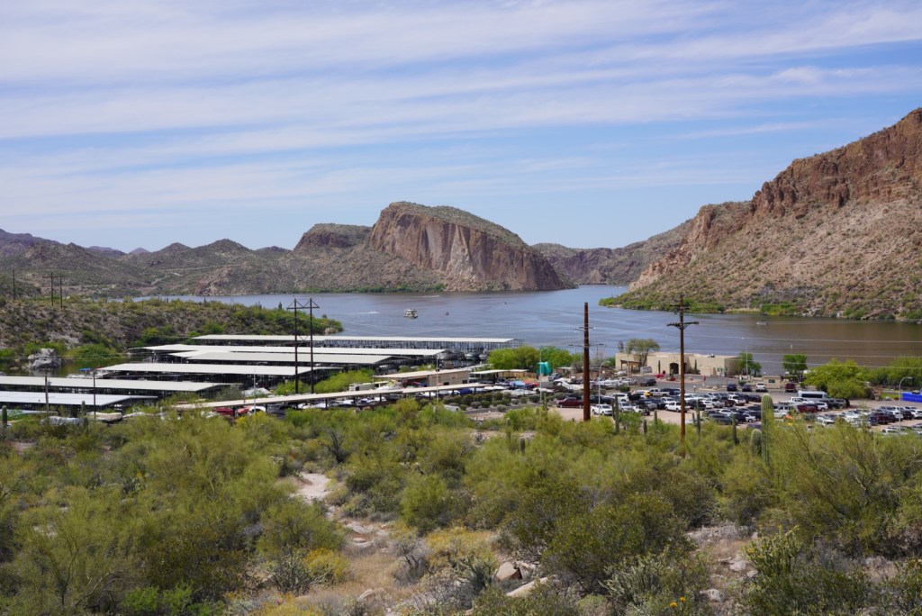
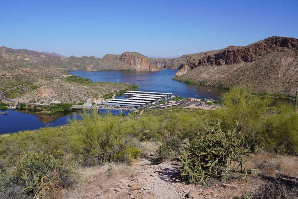
The day started at 3am to bottle feed my son then wait for an Uber. Right before the pick up time my flight was delayed 5 hours so I stayed home and was able to change my flight so I wasn’t so delayed. As a bonus I got to feed Leo one more time! I slept the entire flight in a middle seat and was smart to pick a tiny economy car as there was a huge line for any other car. After a few stops I was parked at the Canyon Lake Marina in one of the 10 spots designated for the Boulder Canyon Trail. The windy Apache Trail road was super fun in my little golf cart car and very scenic.
I started the hike in the heat of the day at 1:20pm and was spewing sweat by 1:30pm. In the same amount of time I went from being extremely hydrated to dehydrated. Desert heat is like no other.
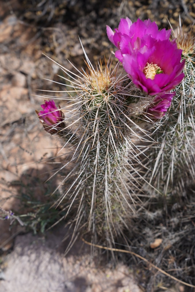
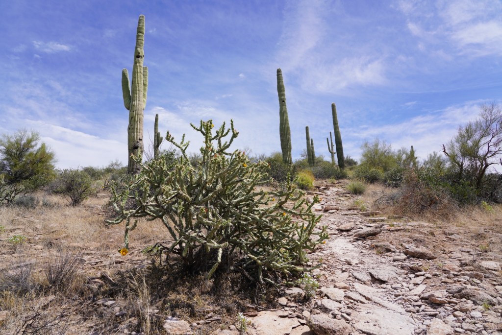
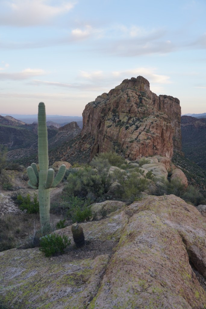
There are all kinds of beautiful cacti for distractions.
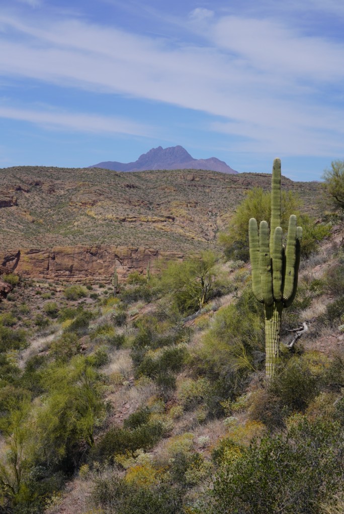
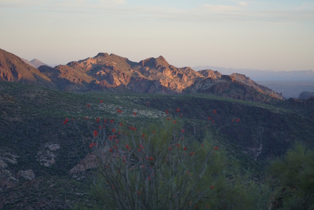
Four Peaks Mountain in the distance.
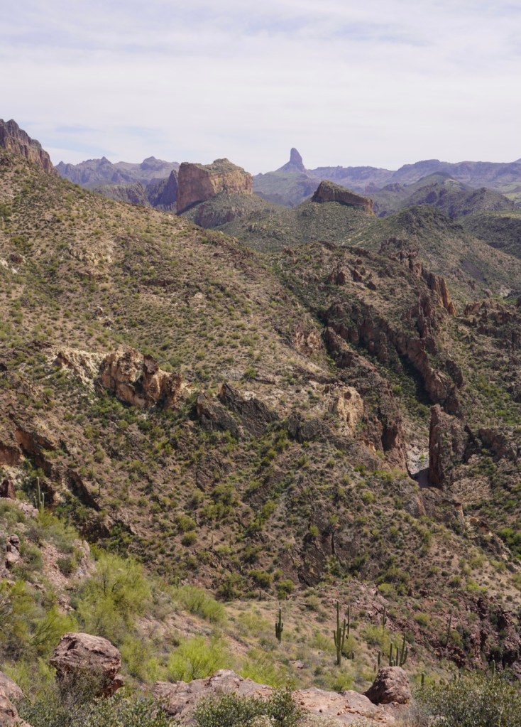
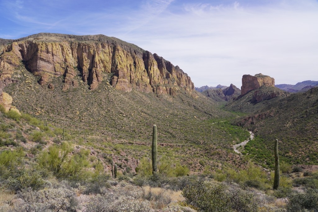
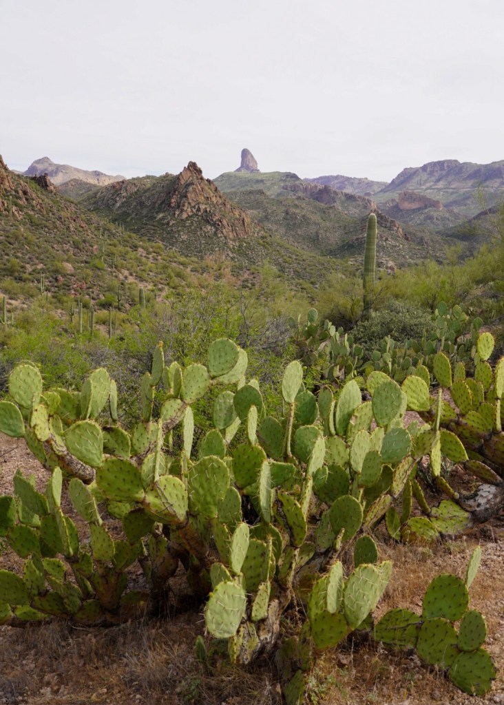
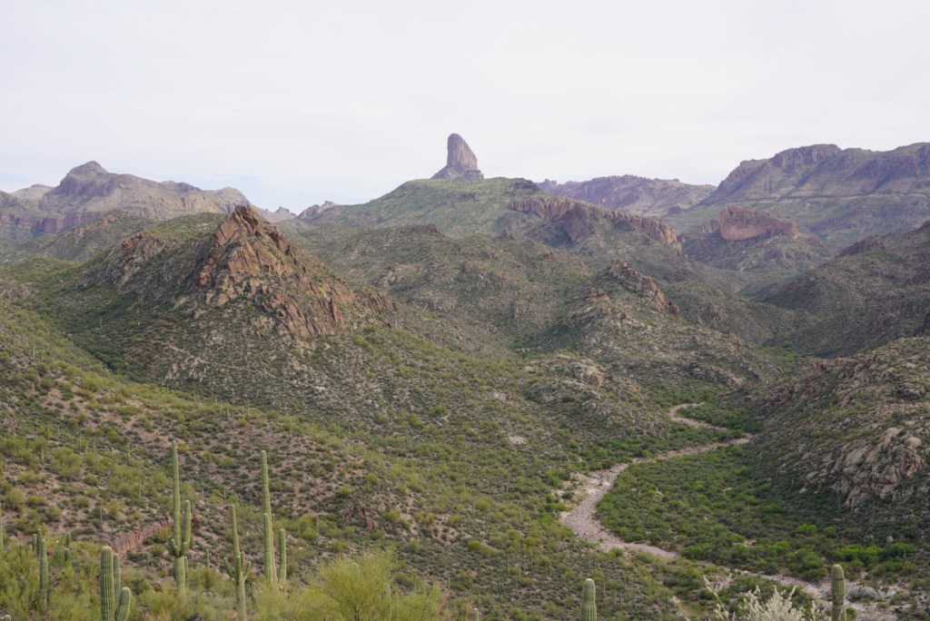
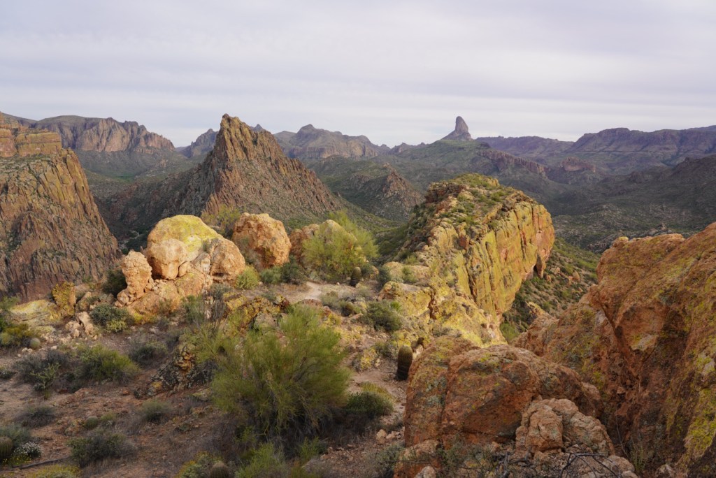
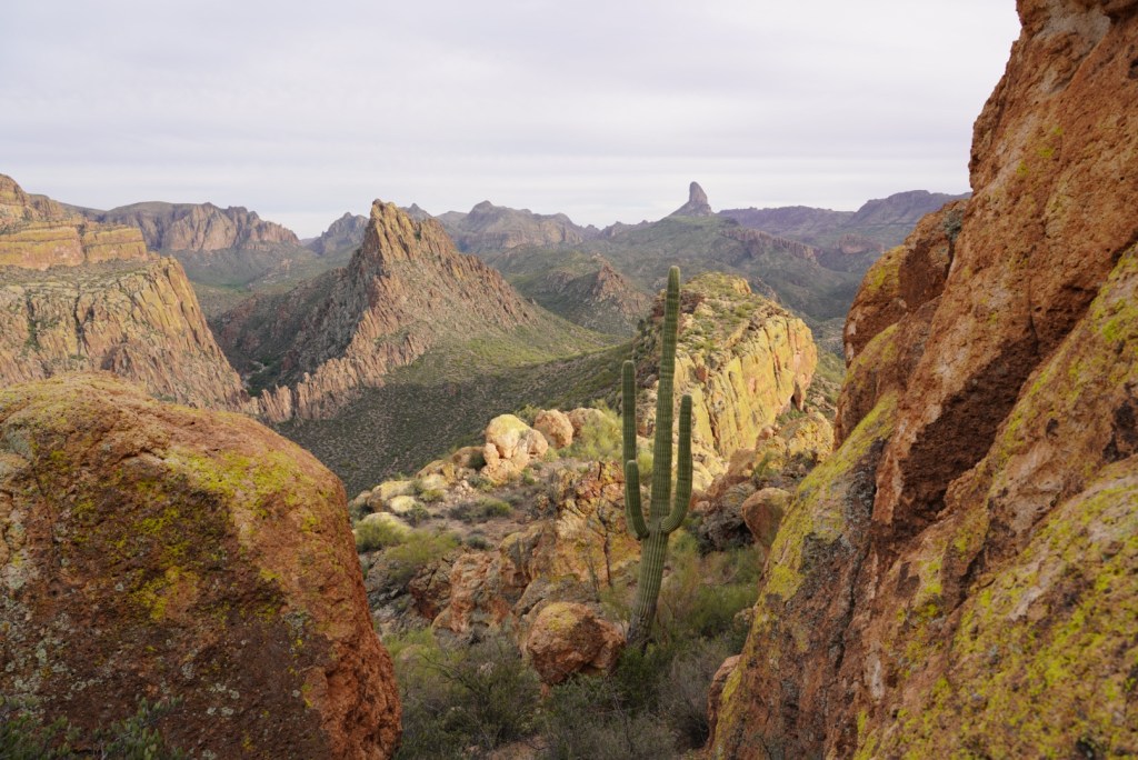
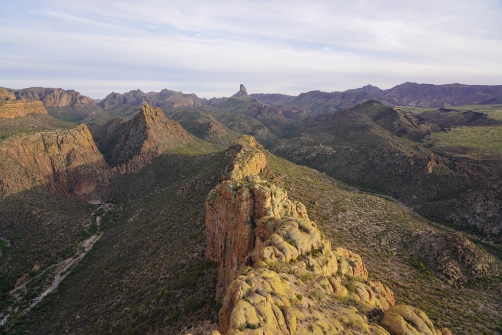
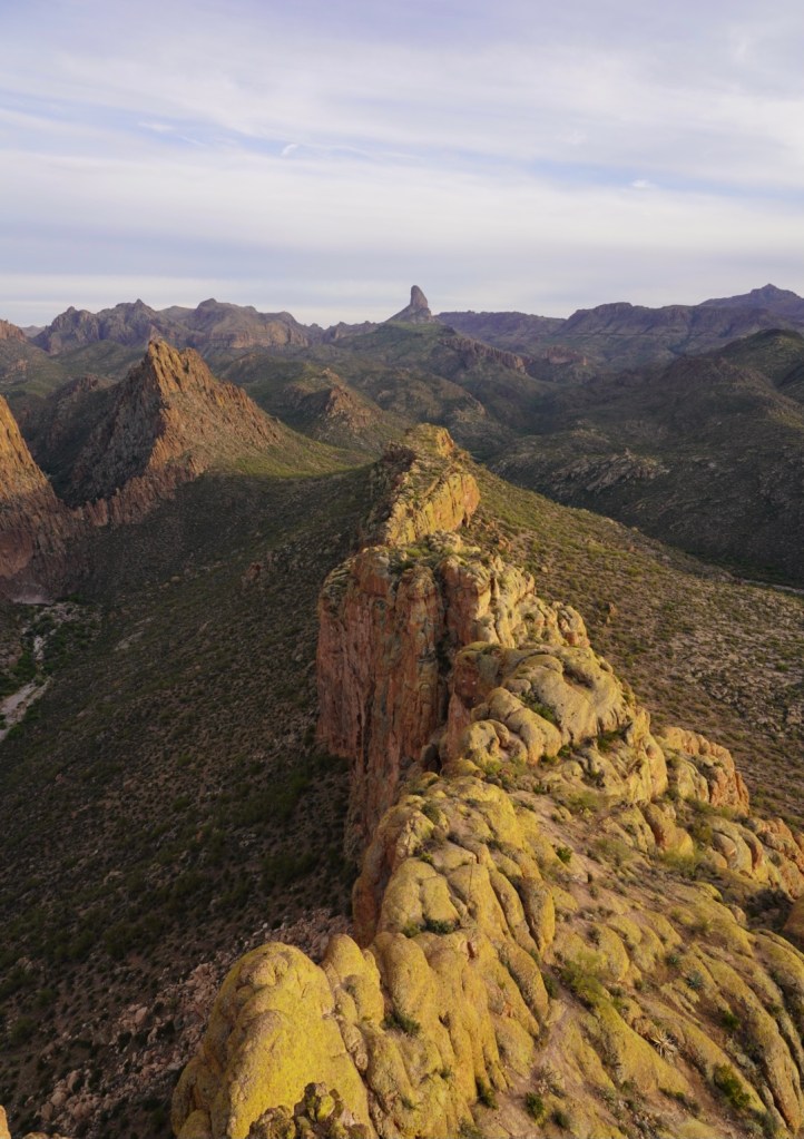
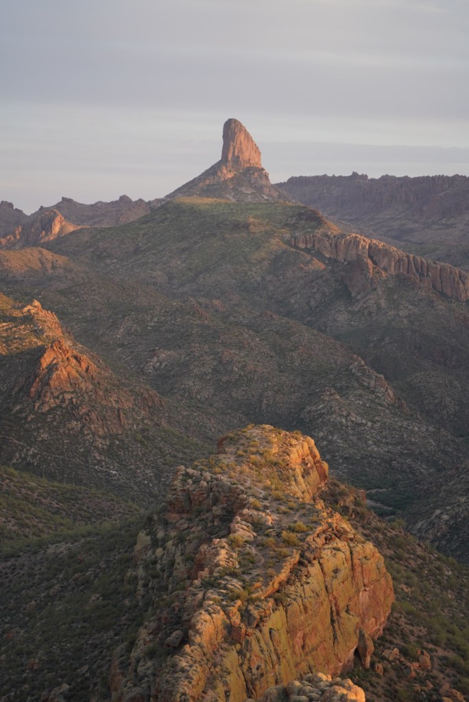
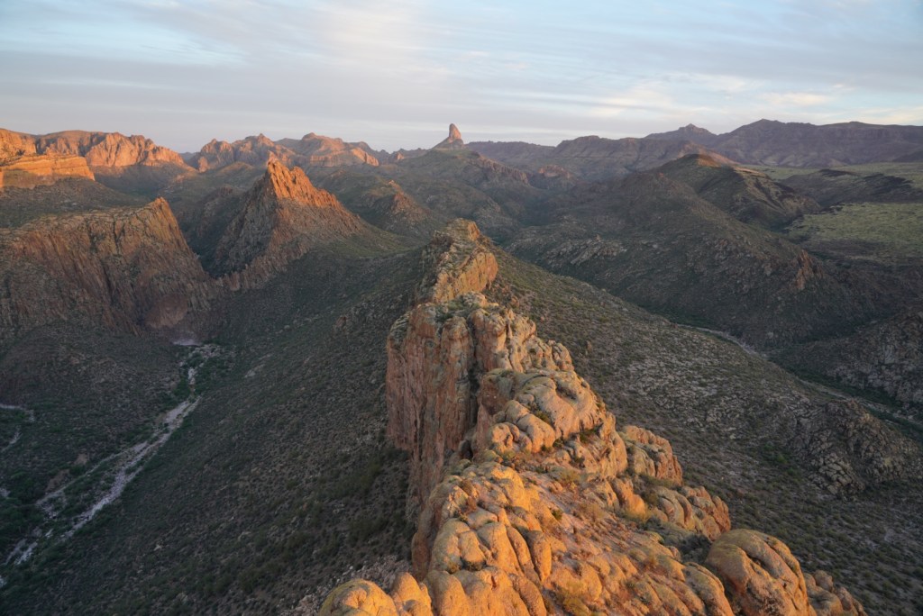
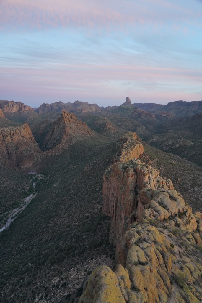
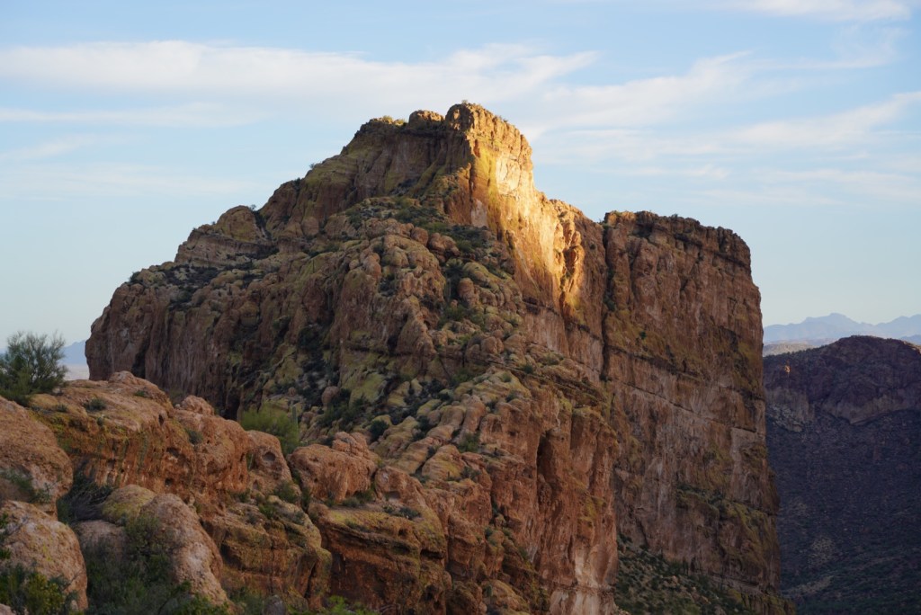
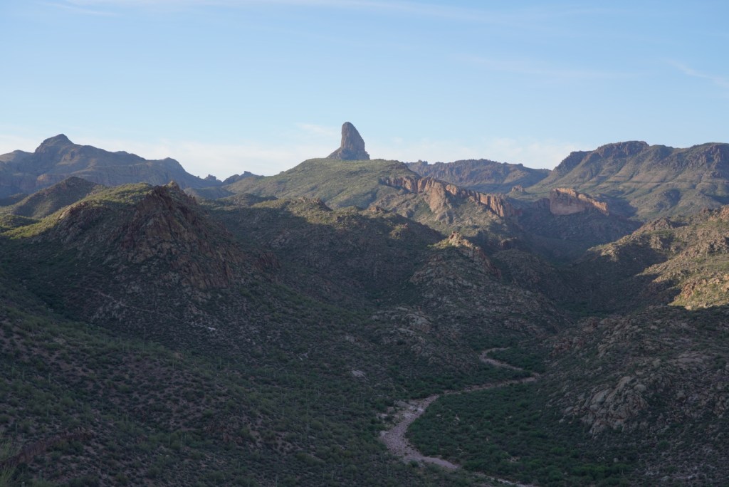
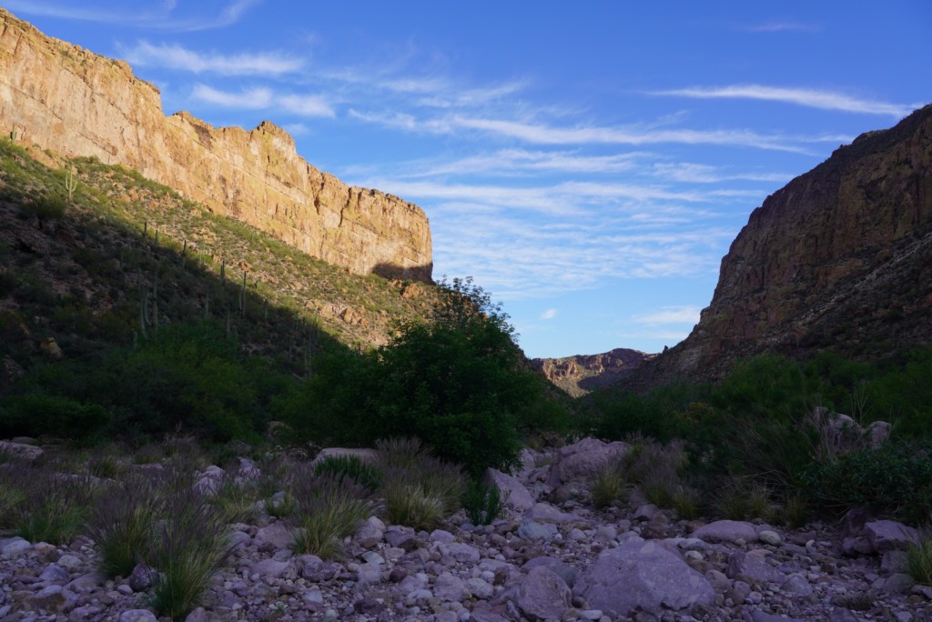
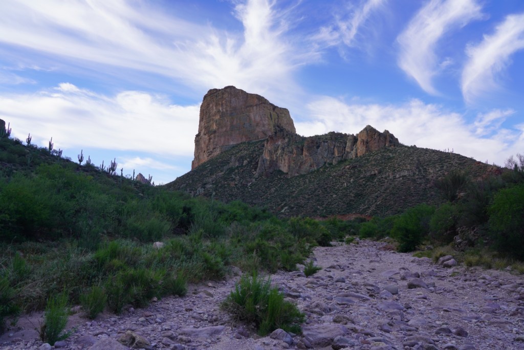
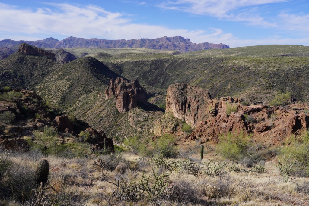
The first big view of battleship and Weaver’s Needle is amazing and worth a trip on its own.
The trail is easy to follow but very rocky and any misstep will most likely result in a prick.
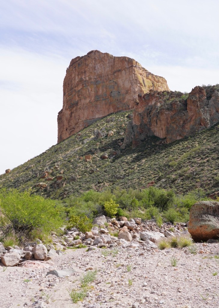
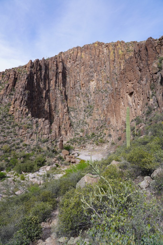
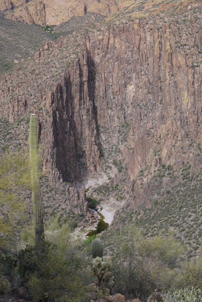
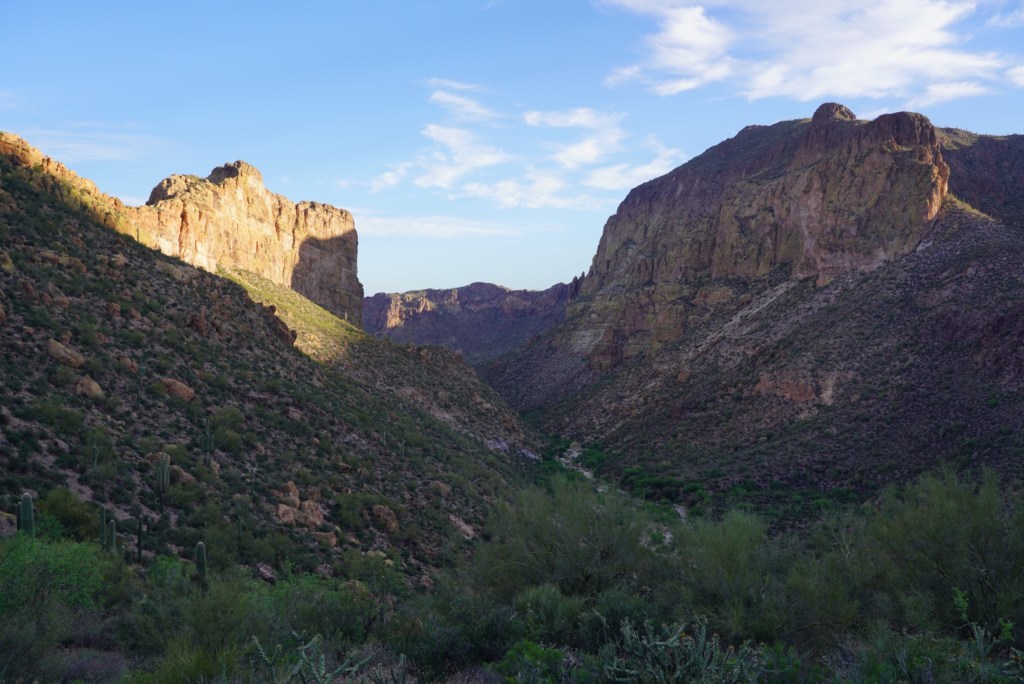
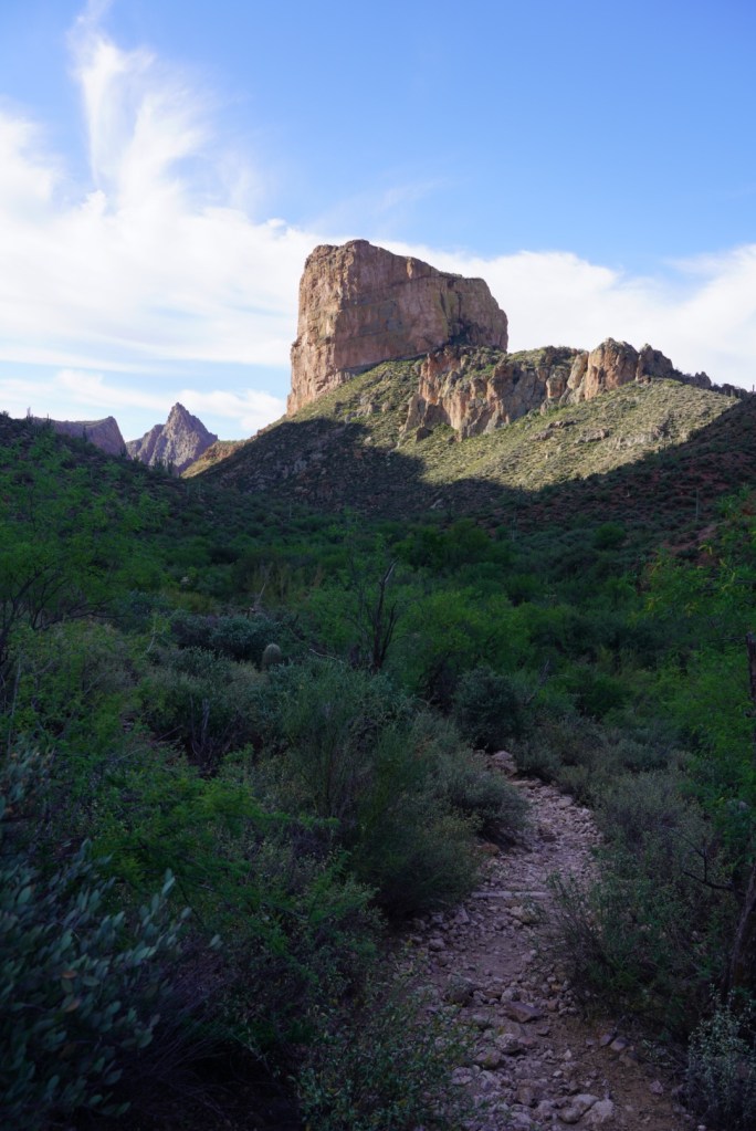
Over every hill was a cool view of Battleship and LaBarge Canyon.
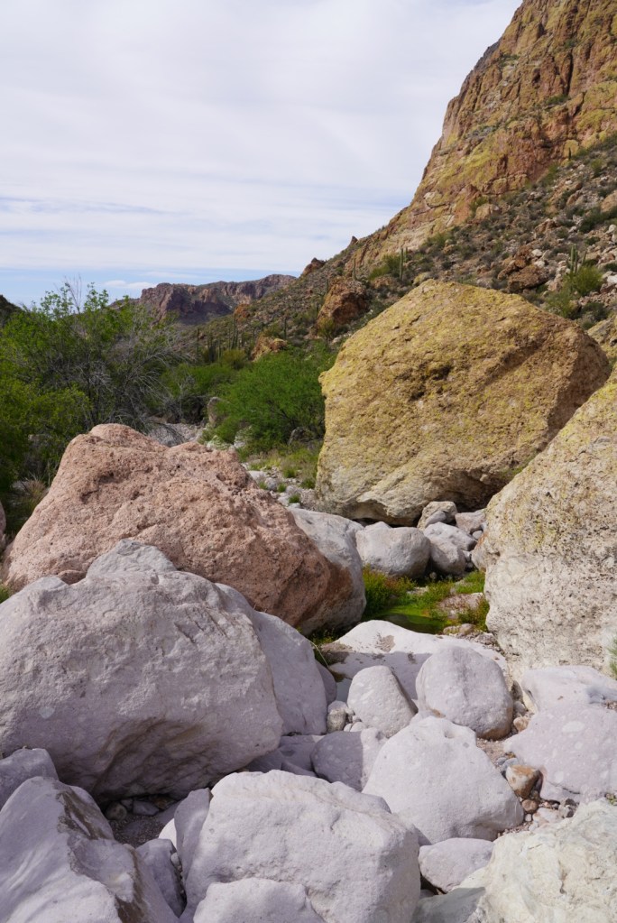
After 3 miles I started off trail hiking through the mostly dry LaBarge Canyon Creek bed.
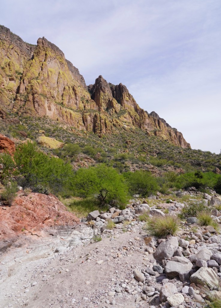
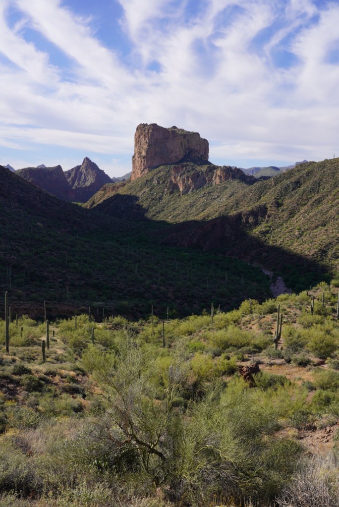
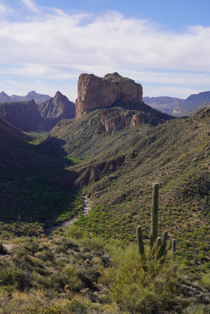
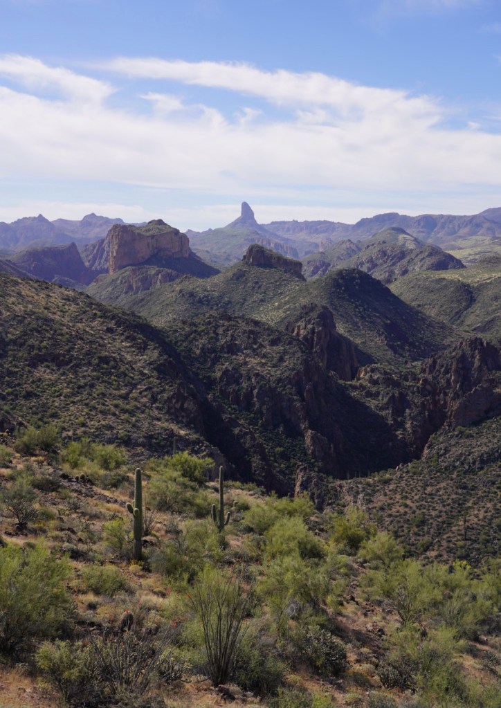
I had two options during my time in the creek bed, sand/loose rocks or boulder hoping. Surprised I made it through without twisting an ankle. Towering above me was Geronimo Head, to the east, and Battleship Mountain, to the west.
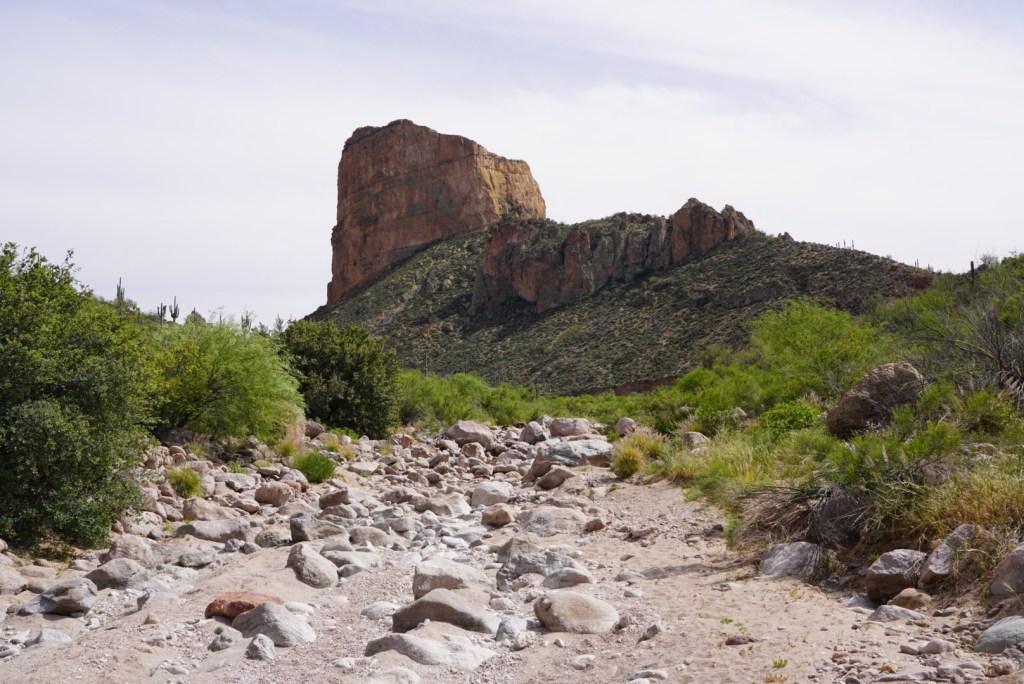
There’s much more boulder hoping as you get closer to the LaBarge Canyon entrance.
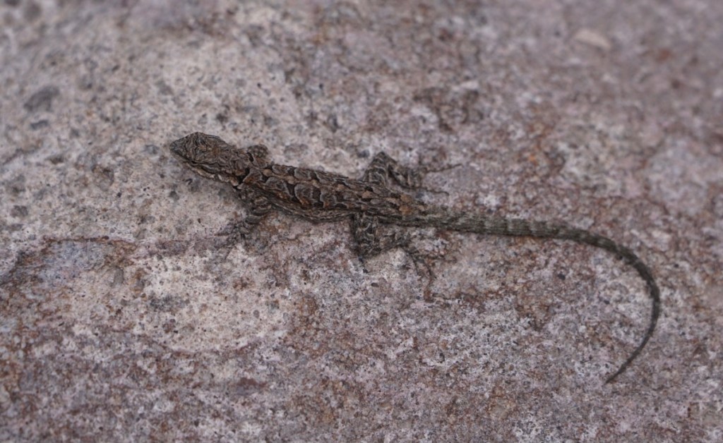
And a lot of lizards!
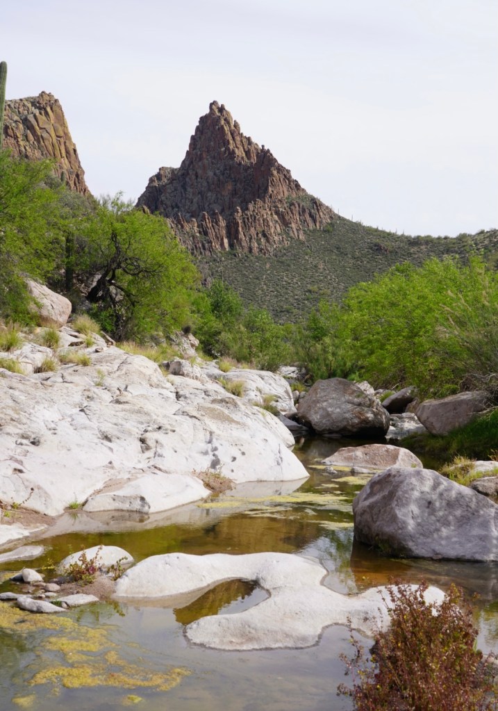
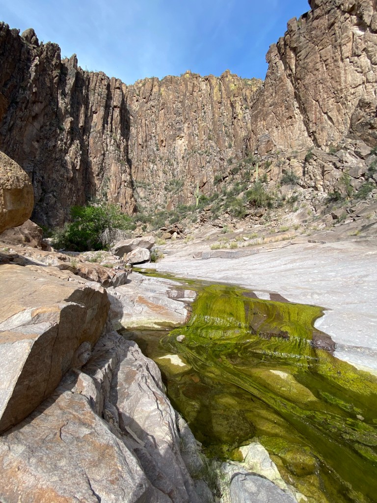
I walked a short way into the canyon, just around the first bend for a view into the narrows. Walking on the smooth rock was a nice change of pace.
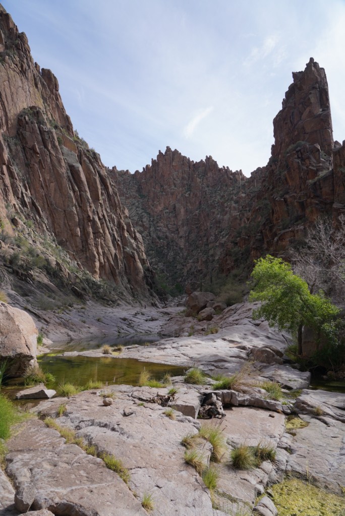
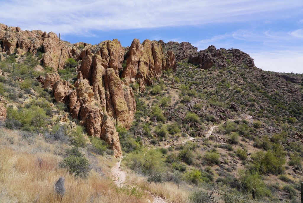
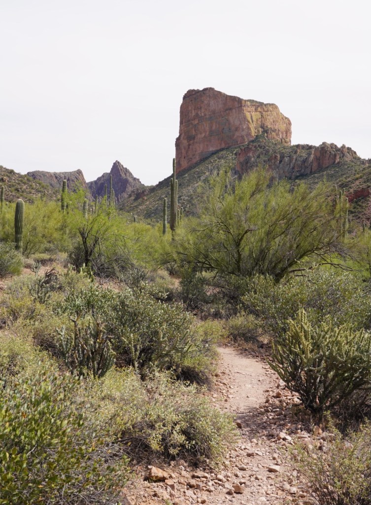
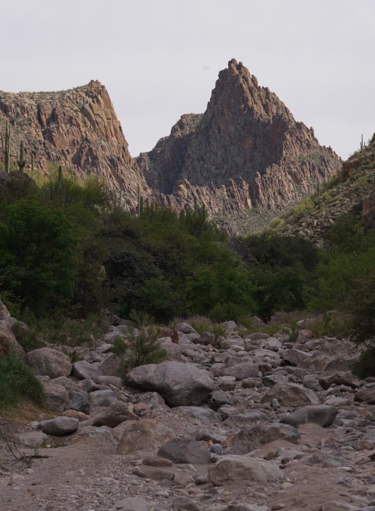
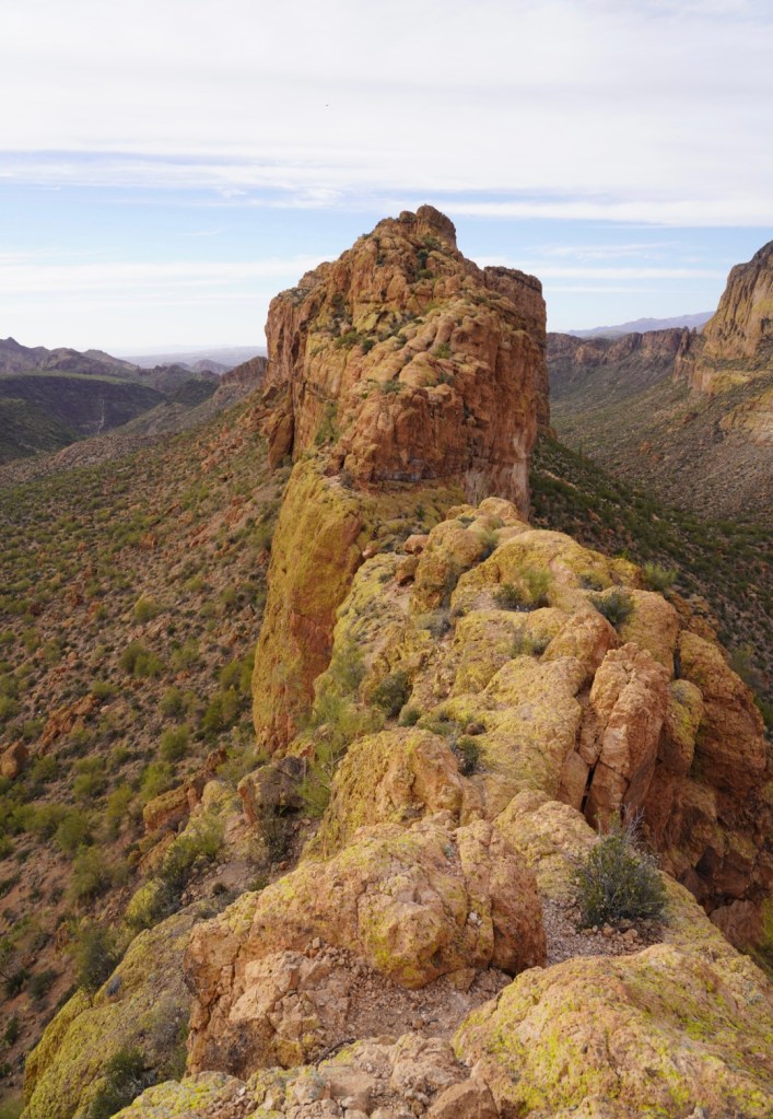
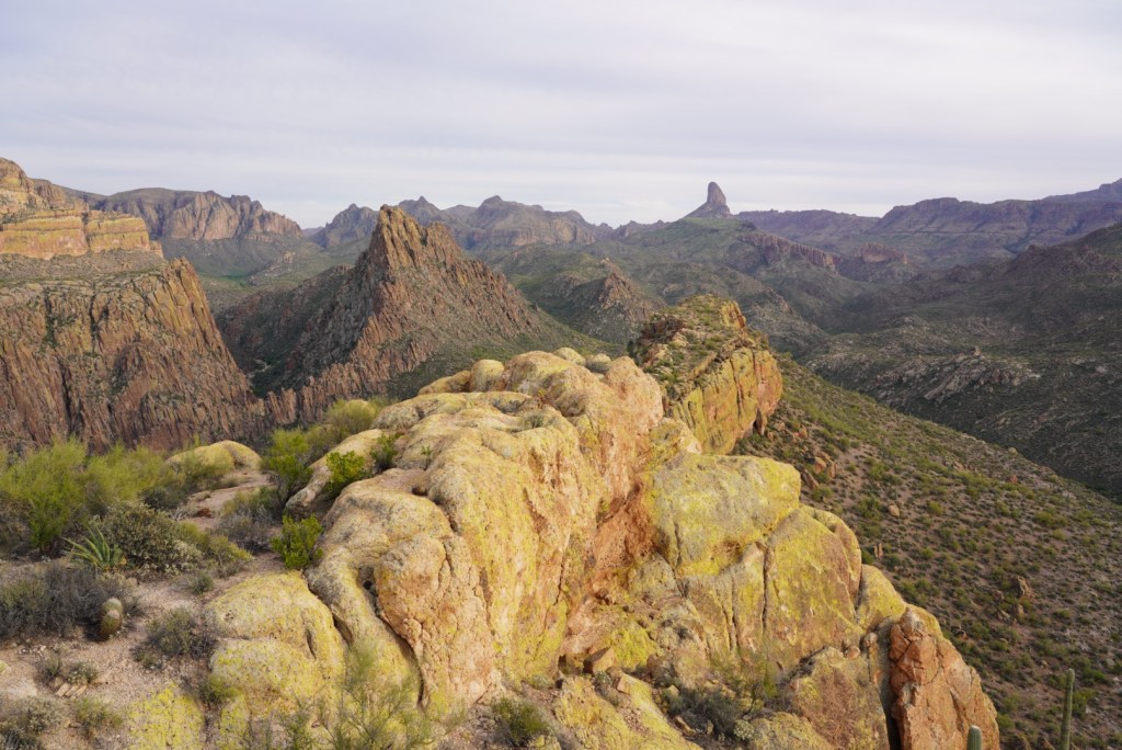
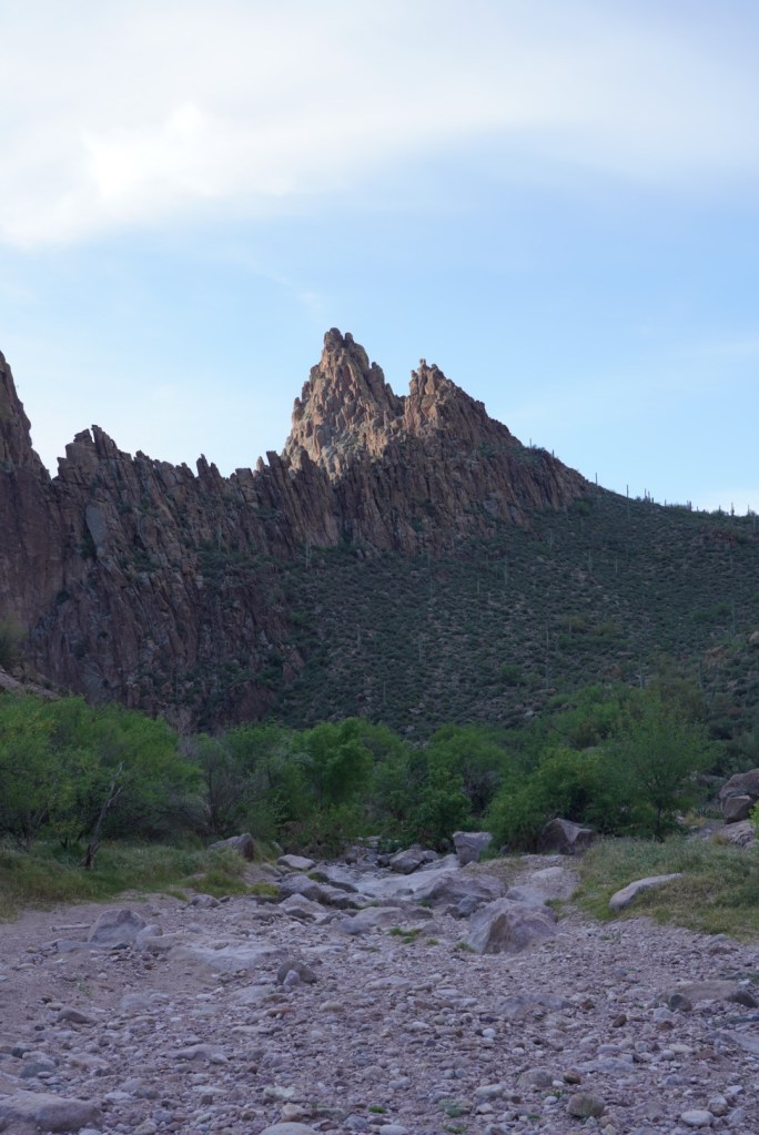
After admiring the canyon sandwiched by rock pinnacles I found the unmaintained trail up to a ridge on the far south side of Battleship Mountain.
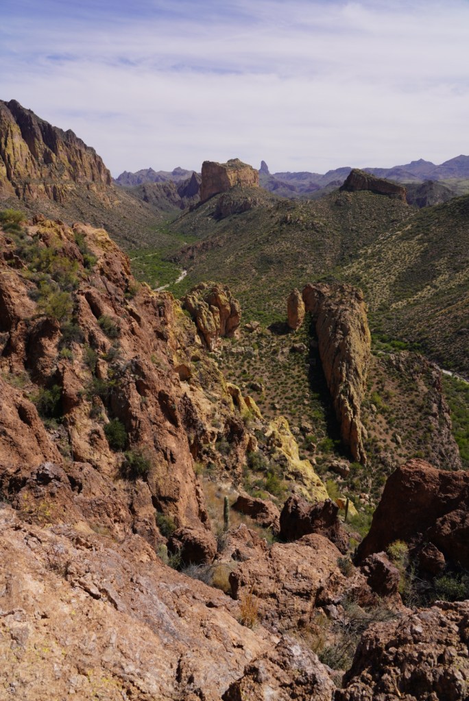
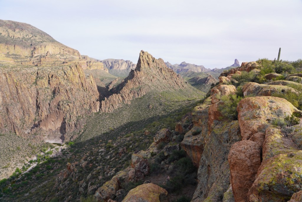
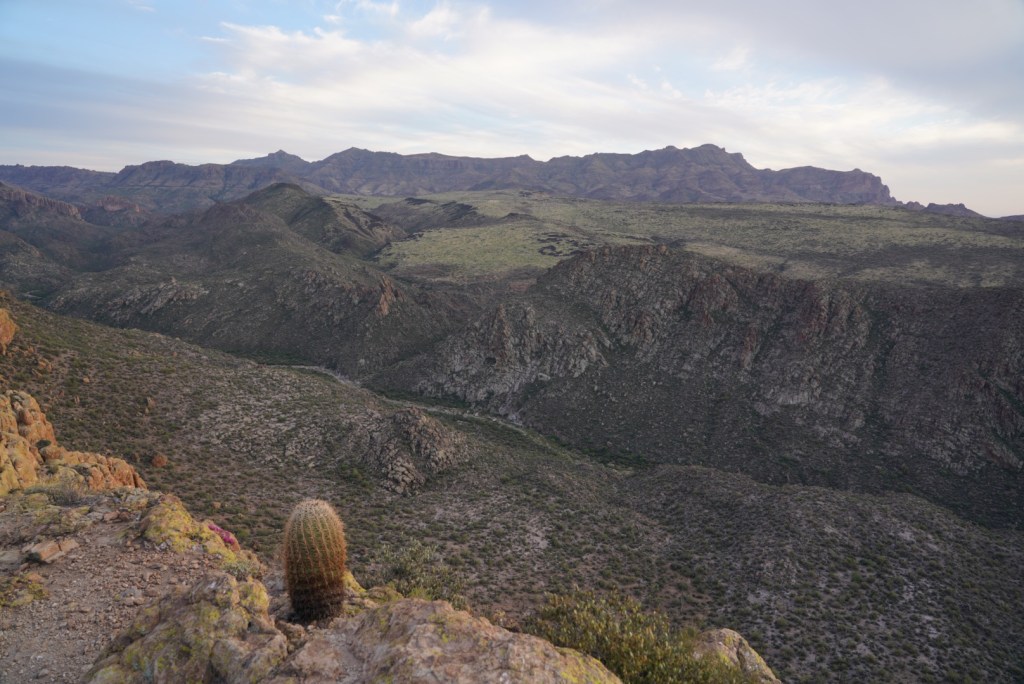
Atop the ridge there was a nice view of Boulder Canyon and Weavers Needle to the south and LaBarge Canyon, to the east.
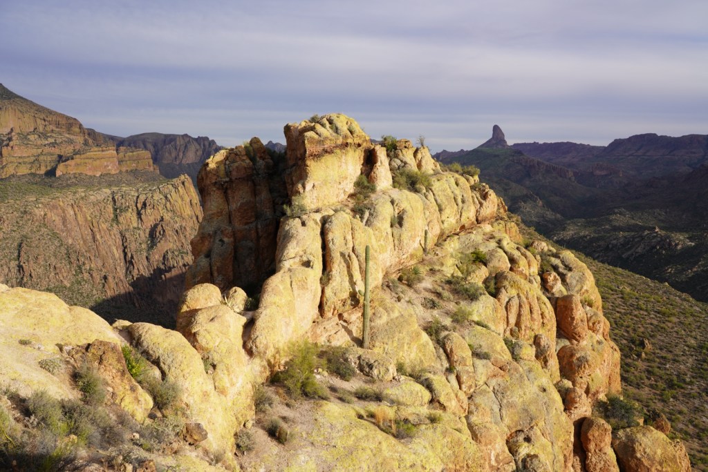
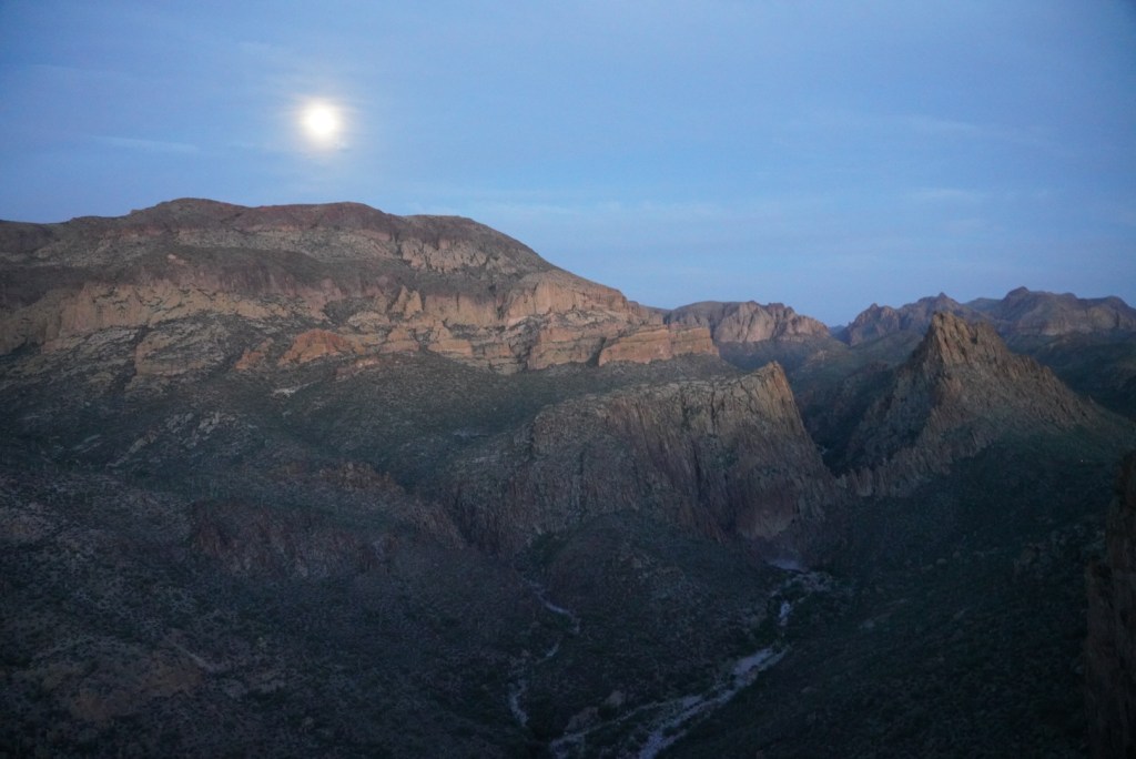
From here there’s a short traverse along the western cliffs before climbing up to the top of the mesa. The mesa is mostly flat for a quarter mile and has a few nice spots where people have camped before. I scoped out the entire mesa before picking my patch of dirt for the night.
After setting up camp I made my way to the summit for dinner and a sunset! To start the summit scramble I had to drop down an exposed ramp to the narrow notch below.
I had spoken with two different groups of locals along the trail who had attempted the route before but never figured out the way to the summit. I shared a trail description and a gpx track, and that you have to be comfortable scrambling. With that info route finding isn’t too tough.
A faint climbers trail appeared here in there.
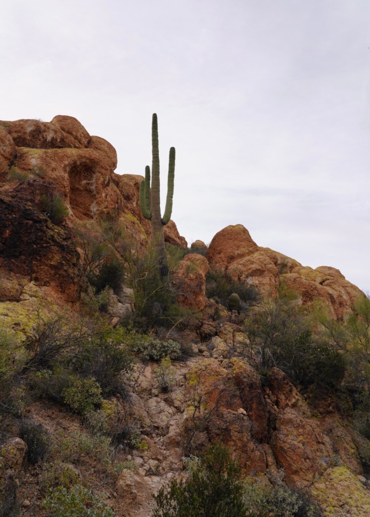

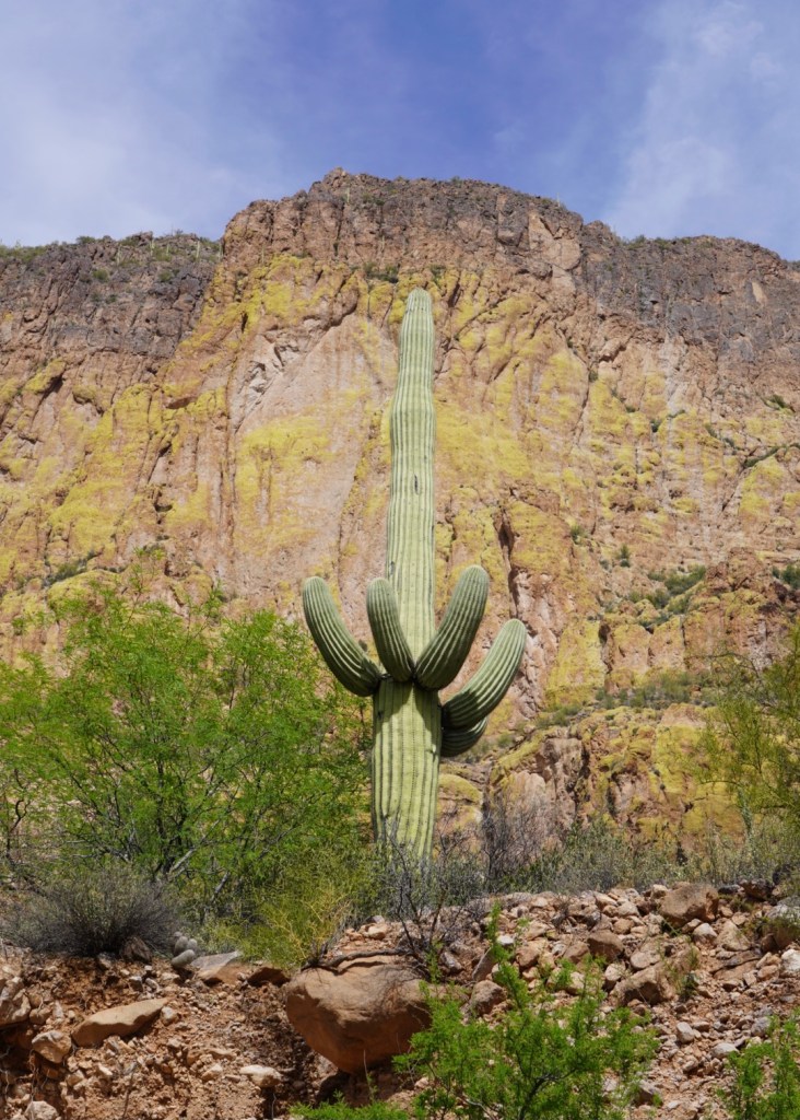
One beautiful saguaro before having to squeeze past some rock and take my pack off.
The rest of the way was a fun scramble!
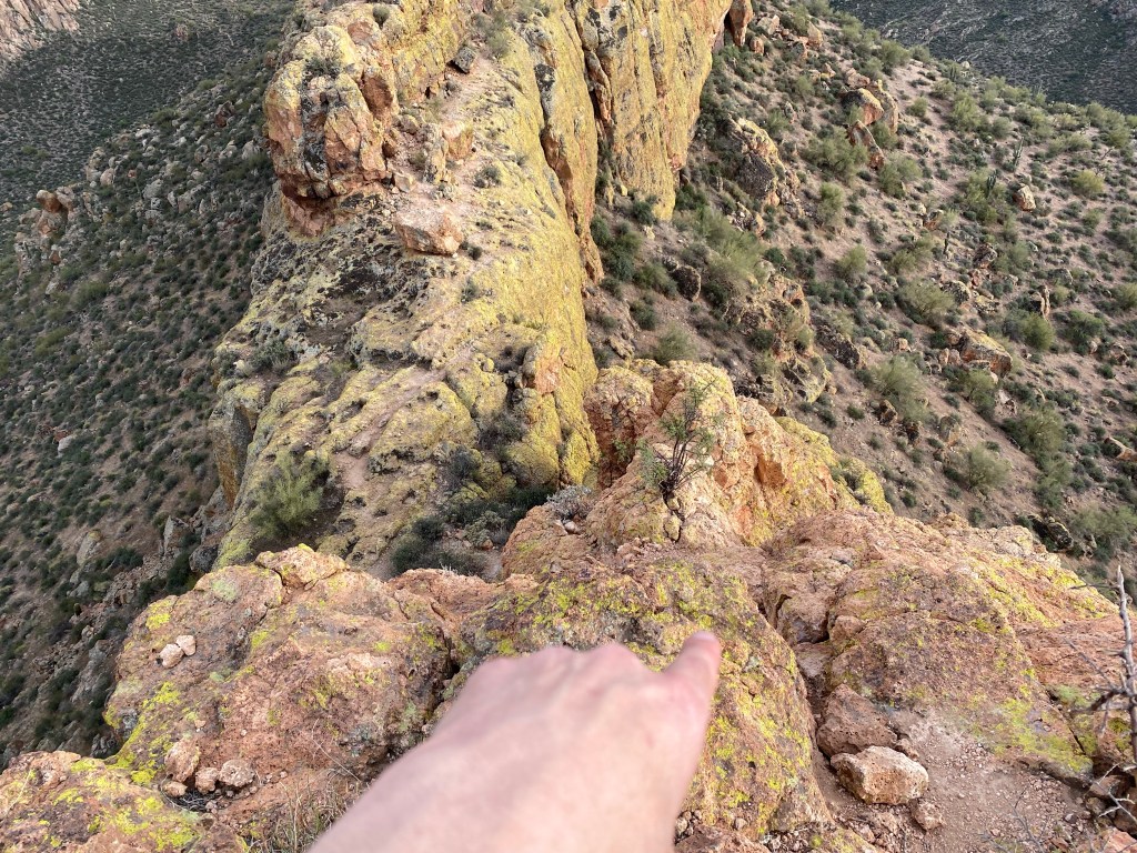
When off trail climbing I always like to take photos looking down and pointing to where I came up so I can be reminded of the best path to go back down.
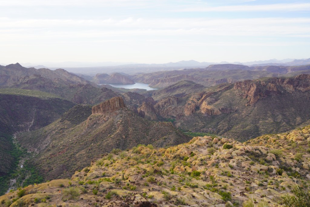
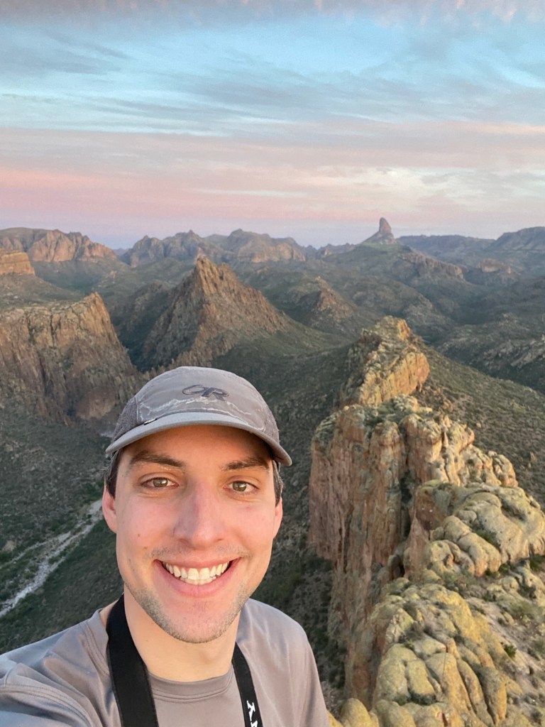
Once atop the battleship I could see Canyon Lake, where I started the hike.
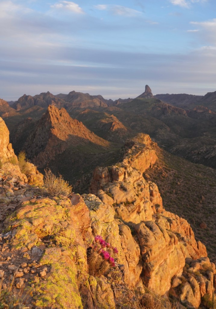
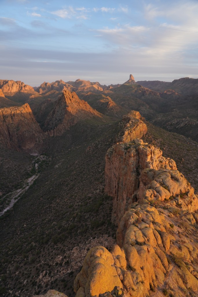
Looking South, back at my route across the tail of the ship and to the heart of the Superstition Wilderness, was stunning! It was a great spot to stop, let time pass and have some dinner.
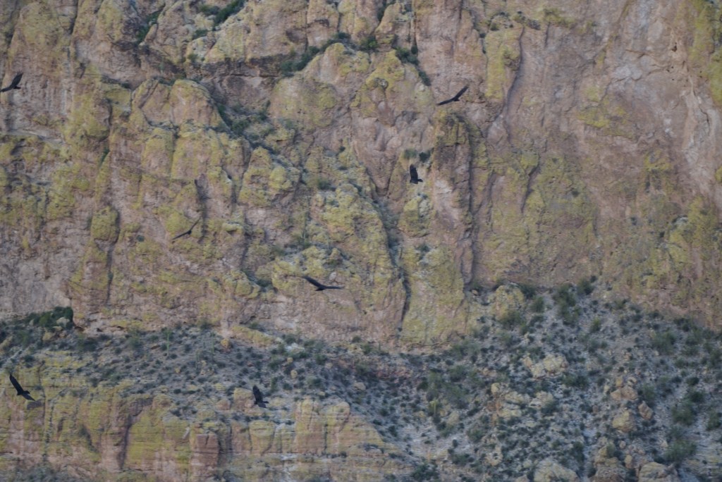
Never a good sign when 15 vultures circle above you.
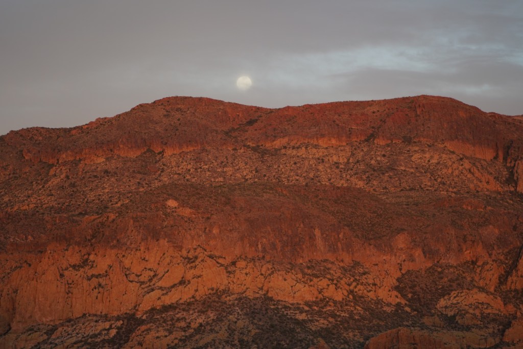
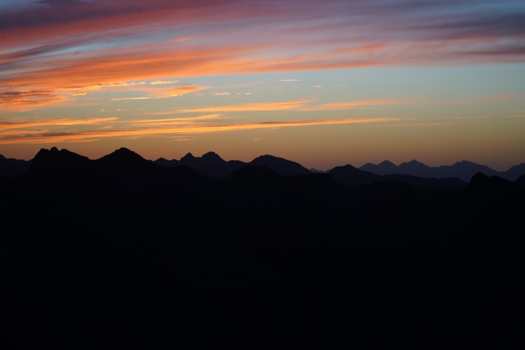
The sunset was lovely and helped me forget about my lack of water and growing dehydration. See my bodies much needed sodium collecting on my hat below.

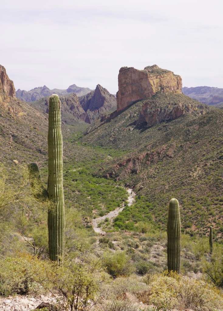
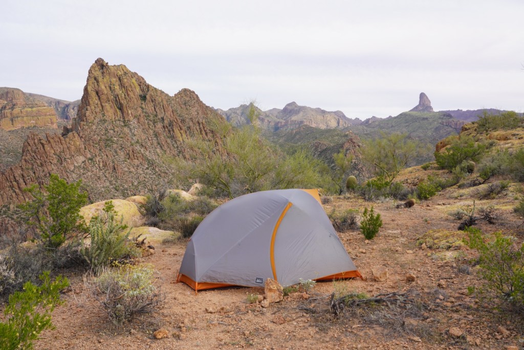
LaBarge Canyon above and Weaver’s Needle. Also in the picture below is my tent on the mesa if you squint really hard.
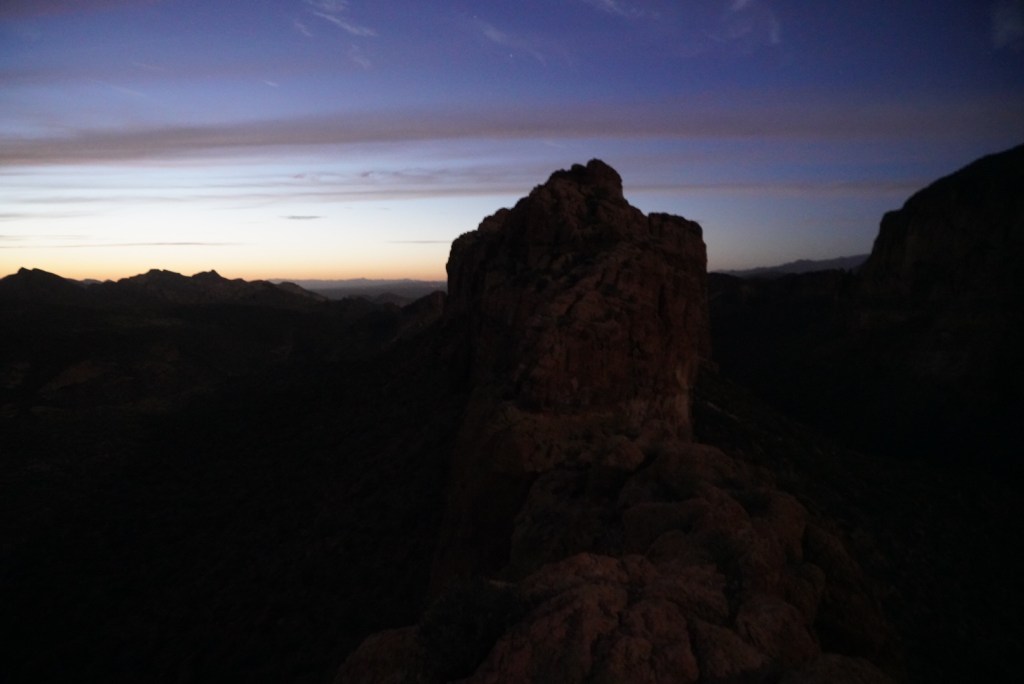
10 minutes after sunset the headlamp came on and I started to carefully make my way down to the mesa. My finger pointing pictures came in handy in the dark. The down climb was almost as fun as going up! I was definitely hooked on desert scrambling!
After crossing the narrow natural bridge back onto the mesa I could breathe easy and enjoy the last light of the day. Before going to sleep I spent about 30 minutes kicking it with the only other people camping up there, 2 friendly military guys. All I needed and wanted was water but they only had whiskey to offer.
I was up with the sun around 6am with water on my mind. I had rationed just enough to take sips most of the way back to the trailhead. Scrambling up one more time was also on the mind but I was here to see family in Prescott Valley so I hiked out as fast as possible while in taking in the beautiful desert morning.
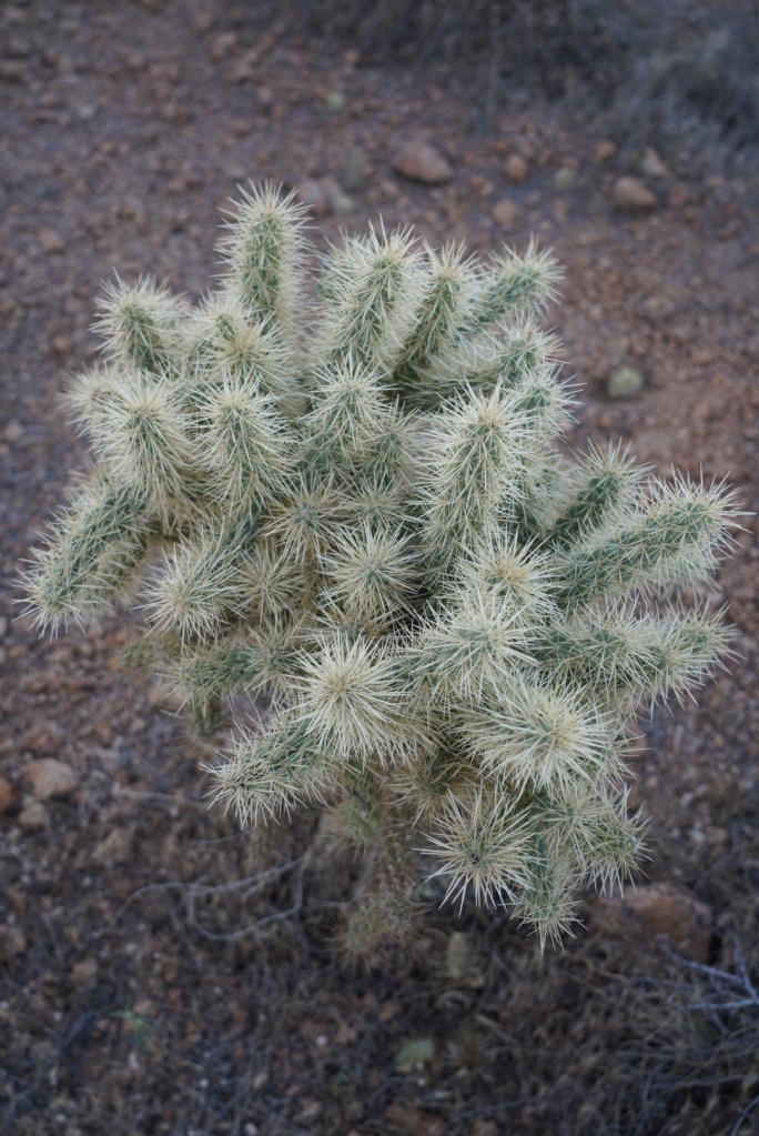
My favorite cacti below: the Teddy Bear Cholla
It was helpful to have trekking poles on the downhill to LaBarge Canyon.
It was pleasantly cool and shaded in the canyon although there were a lot of spiderwebs.
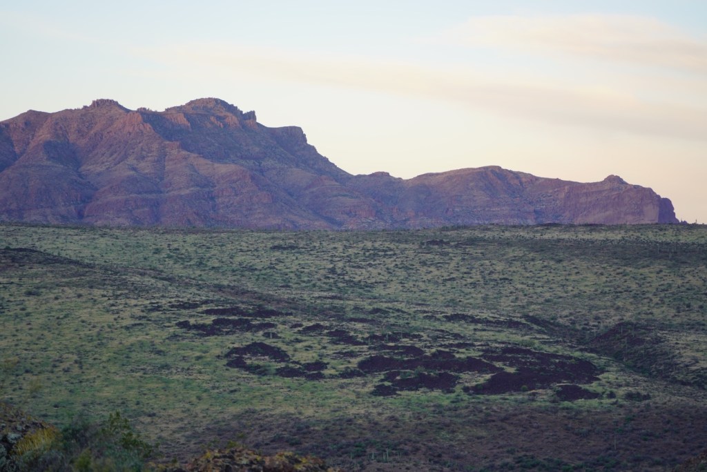
Getting further away from the Battleship and gaining more elevation.
I made it down in about 3 hours and saw many people at the start of the trail already sweating like me the day before. Next time I’m in the desert I’ll bring 3 liters per day and pound the electrolytes. Because of this epic mountain and area I will certainly be seeking out another desert peak soon! Signal Peak in the Kofa NWR has caught my eye.
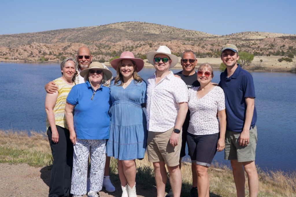
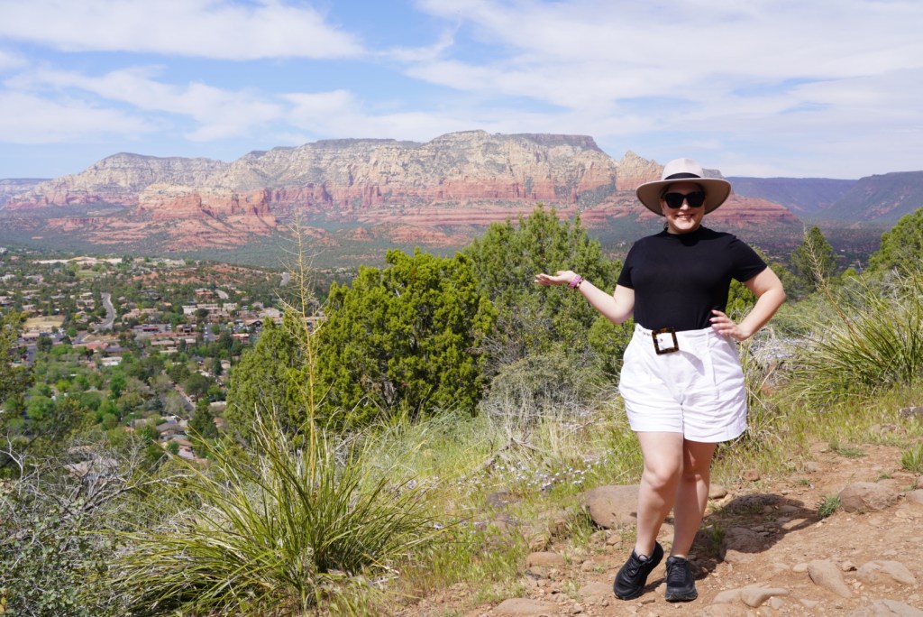
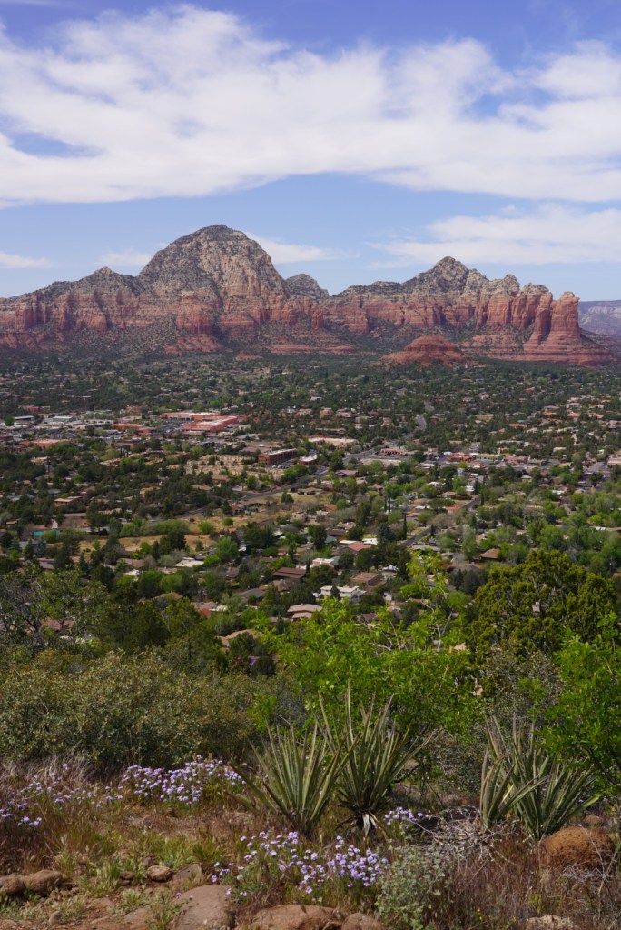
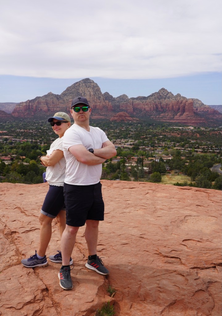
After hydrating and driving a little over 2 hours I was united with family for a fun few days in Arizona. We caught some great views in Sedona and enjoyed Prescott Valley.
Go climb that desert peak but not if the calendar is anywhere close to the Summer. April was pushing it but so grateful for the experience!

Glad to see you back
LikeLike