Summit: 11,753ft
Native land of the: Ute
13.6m 6,500ft gain
Mount Timpanogos towers 7,000ft over the Utah Valley and is one of eight ultra-prominent peaks in Utah. It’s also the second highest peak in the Wasatch Range which stands as the western edge of the greater Rocky Mountains and the eastern edge of the Great Basin. Timp is one of the most popular hikes in northern Utah but there are a few routes to choose from. I found an excellent trip report about a traverse that covers four 11,000ft peaks including Timp and knew that was the one for me! Check out that detailed trip report at stavislost.com. Here is his map of the route which I followed exactly.

1st Trip: 10/6/20
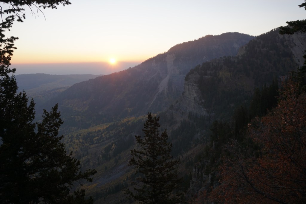
Sunday after Jay’s bachelor trip and Middle Teton I drove back to Utah solo and camped at the Timpooneke Campground. I walked around the campground that night to locate the trail I’d be taking in the morning. I could also see my whole route up North Timp plus some beautiful fall colors!


Around 5am I packed up my tent and drove down to the Timpooneke trailhead. Since I wouldn’t be camping again, I had to move my car and walk up the road a half mile before heading up the northeast ridge of North Timpanogos. I’d gain 3,700ft in the next 2 miles!

Once the bear canyon trail veered to the right I continued straight up the ridge on a faint and very overgrown path.

Past the tree line it’s an easy walk up to the base of North Timp.


Here’s where things would get tricky. I scoped out the ledge to the right which is apparently the way to go but it looked very exposed, downward sloping and scree filled so like Stav I dawned my helmet and climbed straight up the crumbling cliffs. There was also a bunch of pine needles and sap on the wall which did not help but I gained the ridge with no scares, just some sappy and pricked hands.

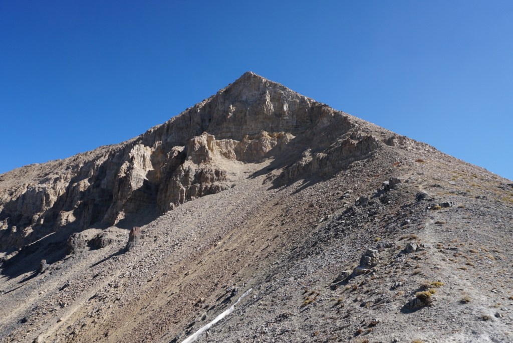
From there it’s an off-trail hike with the occasional need to use your hands until reaching the false summit of North Timp.

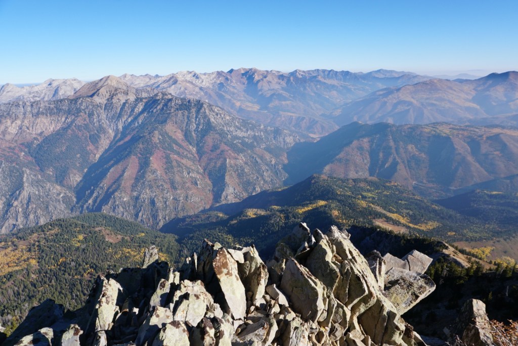


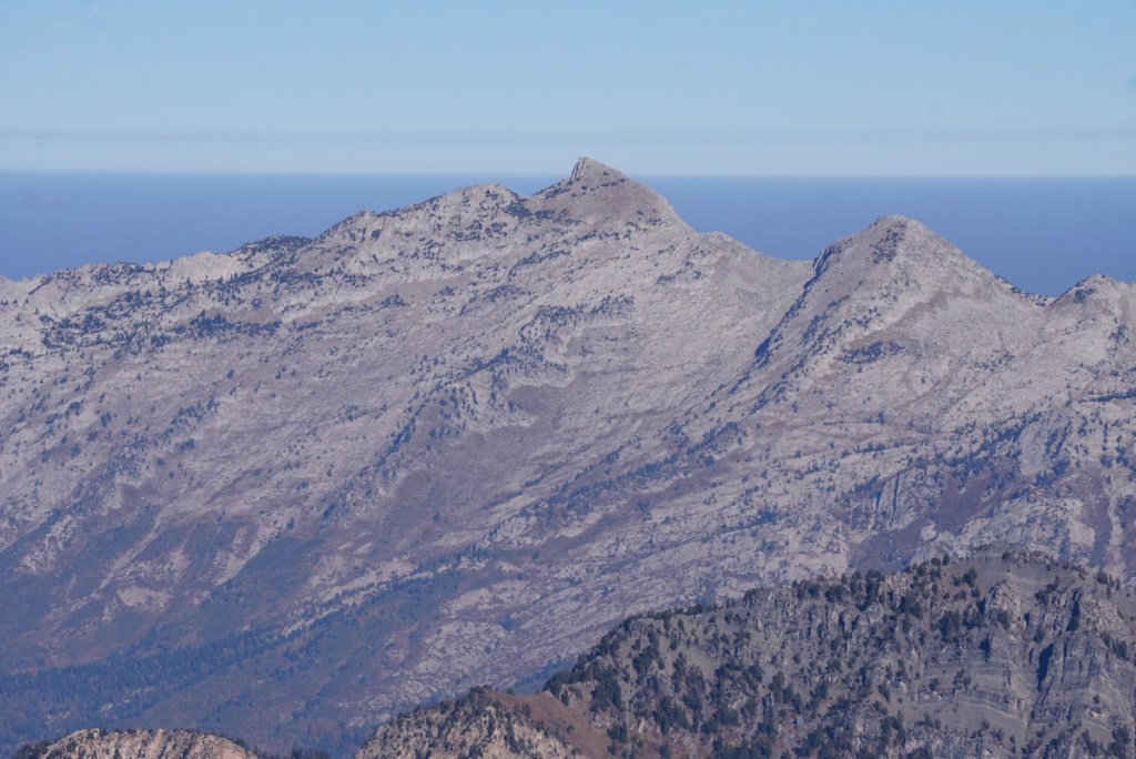
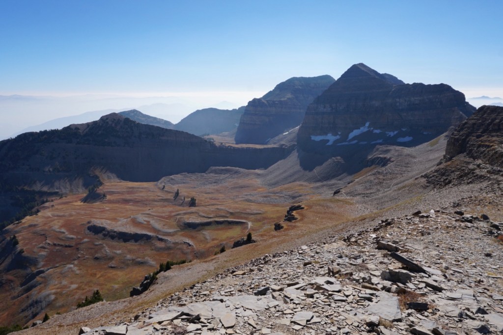
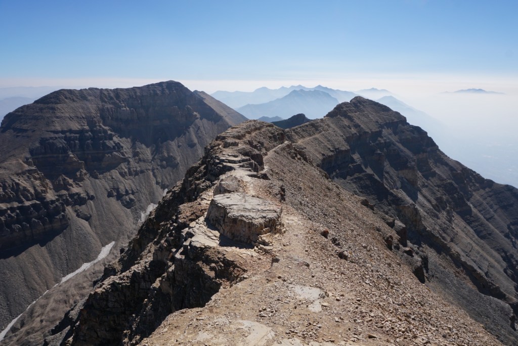
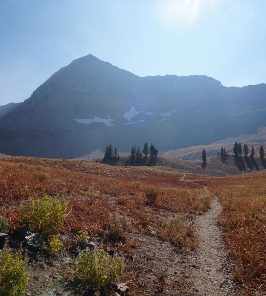
I’d spend the next four miles riding the entire ridgeline from the false summit of North Timp to South Timp staying above 11,000ft the whole time. The entire trail is made up of scree and talus rock but it’s easy to follow and so much fun!
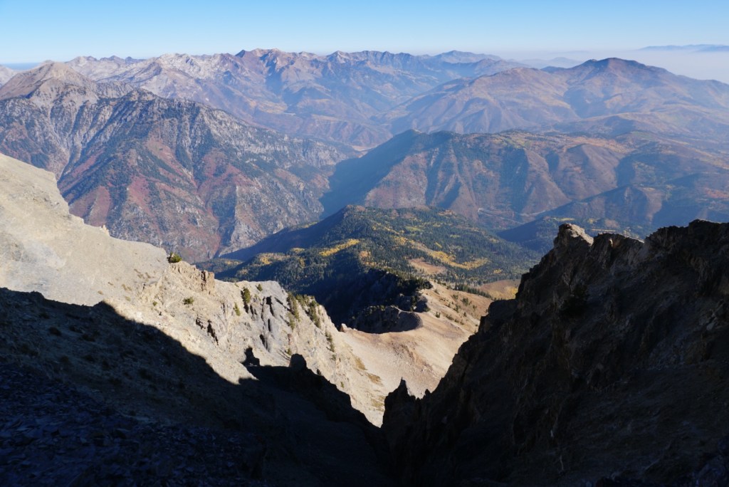


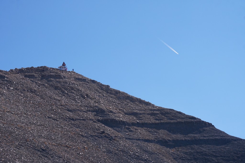
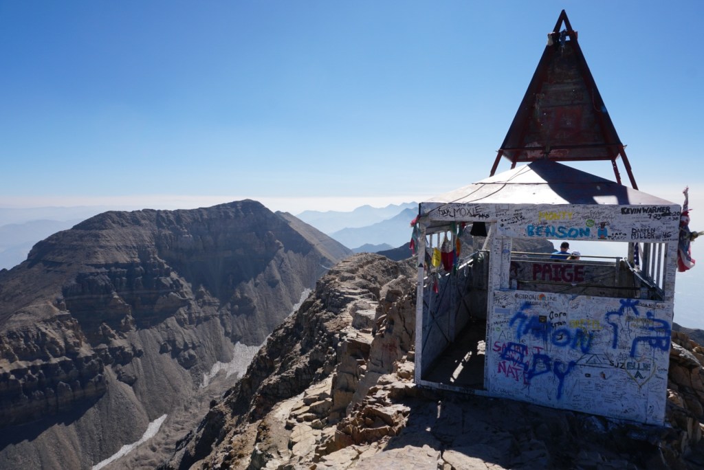
At the summit I’d see people for the first time that morning. I enjoyed the stunning views while having a snack in the shelter. It felt nice to get out of the sun for a second.


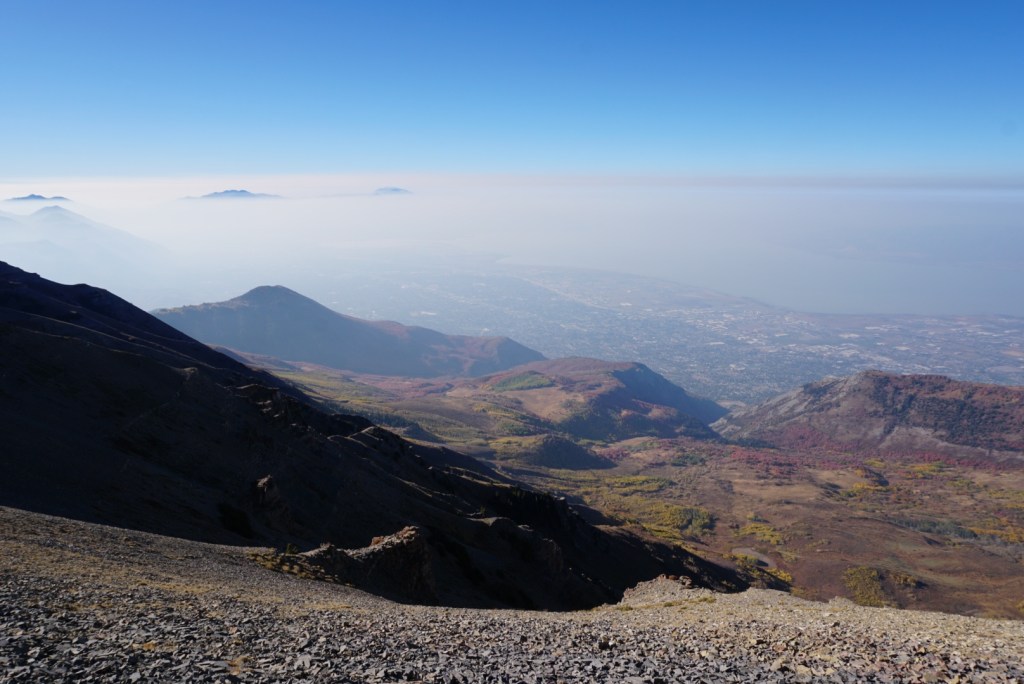
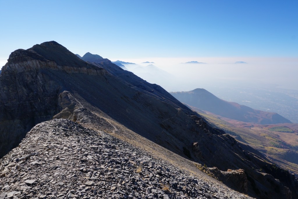
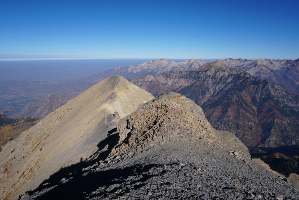
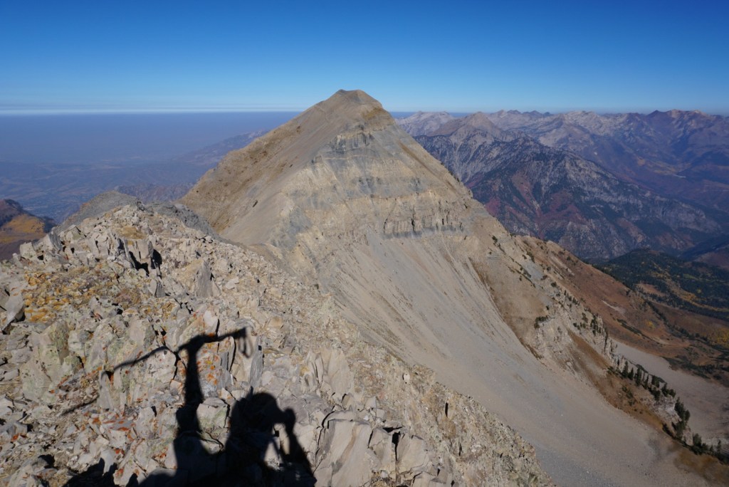
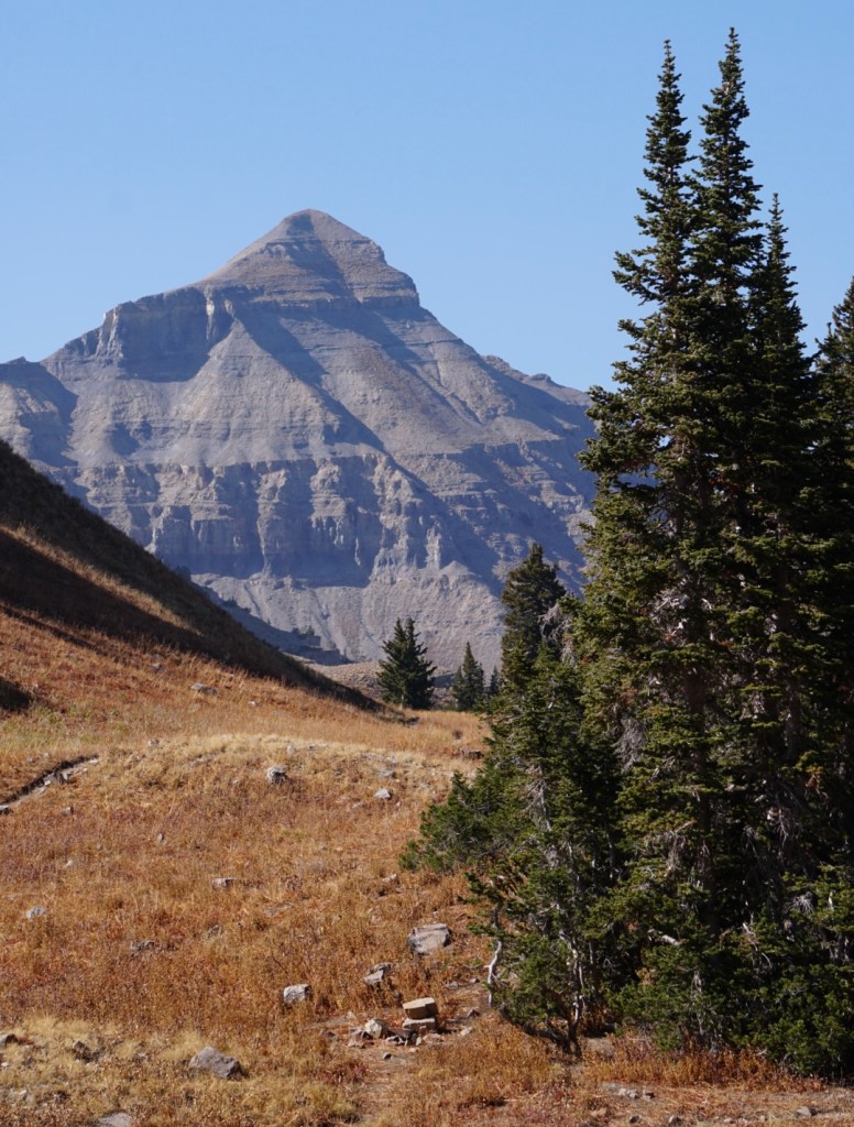
I was making great time so I continued down and up South Timpanogos which had my favorite view of the trip!

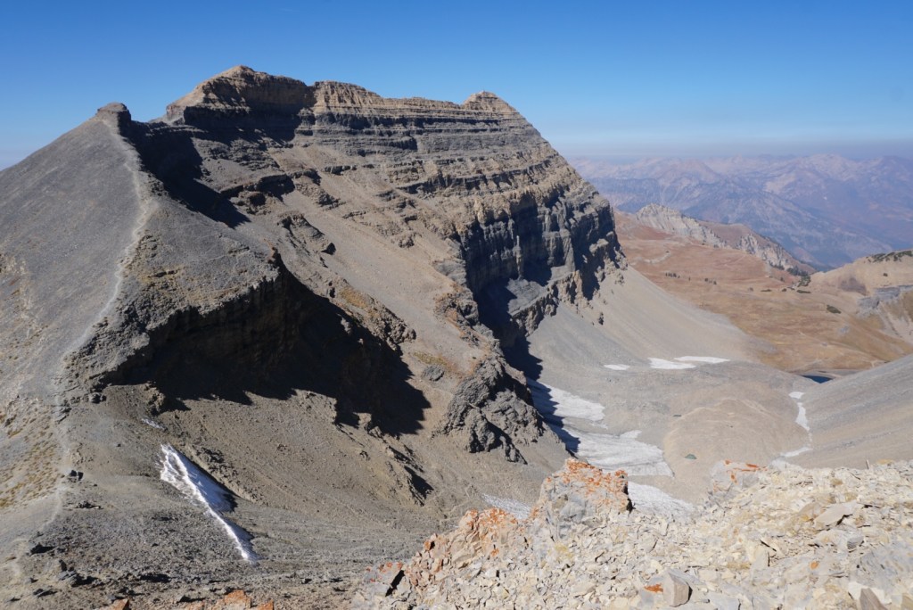


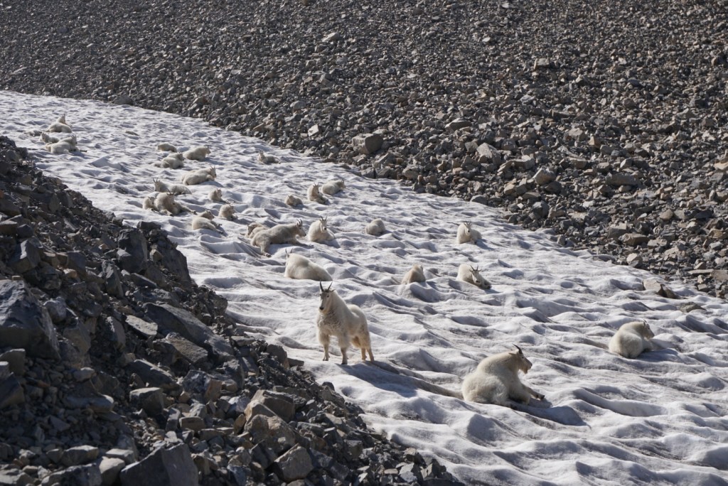
Instead of back tracking I sent it directly down the glacier which is just a rock-covered mass, currently with lingering patches of snow. Apparently there still is a glacier buried beneath the talus. The sun cups in the snow made it easy to get down quickly until hitting the rolling hills of talus. Near Emerald Lake I had to do a double take as I noticed the snowfield moving. It was a herd of mountain goats!


From Emerald Lake I followed a trail into the giant amphitheater. I then connected with the Timpooneke trail and followed that six miles to the trailhead. It was a gorgeous and long hike out.


There were large patches of aspen trees with bright yellow leaves all along the trail. It was really beautiful!


From the trailhead I drove straight to the airport and flew home. Couldn’t have been any more efficient!
This long loop and traverse up high in the Wasatch was the perfect way to end the trip! It definitely makes me want to get out and climb all the ultra-prominent peaks in the Contiguous US. There’s really no better way to see it all!
