At 14,505ft Mount Whitney towers over California’s Sierra Nevada and rises higher than any other peak in the Continental United States! Only 85 miles away is the Badwater Basin in Death Valley National Park which marks North America’s lowest point at 282ft below sea level. Safe to say there’s a lot going on here in terms of fault zones and geology. It’s a beautiful mess of granite!
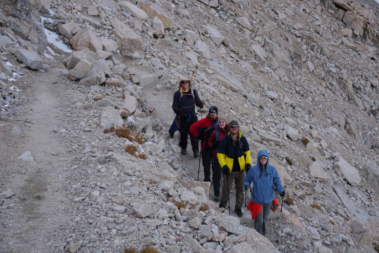
Because of Whitney’s accolades and grandeur it’s frequently climbed but only for those who can attain a highly sought after permit. The window to apply for a permit is February 1st – March 15th. You and your friends can choose 15 different dates to increase your odds. Our group of 7 was lucky to secure a permit for the Whitney Portal Route September 22nd-23rd (Fri-Sat). To prepare we hiked a lot of mountains in Washington which gave us the endurance we’d need. The Whitney Portal Route doesn’t require mountaineering skills but the 22 miles and 6,100ft of elevation gain/loss is no joke. Unless you live in Colorado it’s tough to simulate the altitude so to help us adjust better we camped Thursday night at the Whitney Portal Trailhead. We would get use to being at 8,000ft before starting our hike Friday Morning.
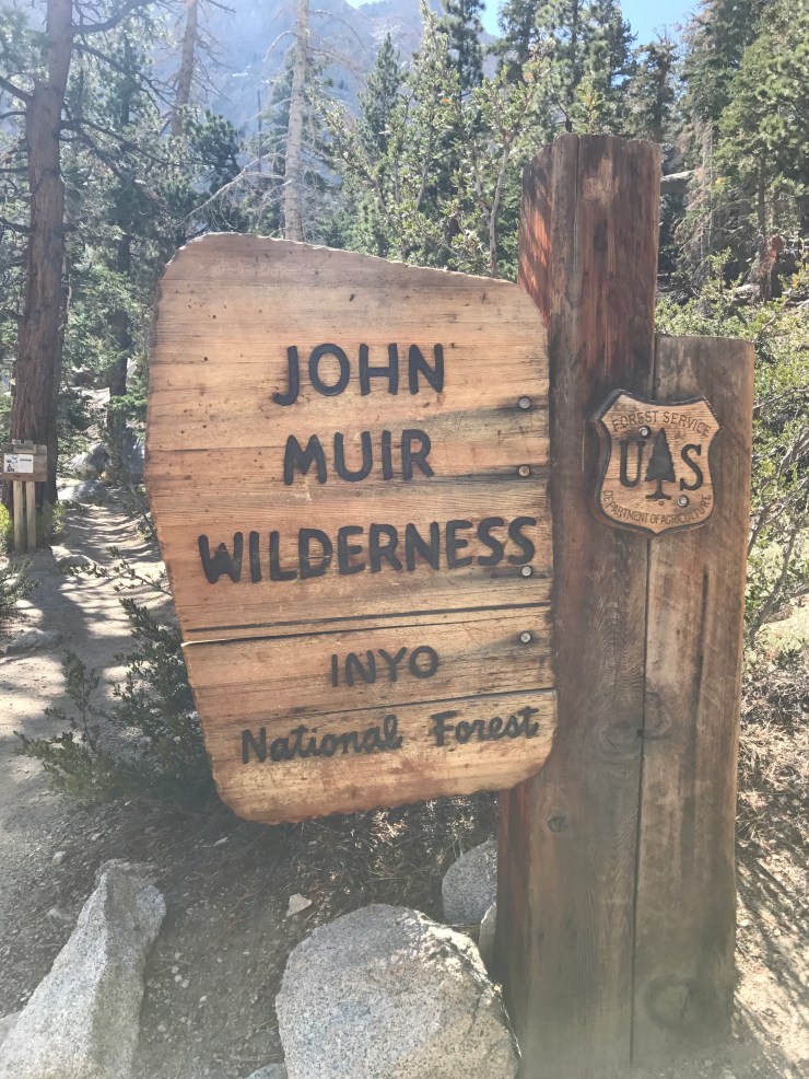
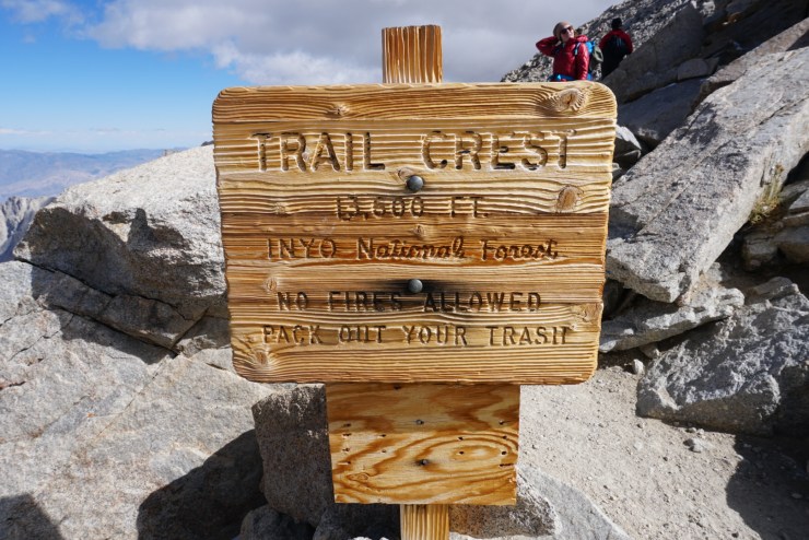
For a majority of the hike we’d be in the John Muir Wilderness within Inyo National Forest. Only once we reached the trail crest could we say we were in Sequoia National Park! Until then we were Inyo!

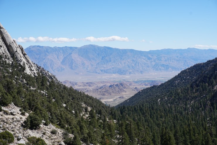
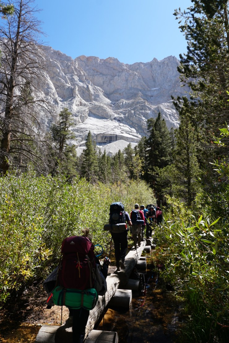
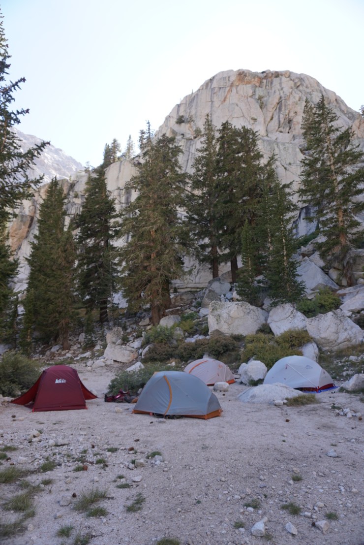
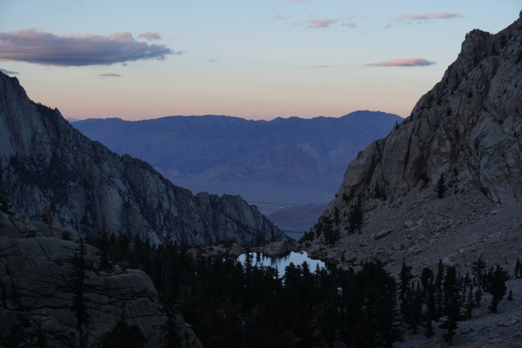
Friday we’d only hike 3.8 miles to Outpost Camp at 10,300ft. Most people choose to stay at Trail Camp at 12,000ft but we were very grateful for our decision. It was much warmer at 10,300ft and we’d spend less time hiking with a big pack. Both days were perfectly sunny so almost the whole way up we could clearly see the Inyo Mountains, Alabama Hills and Owens Valley.
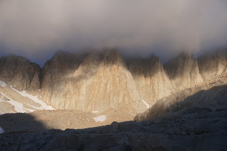
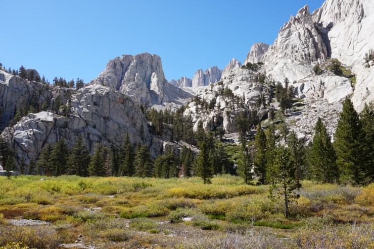
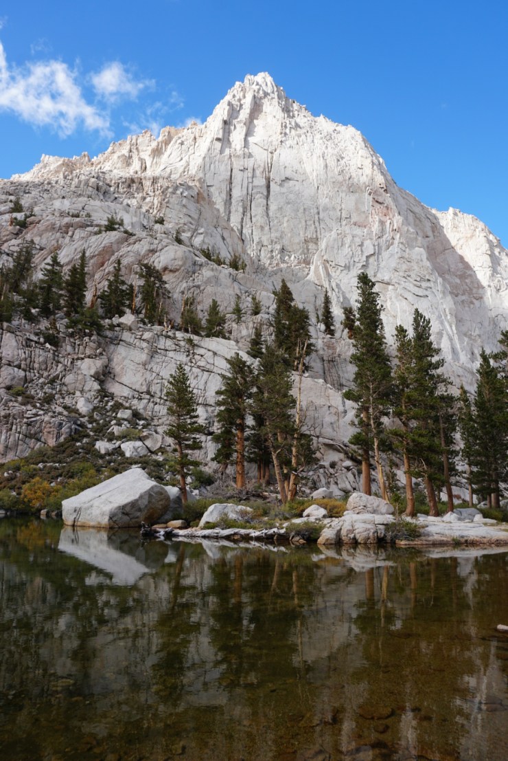
Looking west (up) always gave us a look at the gnarly spires of Mount Whitney.
The trail is pretty easy to follow the whole way. The first point of interest is Lone Pine Lake. From there to Outpost Camp is the easiest section crossing a flat meadow surrounded by granite.
I couldn’t ask for a better group to suffer with then these fine folks! I spent the 2017 New Years with them in Joshua Tree National Park and they were so much fun. I also admire their positivity as they endured through my terrible farts. Note to self: don’t combine brussels sprouts with freeze dried meals.
We had almost all day to relax and prep for Saturday’s summit push. Right by the campsite was a partially frozen waterfall.
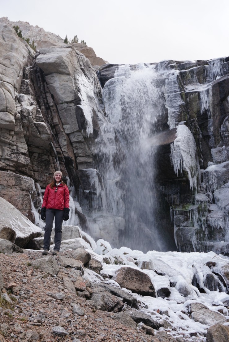
There was a nice view from the top of it!

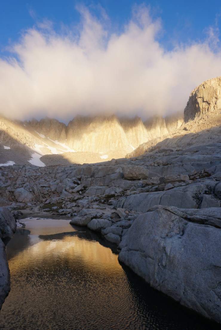
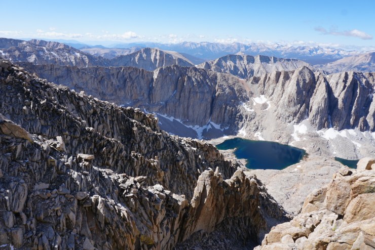
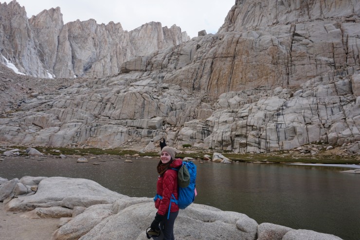
Just past Outpost Camp is Mirror Lake which is a great showcase for the High Sierra!
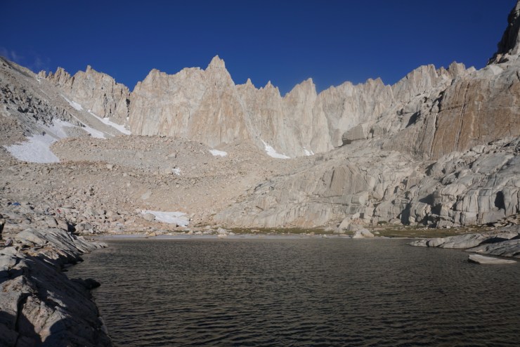
It was an early night and even earlier morning. Before the sun rose we climbed 2,000ft over 2 miles to Trail Camp and Consolation Lake.
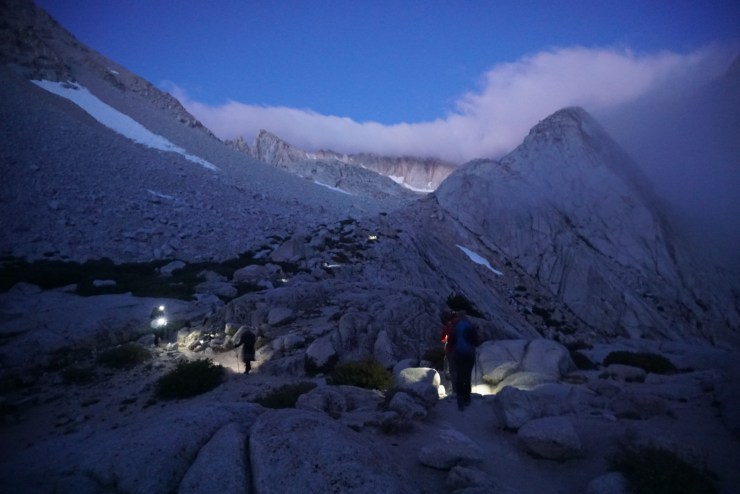
Over those 2 miles we passed the tree line and froze our butts off. This section may have been the toughest for me just because of the bone chilling cold.
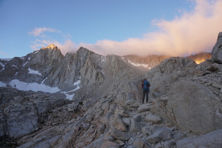
Seeing that alpenglow made it all worth it!
Everything was frozen so filling up at the Trail Camp Pond was difficult. This was the last water source so we may have shorted ourselves but Nuun’s electrolyte tablets sure made up for it. As we finished filling up light finally reached us giving us some much need warmth.
We were really warmed up after the next 2 miles covering what is known as the 99 switchbacks. We wiggled our way up quickly leaving Trail Camp in the dust.
Each step brought us closer to the summit. I almost want to say goal but I’m the nerd of the group who asks that question so I can say no our goal is to make it back to the trailhead safely and have fun!
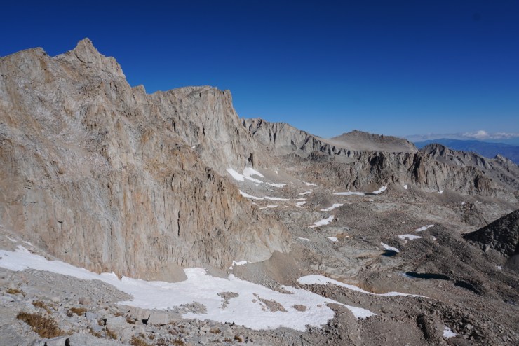
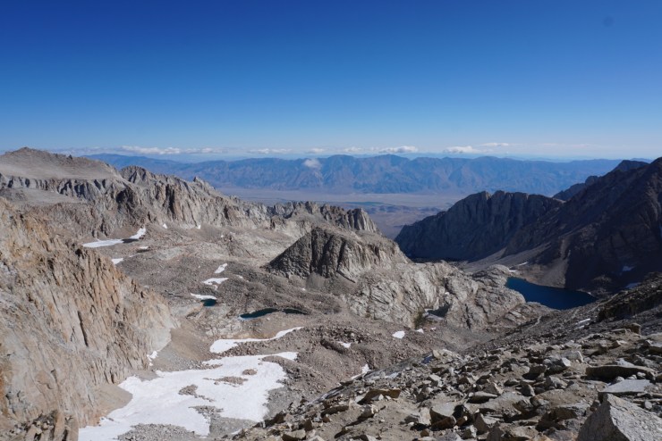
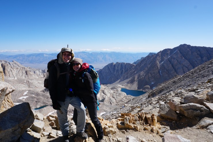
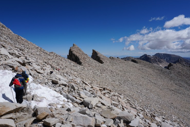
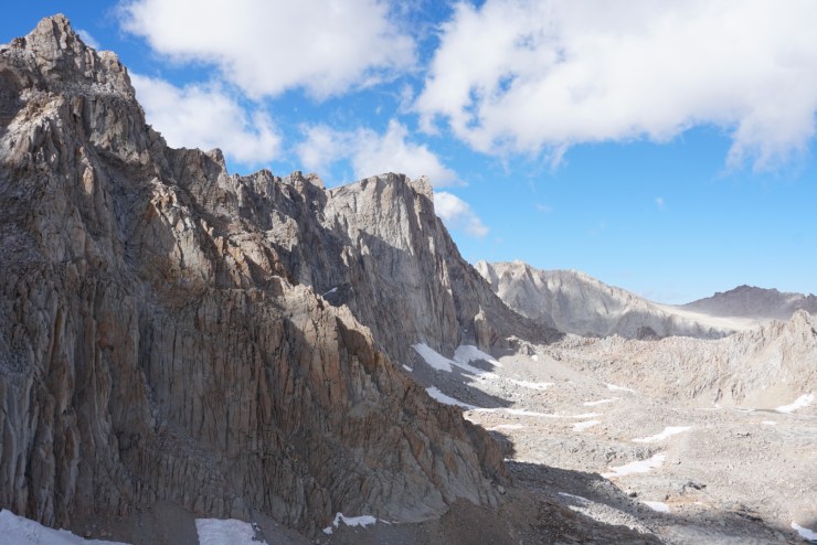
After the switchbacks the trail evens out until arriving at the Trail Crest 13,600ft up.
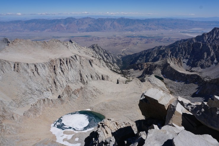
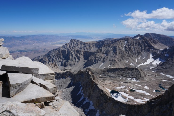
Looking east we could see how far we’d come and looking the west we could see the beautiful peaks of Sequoia National Park.

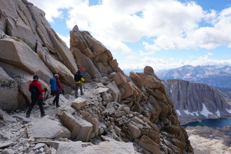
I look forward to walking by the World’s largest trees but this was a great intro for Sequoia National Park! We’d be in the park for the next 2.5 miles and it was glorious!
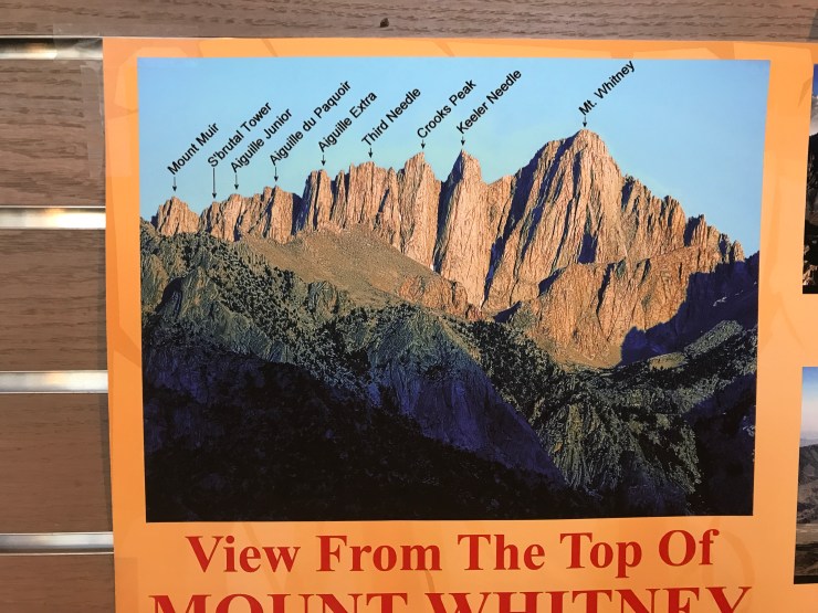
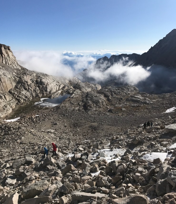
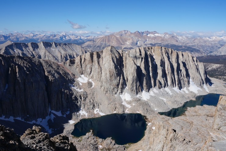
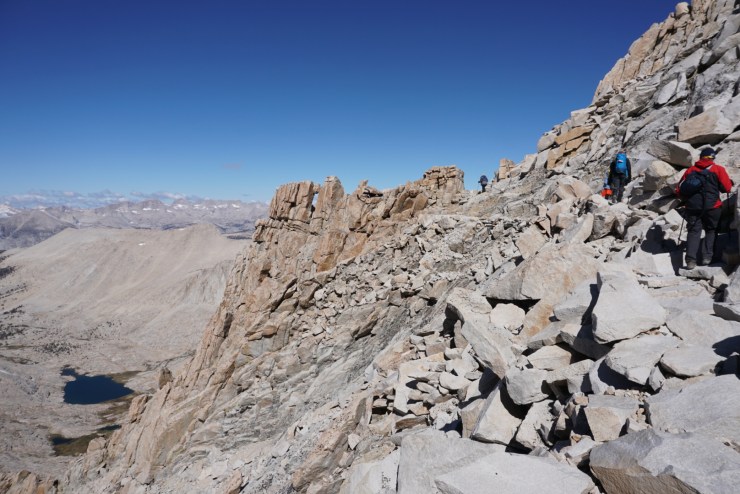
We rode the western cliffs past some of the coolest rock formations I’d ever seen. We’d also pass the southern terminus of the John Muir Trail (JMT) which is on the bucket list. There were so many crazy scenes but I didn’t take many photos as I was focused on getting to the summit. 2 of 6 members of our group were experiencing signs of altitude sickness so we took it slow.
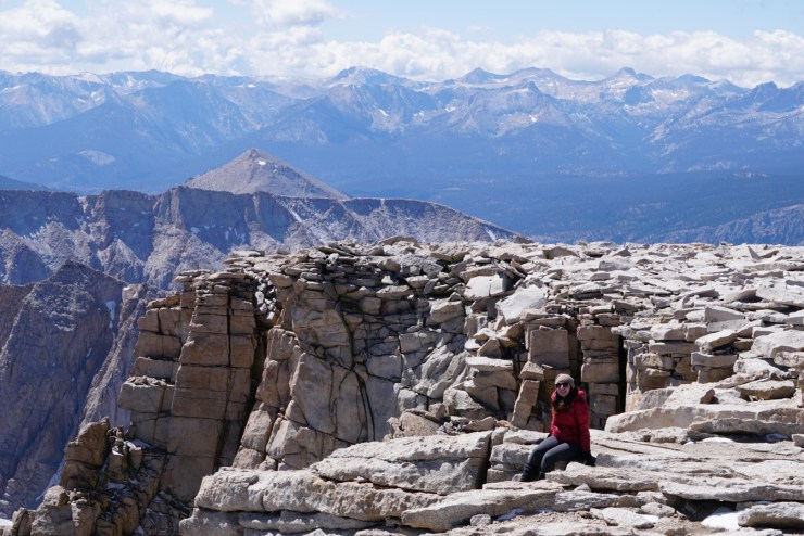
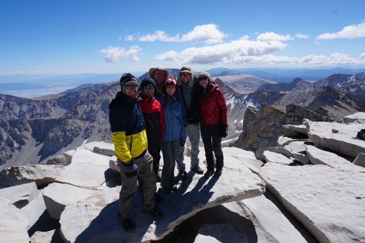
They were A-OK after we carefully negotiating a few rock fields and claimed the highest peak in the lower 48!
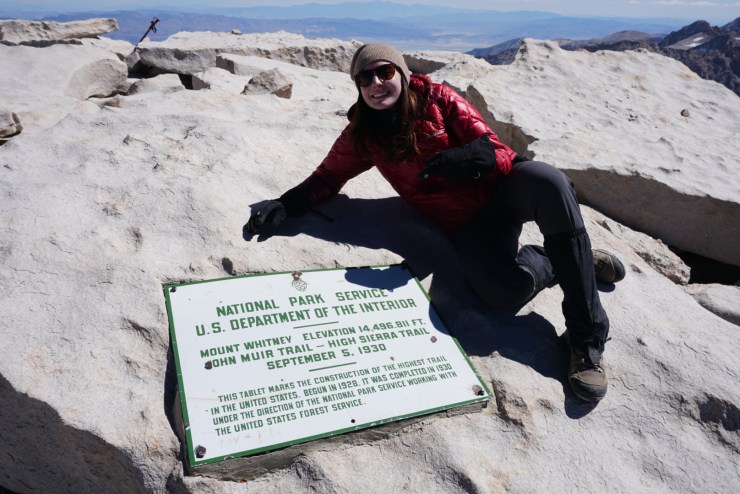

We rejoiced and took a long break at 14,508ft waiting to see if we would meet up with our friends who took the mountaineers route (John Muir’s Route).
Here’s our amazing group of hikers who all have incredible stories worth following. @elbittorna @jfavaro89 @sea_science_sam @nickpicon @jennifernicole1121
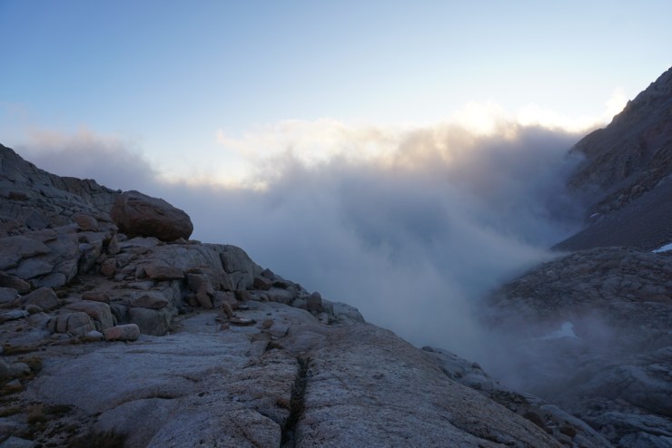
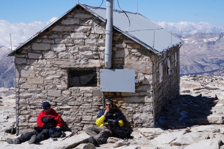
We had excellent weather but if we had ran into a storm we would have used the Smithsonian Institute Shelter built in 1909.
After some food and rest my lovely girlfriend and I both had the urge to go. A requirement for hiking Whitney is that anything that goes up must come down… They give you doo doo bags with your permit and I put that in a Pringles can for safe and easy transportation. This was defiantly the best view I’ve had while doing my business.

It was about 1pm when we started our 11 mile descent. We were feeling happy and accomplished as with each step our oxygen levels increased! This time I took a bunch of pictures before getting back to the Trail Crest.
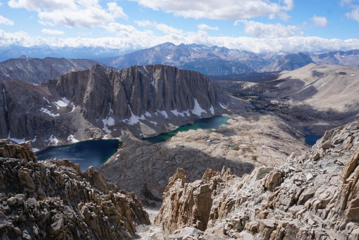
Being on the backside of the Needles was way cool and so much different than the eastern slope. The next section, the Windows, had views looking thousands of feet down to both the east and west.
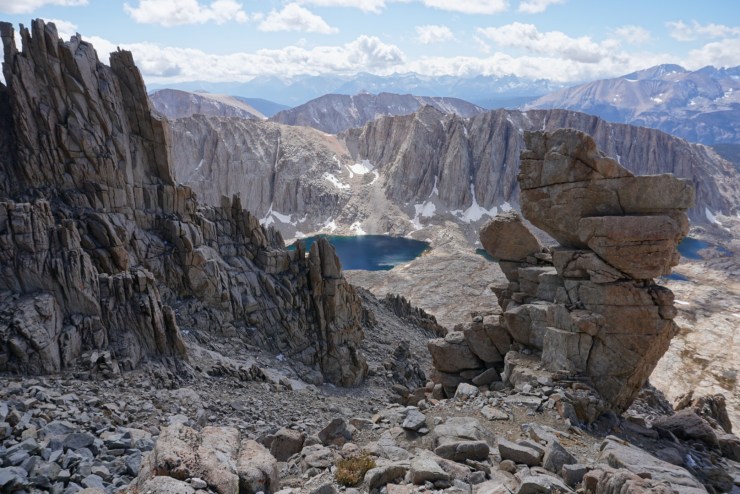
The beauty of the High Sierra is unmatched!

Spirits were high as we retraced the 99 switchbacks.
You’ll know you’re halfway done with the switchbacks when you reach the cables. There’s commonly ice here so the cables are lifesavers, literally.

It’s always a special feeling when you can see a mountain that you’ve climbed from a distance.
Our second time at Trail Camp was much more enjoyable!
Daylight was burning though so we slugged our way down as fast as we could. We’d only stop to pick up our camping gear and cook some food. With 3 miles left the sun dropped below the horizon.
I couldn’t find my headlamp so I had to rely on my team and the stars to navigate back to Whitney Portal. We reached our goal and so did our 2 other friends who came running down right behind us! We talked about camping but the idea of sleeping in a real bed urged us to drive back to LA. We slept like rocks and boy was it a treat to be recovering at my Uncle’s beautiful home.

I had no feeling in my right big toe but I’ll only remember what we saw and accomplished! I’ll be back for the JMT or the High Sierra Route!
P.S. If you’re in LA go to a restaurant named Little Sister and order the Shaky Shaky Beef. Glorious!

Beautiful place
LikeLike