Dec 27th, 2016 – Jan 6th, 2017
Just as a free safety would do on a running back sweep I ran “The J” from Georgia to Washington.
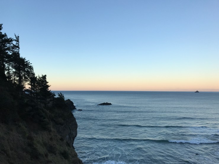
![CropperCapture[2]](https://grantcappy.com/wp-content/uploads/2017/04/croppercapture2.jpg?w=740) Highlights:
Highlights:
- Vicksburg National Military Park, MS
- Carlsbad Caverns National Park, NM
- Guadalupe Mountains National Park, TX
- Saguaro National Park, AZ
- Joshua Tree National Park, CA
- Pinnacles National Park, CA
- Redwood National and State Parks, CA
- The Oregon (Peoples) Coast

Leaving Hotlanta was tough. I am extremely grateful for the support of my friends and family and for my 23 years as a Georgia native! But in an effort to accomplish my dream of visiting every US National Park I’d be relocating myself to Seattle, Washington.

After much appreciated help and sad goodbyes I was on the road with all my belongings heading west. From Suwanee to Jackson, Mississippi I killed at least 100 million bugs. With foggy weather that’s really the only thing to note until my arrival at Vicksburg National Military Park.

The drive thru park in Mississippi has over 1,400 monuments and tablets honoring the courage and sacrifice of Union and Confederate troops during the Civil War.
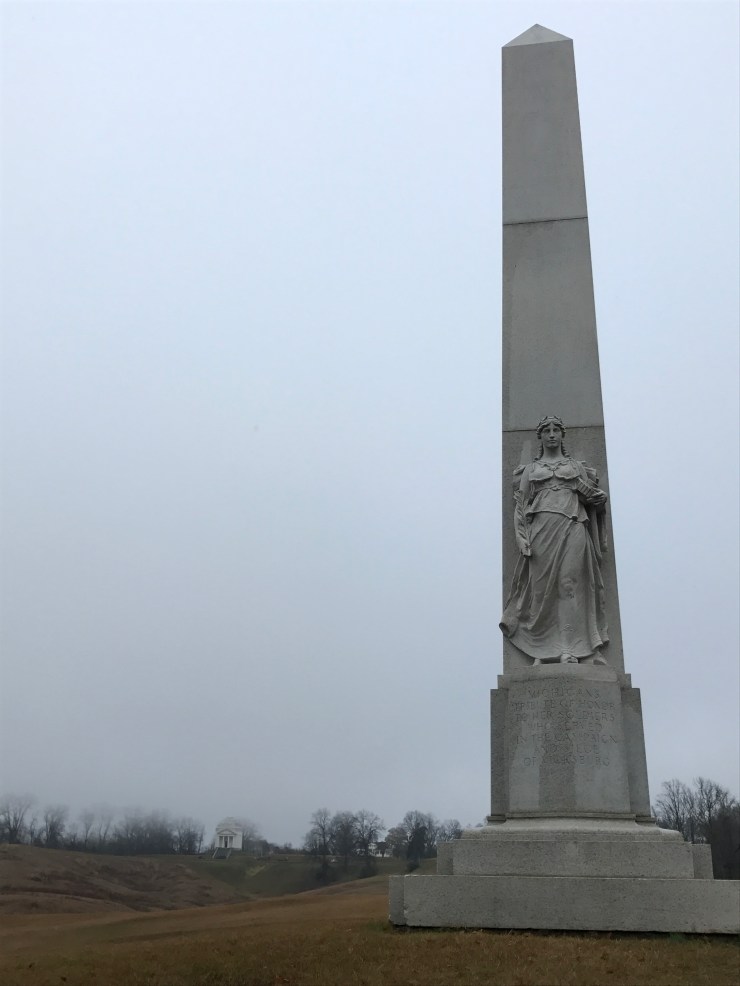
I really loved the Michigan (above) and Illinois (above left & below) monuments.

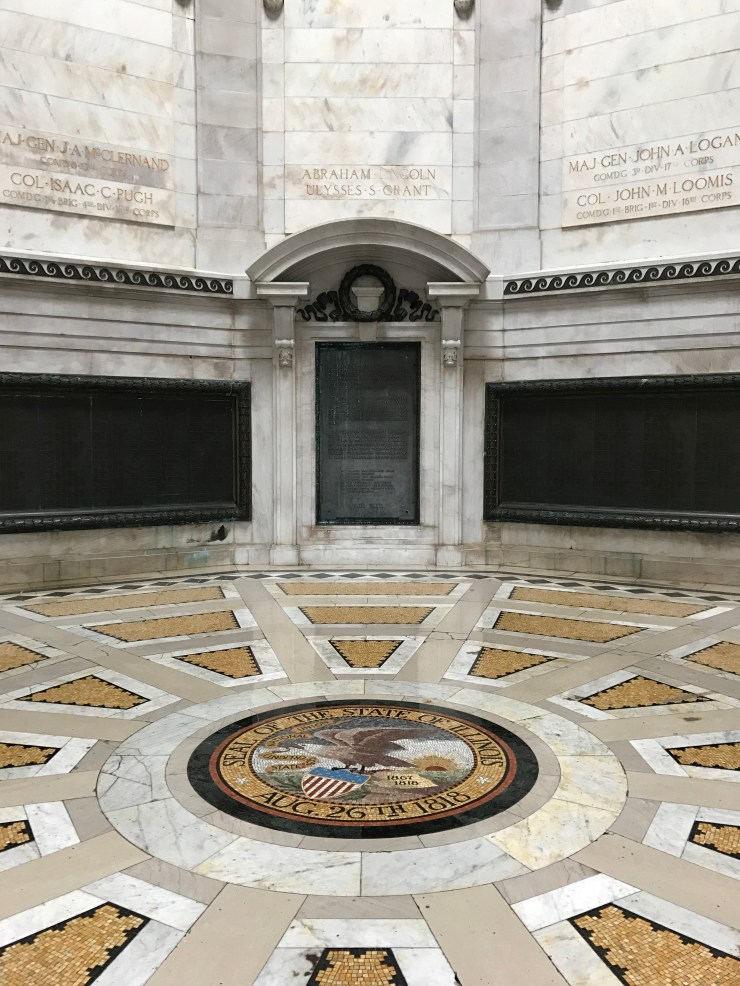
The two most important names during this time period were President Abraham Lincoln and Major General Ulysses S. Grant.

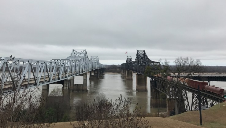
It was my boy Ulysses, the military genius, would eventually take over Vicksburg and provide Abe with the key to a Union victory. Being named Grant I’ve always been a big fan so I paid my respects and bought his personal memoir book. Just outside the park is the largest drainage system on the North American continent, the Mississippi River.
After a quick hello I’d make a second pit stop to hike to the highest peak of Louisiana, Driskill Mountain. As you can probably guess it’s a short hike but once parked at the trail head (Mt. Zion Presbyterian Church) I decided against it. Something was off about the one person and vehicle in the parking lot and I did not want to risk all my valuables being stolen for a 535ft summit. Happy to have all my possessions I continued west on I-20 to complete the longest leg of the trip in Fort Worth, TX.
I would stay the night with a gracious family friend before leaving promptly at 4am. Ahead of me was a 6 hour drive to Carlsbad Caverns National Park. I would finally be veering off I-20 but nothing ever seemed to change in Texas. The roads were perfectly straight, the landscape was dry and yellow, the wind was wicked strong and the sky was as expansive as I’d ever seen it!
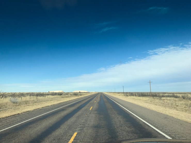
I’d quickly learn that wind was my worst enemy especially in places like west Texas and New Mexico. The cheap tonneau cover containing my life’s possessions would pop open anytime the wind picked up or if I was going over 65mph. It was frustrating at times but that all changed after seeing the first mountain range in 1,500 miles and realizing that half of the driving was over!

I’d be sleeping in those mountains that night but first I’d go below the surface into one of the deepest and most ornate caves ever found!

I’d love to come back and get dirty on a wild cave tour but strapped for time I choose the self guiding option. I started by walking in the natural entrance. The 1.25 mile route descends 750ft into the Big Room. In every possible direction you look there is a different otherworldly feature.
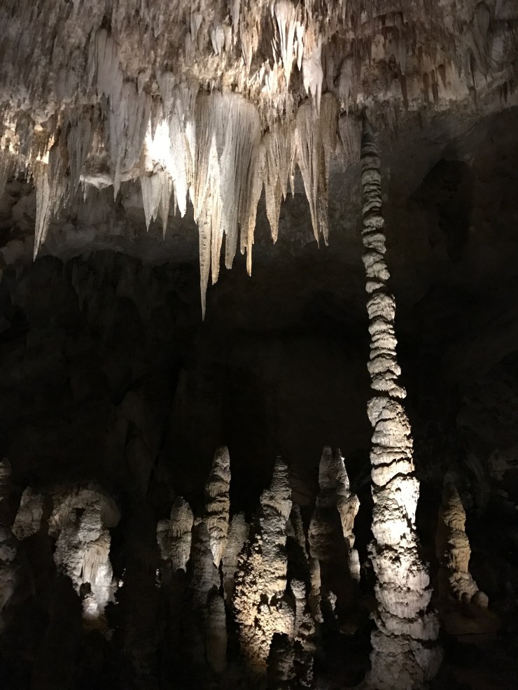
The “Big Room” covers an area equivalent to 14 football fields with a 255ft ceiling making it the largest know chamber in the US and 7th largest in the world!


The Big Room is even wheelchair accessible as an elevator drops into the cave straight from the visitor center. Anxious to get to the mountains I’d take the elevator up. The Guadalupe Mountains National Park in Texas is only a 30 minute drive from Carlsbad Caverns National Park in New Mexico!
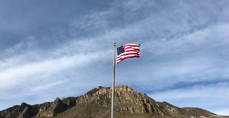
Although I’d see an American flag upon arriving I felt as though I was in Africa for some reason. I was amazed and so excited to do some backpacking until I found out they already hit the permit limit for the day. Luckily there is a campground near the Guadalupe Peak trail head so I stayed there.
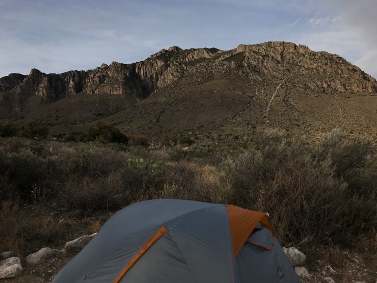
With daylight fading I’d get a quick taste of tomorrow’s hike before a much needed rest.

The cloud formations where crazy!


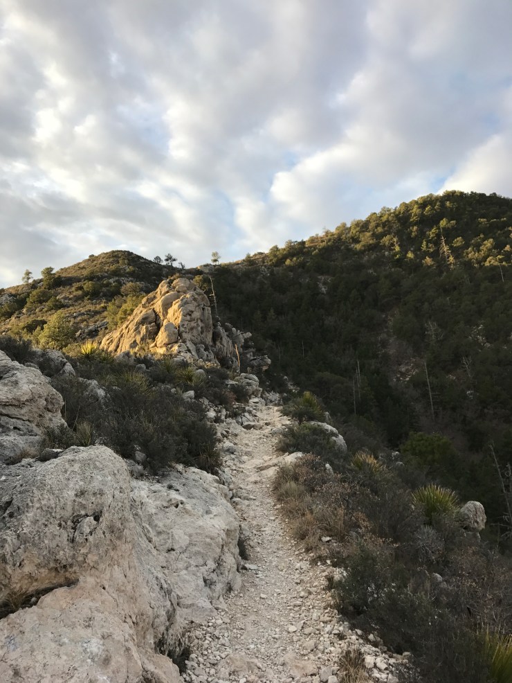
Another early night lead to an early morning. With a few stars still out I’d began my hike to the highest point of Texas! 45 minutes later the sun made its grand entrance.

The white sandy trail was easy to follow although there were many exposed cliffs.

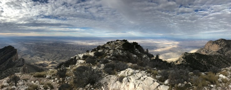
With every step the view of the same mountain range would get better and better.

The first light on the mountains were spectacular!


Who would have thought heaven would be in west Texas!
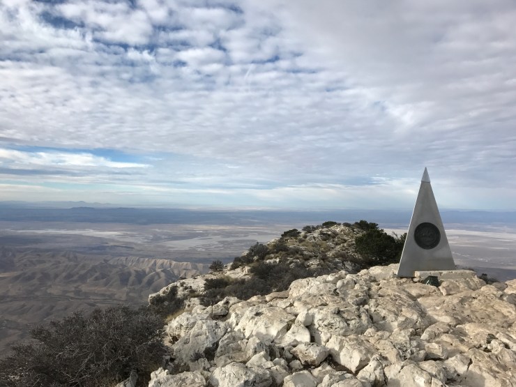
At about 8am after 3,000ft of elevation gain I made it to the 8,749ft summit of Texas. I was greeted by a significant decrease in temperature and a significant increase in wind.
Beams of light were shinning down on the open plains of Texas through cracks of the cloudy sky. The scene was incredible and once again I wondered if this is what Africa looked like…

I snapped as my pictures as I could until my hand went numb.
Before descending I found a spot that wasn’t completely exposed to take a rest and have a sandwich. The new found grandeur of Texas made it hard to leave but my hands were frozen and I had a 6 hour drive ahead of me. It was time to head down.
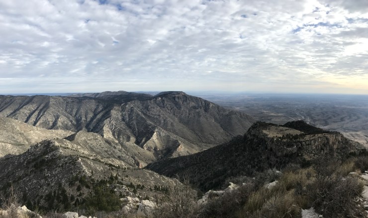
Right before the summit you’ll be standing over El Capitan a beautifully rugged peak facing west. On the drive out I was stuck looking in the rear view mirror but if you are coming in from the west you are in for a major treat!

About a mile down from the summit I’d run into the first other hiker who was decked out in Montreal Canadian gear and holding a hockey stick. Of course I had to ask and it was serving him two purposes. Trekking pole and photo prop. I should have taken a photo with him but he was nice enough to take a photo of me.
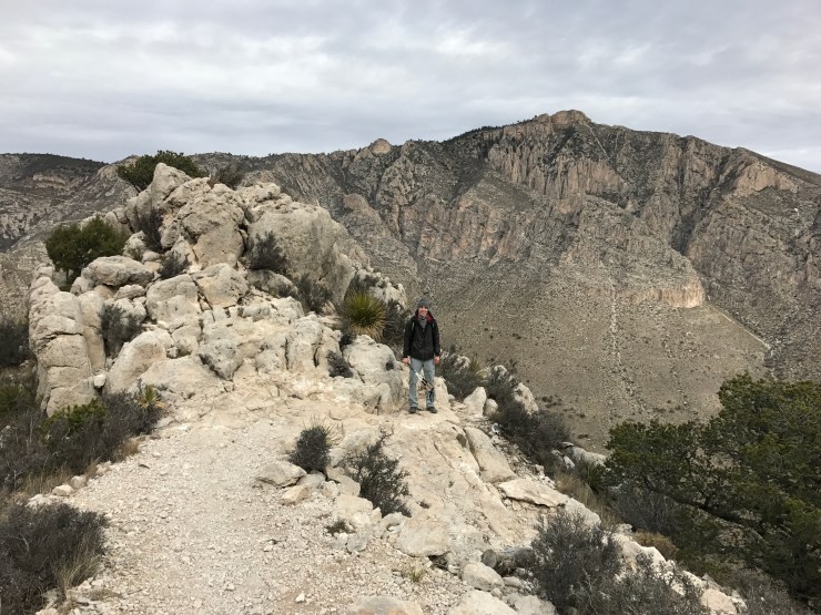
With very little expectations coming in I was blown away by this enchanting place. Since that day I have considered the Guadalupe Mountains the most underrated National Park and one of my favorites! I was in such a happy place until I began driving again.

I was back to open plains and insane wind. The words I choose when describing the wind in my notes where a bit more vulgar. I think that was right after avoiding a few tumbleweeds and of course a few pit stops to snap the cover back on. Lucky for me Arizona was there to lift my spirits. The gorgeous mountains ranges surrounded by flat desert made for an epic sunset.
That night I’d be camping just outside of Saguaro National Park’s west region at the Gilbert Ray campground. It was completely dark driving in but I could see cactus lined the road and was stoked! It was a very windy night but the white noise it created kept me sound asleep.
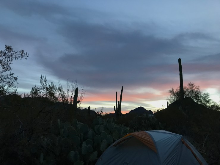
Waking up felt like Christmas morning having no idea what would be (under the tree) outside the tent!

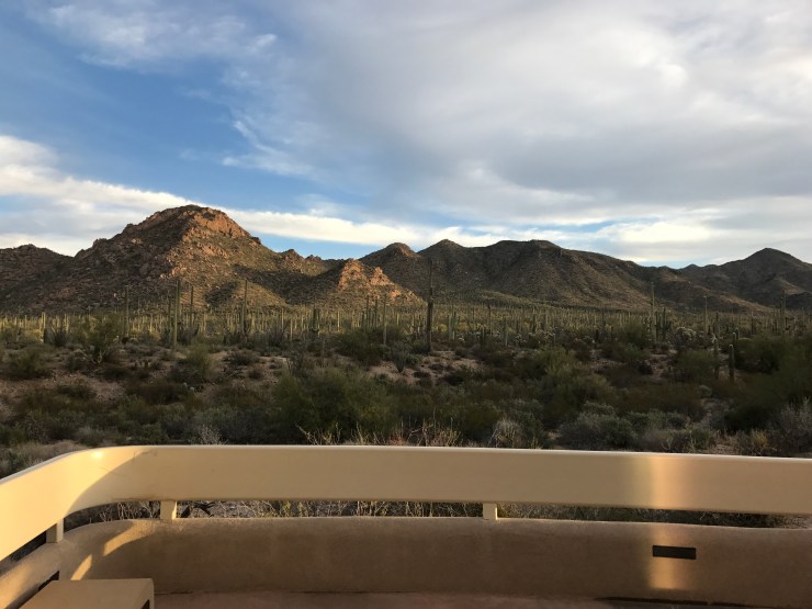
It was a great surprise and just the energy boost I needed to start the day. Later I’d be taking another 6 hour drive this time to Joshua Tree. So my half day visit in Saguaro (pronounced without the G) National Park started at the Red Hills Visitor Center. There you can take the cactus garden trail to learn about some of the flora you’ll encounter.
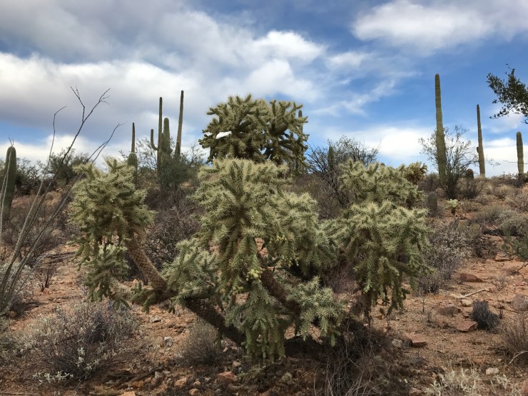
You’ll quickly recognize the icon of the American Southwest. It’s what you think of when someone says cactus and they are beasts! Reaching heights of 50ft and weights up to 8 tons the Saguaro Cactus stands as the largest cactus in the US and the largest living organism in the Sonoran Desert! With all that said I think my favorite cacti were the Teddy Bear Cholla.
You’ll find at least 25 more species of cacti throughout the park but if you only have a few hours I’d suggest taking the 5 mile Scenic Bajada Loop Drive through a dense Saguaro forest. It’s a graded gravel road with a few fascinating trails to take.

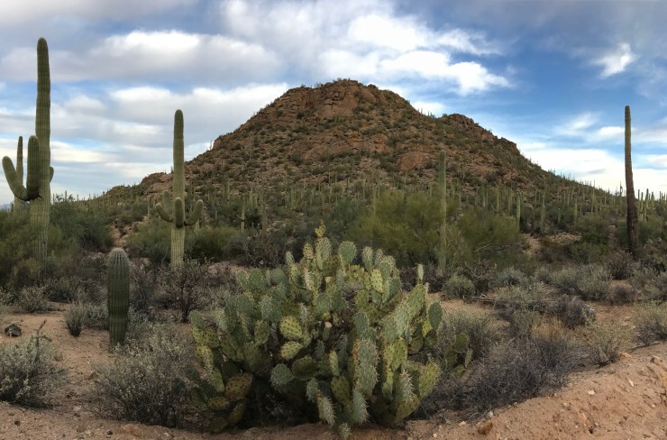
The first trail going counter clockwise takes you 1 mile to the Valley View Overlook where there must been a billion Saguaro Cactus.

Outside of this massive valley the area was much more mountainous then I envisioned. I have to return to explore the even more mountainous East region.
This trail was also a great spot to search for the perfect cactus. I felt shallow but in the end of my search I decided on the most odd looking Saguaro as my favorite.

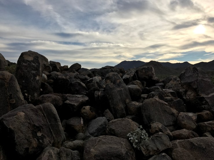
The next trial takes you .5 miles to the Signal Hill Petroglyphs. There are only a few petroglyphs still visible today but it’s also a nice spot to scan the valley for wildlife. After only a few minutes I witnessed a coyote prancing around!
The weather was perfect which made leaving a drag but I couldn’t be happier to be going from a desert heaven to camping two nights in Joshua Tree with a few friends old and new. Shout out to Arizona for being the only state with a clever ‘don’t drink and drive’ sign. “Drive hammered, get nailed”

If you’ve ever looked at the Yelp top 100 restaurants in the US you should. It was there I found the perfect stop just off I-10 in Indio, California. TKB Bakery and Deli was by far the best sandwich I’d ever had! It was called the Trump and they made a point to clarify there was no connection with the president.

Saving the other half for dinner made for a happy palate. Along the way I also received some happy vibes coming from exactly where I was headed!

I’d keep the uplifting day rolling at the visitor center in Joshua Tree National Park before setting up home at the Blackrock Campground.

It was a wonderful bonus to reunite with a great old friend and to meet his fun and entertaining friends. A bunch of them were originally from Georgia so I’m glad I saved a pack of Sweetwater 420 to kick off the weekend. They were pros at car camping and that made the last days of 2016 and the first day of 2017 very enjoyable! During my one full day we explored by car and foot!

Joshua Tree National Park is a haven for hikers and especially for rock climbers. It seemed like every collection boulders had a few tiny humans scaling up it.

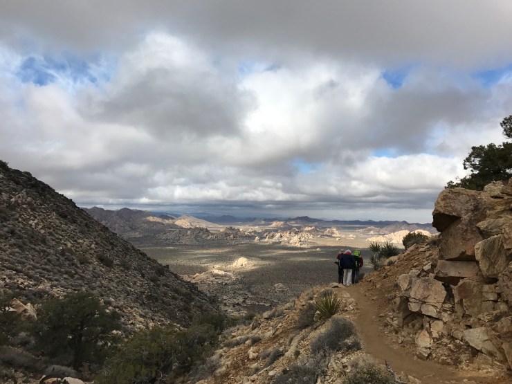
Our first stop at Key’s View felt like we were looking out the window of a plane. We had a crazy expansive view of the Coachella Valley, San Andreas Fault, Salton Sea and the Santa Rosa Mountains.

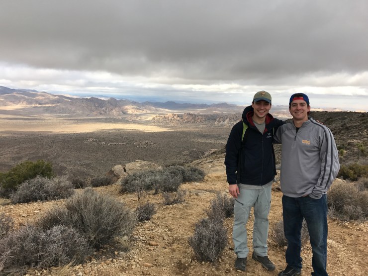
Next we would use our legs to get to the summit of Ryan Mountain! Instantly the trail provides exceptional viewpoints and a good workout.
1,000ft up you’ll have a 360° view of a wonderland of rocks and cactus.

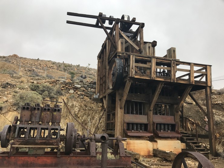
We didn’t stop there as our next hike was the 4 mile Lost Horse Mine trail. This trail lead to a whole new world that was both ominous and cool.


We found the mine but no horses.
After a trip back in time we finished the day climbing rocks in the Hidden Valley.


Probably the most fun hike if it counts as a hike! From there we wrapped up 2017 with some fun by the campfire and thankfully no one got hurt!

It was a satisfying feeling to start the year in a National Park with great friends and a bunch of Yuccas! Although after a delicious meal of eggs woodhouse and a quick climb up the nearby hill to see white caps I’d head to LA for football.

I’d stay with my generous uncle who took me to see the LA Rams play in the Coliseum!


They lost to the Arizona Cardinals 44-6 but there was no shortage of action! Soon after I was disappointed by my Lions yet again but that loss meant they would play at Seattle in the wildcard the day after I arrive… Of course I bought tickets! After a bit of serendipity and a good night sleep I’d leave early to head north. The color greens in central California where amazing greens I had never seen before.
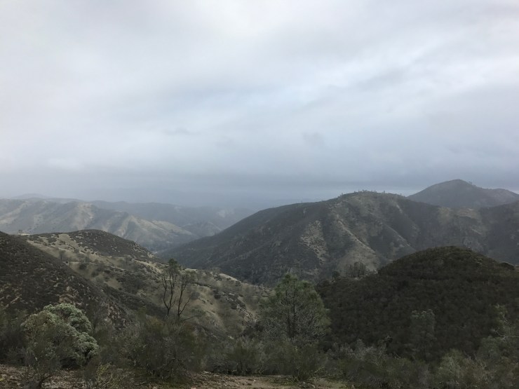
It was very interesting and windy but things got even better once arriving at Pinnacles National Park! It’s the most recently established major National Park but it’s been a National Monument since 1908!

The landscape is unlike any other. It’s covered by eroded rock formations from a volcanic eruption that happened 23 million years ago.

I took the 5.3 mile Condor Gulch to High Peaks Loop for a challenge and a chance to see the heart of the park. You can extend the hike to walk through the talus cave to a stunning reservoir.

From there I was on the lookout for a California Condor, the largest North American land bird. Many call here home but I only got to see their views and friends.

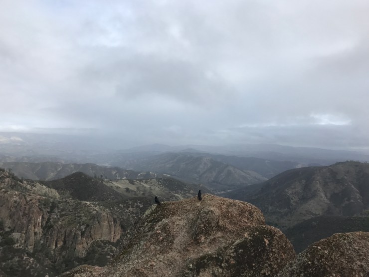
At the highest peak I had service and was able to catch up with a few friends before heading to San Francisco for the night.

My plan was to leave in the morning to explore Point Reyes National Seashore which I fell in love with my first time visiting but Mother Nature said otherwise. Bad storms and winds that reached 70 mph in the park and 50mph in the city kept me shacked up in one of my best friends apartments for an extra day. I found a break in the storm and was still able to check out a park and my favorite breakfast spot in San Fran, Eight AM.

I was very thankful for another night with a lifelong friend in Nob Hill before I’d continue my trip north the next day.

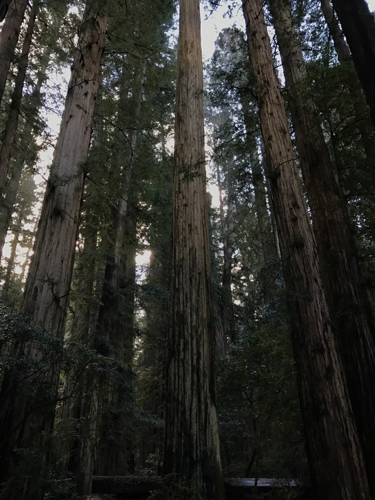
I had to pass Point Reyes but from San Francisco to Washington I stayed locked to Highway 101! My first stop was in the Redwood National and State Parks. I searched for some whales before a much easier search for tall trees.
My left knee was giving me trouble so instead of a long hike I took a gravel road (Howland Hill Road) through Jedediah Smith Redwoods State Park. This gave me that small feeling I was looking for.

I was waiting for a storm trooper or wookie to come running out of the forest but they must have been hiding. Thinking I was in a Star Wars film plus the little fog and afternoon light made for a memorable scene!
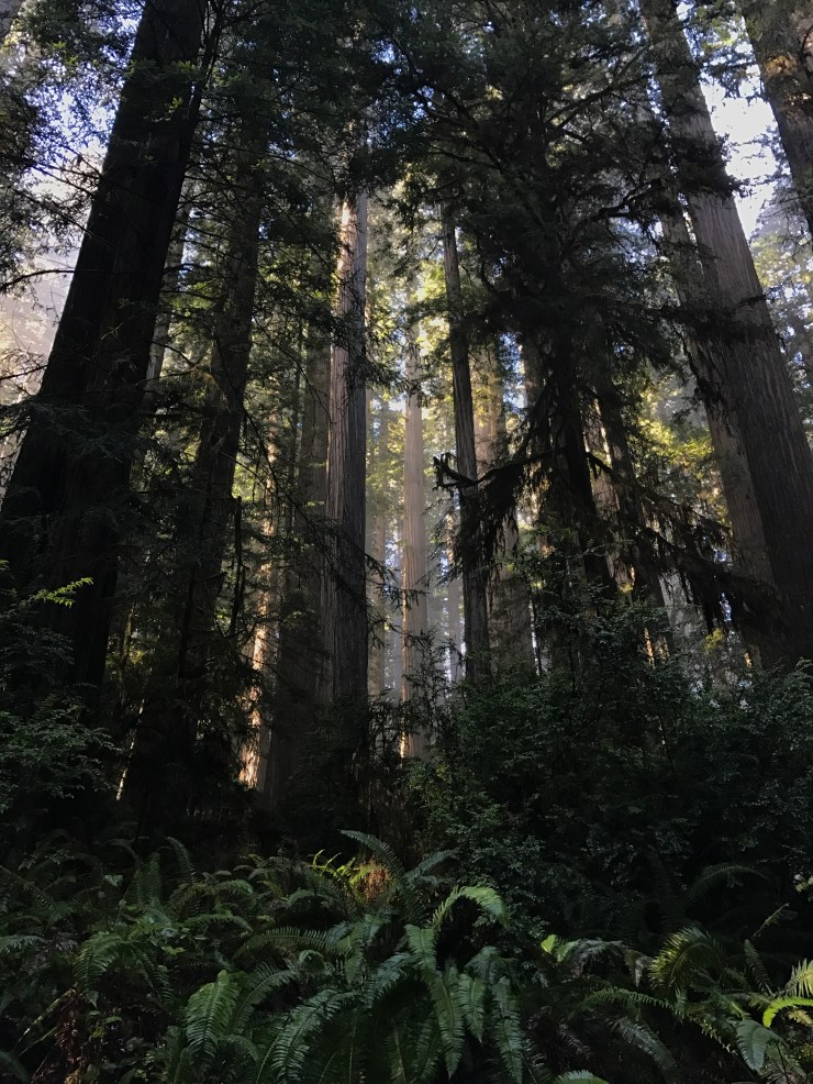
I couldn’t go without a short hike so at the end of the road I took the 1/2 mile Stout Memorial Grove trail. I was never rushed in the car but it was nice to slow down even more and take in these towering old growth Redwoods by foot.

You know what they say, good things come in trees!
I was totally satisfied but it was still early in the day so I decided to get a head start on the Oregon coast instead of camping in the Redwoods. If you can take a long hike do the James Irvine/Fern Canyon loop. I’ll be back for that and much more.
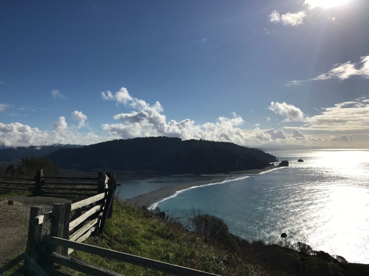
Not too far into Oregon I found a nice camping spot at Harris Beach State Park. I had an amazing spot for a sunset over sea stacks and the mighty Pacific!

Once the sun set I went into the town of Brookings to have a real meal and fill up the gas tank. It was another early night as I had a lot of stops planned for the Oregon Coast.

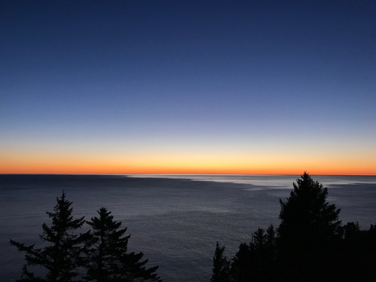
The Oregon Coast is nicknamed the People’s Coast thanks to the passing of the Oregon Beach Bill in 1967 which allows free beach access to everyone! All 363 miles of beach are free to the people and each mile is spectacular! I started before 5am and was graced with some pretty colors in the Samuel H. Boardman State Scenic Corridor.

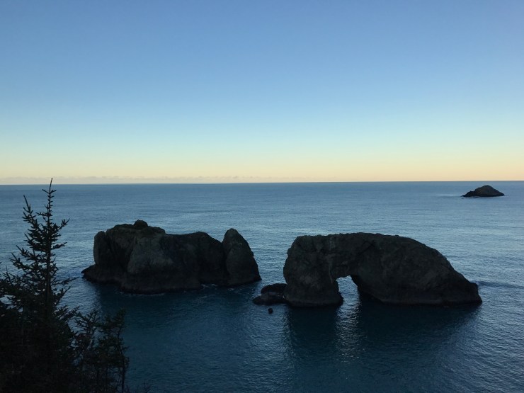
This corridor is one of the best. It has a number of inspiring viewpoints and interesting geology like the Natural Bridges. From here I slowly meandered up to the city of Bandon where I stopped for a little hike around Kronenberg Park to Coquille Point.


Sea stacks make for some majestic sights and they just kept getting better. The 101 soon became lined with snow and even though I didn’t listen to music or use cruise control I was even more locked in. It was easy to do since everything was so interesting and new.

I was so stoked to check out the Oregon Sand Dunes NRA but when I arrived the side road to get there had over a foot of snow covering it. I knew the dunes had to look insanely cool with snow but I didn’t want to take the chance of getting stuck so I continued on. Luckily just up the road were about a hundred sea lions to cheer me up!
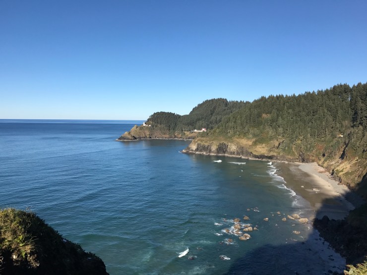
It’s hard to tell but they are all relaxing down there in the shade. That was at least my thought until the gentleman standing next to me told his friend they were all probably doing it… I then focused my attention to the Heceta Head Lighthouse in the distance. If you have time you can explore the sea lion caves for $10. I again continued north making my next stop at Thor’s Well.

The real attraction to this area is during high tide when water from all sides dumps into ‘the well’. It was cool to explore during low tide though!

From there I stopped at a few more oddly named places like Devil’s Churn, Devil’s Punchbowl and the Spouting Horn. Each place was awe-inspiring but what stood out to me the most was a collection of random sea stacks off the road close to sunset. I’m glad I turned around for it!

I couldn’t believe how clear and nice the weather was after hearing so much about grey skies. The weather would even follow me into Washington which I am really grateful for having lived here for a couple months and knowing what the weather is usually like. It was pretty cold camping but the scenery like below at Hug Point made it all worthwhile!
My last day started early as usual but I wasn’t alone thanks to a sweet white bunny that helped me put up my frozen camp. He didn’t join me but I quickly hopped over to Cannon Beach.

There were no clouds and more colors to put a giant smile on my face! The Pacific Northwest was making great first impression. I stayed close by to walk around the sightseeing mecca that is Ecola State Park.

The rocky beaches and grand expanse of ocean was incredibly humbling.


At this point my end goal was in sight and I felt like I had seen everything I wanted to plus some. Before I’d venture into my final state I’d stare in the distance at the Tillamook Rock lighthouse dreaming of paddling out and finding it made entirely out of cheese.
Once out of my daydream and after going through all the excuses to stay I eventually took Rosie’s talents into the state of Washington!

I continued on the 101 until turning east at Aberdeen, WA. From there it was smooth sailing to Seattle. Another blue bird day gave clear views of The Mountain (Rainier) and my new city!

It was a wonderful feeling to make it to Seattle with all my stuff and truck intact! I had a lot of people to thank but no one more than my badass purple truck!

3,000+ miles no problem!!


This is phenomenal. Excellent, excellent job chronicling your sojourn. Excellent photo’s and commentary. Just enough, not too much like I would do. “Brevity is the source of wit”. I finally have the time to look at these and I am in awe. (btw, I got your nice call thanks, I’m doing just great.) I would not have known about W. Texas, who knew? I saw Grand Canyon, Sedona and Flagstaff, the San Joaquin Valley, near, I say NEAR,Yosemite -probably the biggest regret of my life, being 70 miles away and not going- [too stoned I guess]. I did drive up the Oregon Coast from California, but alas I did it at night, then on into Seattle, for the next year and a half. Your shots of the Oregon Coast are awesome. One thing to keep in mind, it rarely if ever, snows on the Oregon Coast. I think I remember hearing it was the first time in 35 years when we were in Bend, and you saw it! It may not ever be that clear on the coast again in years, what good fortune. Yeah, you will experience the rain-forest part of the Pacific NW, and it does get grey, but you will have your chances to get out and enjoy the days in the summer months that I found to be the most beautiful places I have ever seen or lived in. The Olympic peninsula divided by the Puget Sound and Elliott Bay and the mighty Cascades and Rainier. I took your Mom up to some friends about 45 minutes North to Skagit Bay or Snoqualimie Pass, I don’t remember. But anyway, you would make Teddy Roosevelt proud. You have gotten out and gotten into this Land! That was intention in establishing the national park system. Hell you camped alone! Your Mom musta shit. I also never knew about US Grant, but of course! Probably not the most popular name in Atlanta, but I like it even better now…..the park in Mississip looked very cool. I guess you will be updating your blog with the 2 parks in WA you’ve visited and now Hawaii…how did you manage that you guy, you? I eagerly await those chapters! Very ,very good job on the blog and on the trip. I hope I can forward this somehow to Andrew, we will be asking your opinion on gear as we plan on doing some camping ourselves this summer. We have air miles, maybe we will get to see you on your turf or better yet, somehow meet in Utah for the Fab 5,we’ll see. Take Care God Bless Loved It
LikeLike