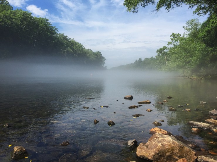
Nothing better to kick off a three day weekend than waking up early to fish on the Chattahoochee River. Especially when your friends bring all the gear and the hooch has that beautiful morning fog. We dropped in at Buford Dam and stuck around Bowman’s Island until we got tired of casting. We didn’t catch as many trout as we hoped but the plan was to cook what we caught. Don’t take our advice but we found a nice uncovered beach along the shore with dry rock to cook up the Trout. My MacGyver like buddy was in heaven gutting the fish, building the fire and putting together a great meal. Although since we didn’t catch much I decided to leave them to their feast and head to the mountains. I paddled 4 miles to Settle Bridge like a man possessed. From there I dropped off my kayak, grabbed my prepacked backpack and was off towards North Carolina.
My first destination was Max Patch a gorgeous bald mountain on the NC/TN border and part of the Appalachian Trail. It’s about a 3-hour drive from Atlanta and the last 8+ miles are on gravel roads. 2 miles into the gravel my gaslight came on. Dumbass! I knew I would run out if I continued so I backtracked 15 miles, filled up and learned a lesson to always have a gas plan. Since I so frequently make mistakes I created a gear checklist to review before any trip. It does a great job of keeping me accountable.

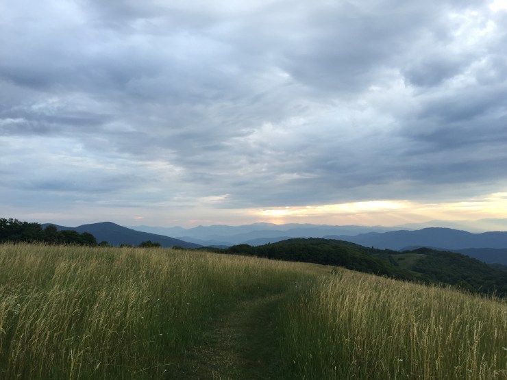
Even with the detour I made it to Max Patch before the sun had set! I was blown away in the first half mile and a mile later I was at the summit with 360-degree views of mountains, mountains and more mountains! I was star struck so I found a little patch of flat ground among the tall grass, put my sleeping pad down and just starred at the beautiful production Mother Nature was putting on.
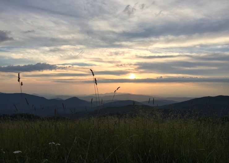
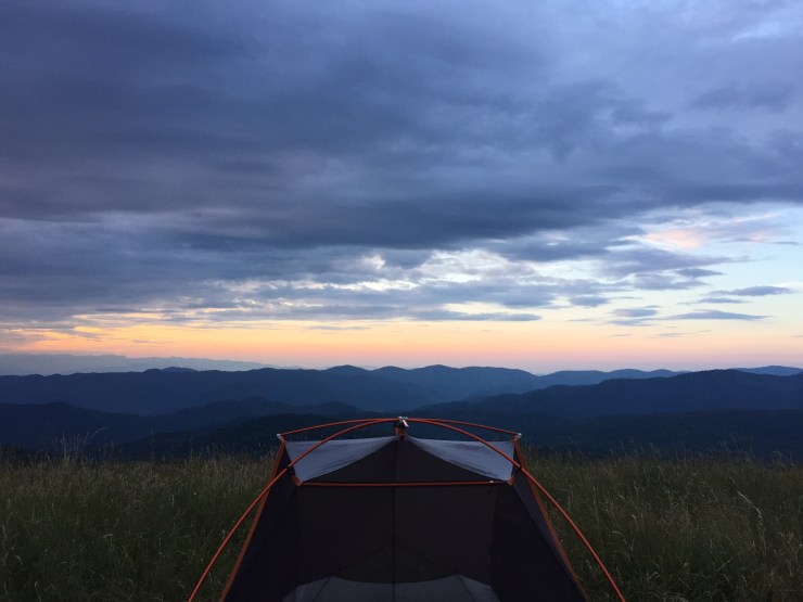
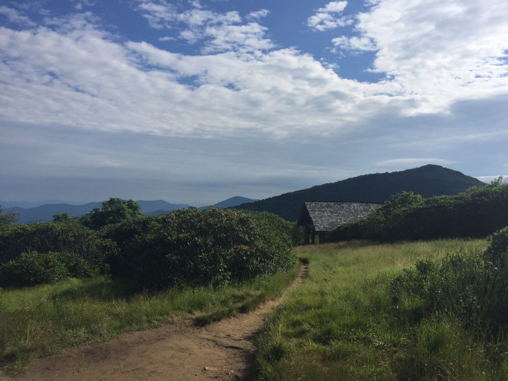
Later a group of people passed by and said they saw me reach the summit earlier and hadn’t seen someone smile that big in a long time! Needless to say I was in my happy place. Once the sun nestled behind the Smoky Mountains in the West I looked to pitch my tent. A nice hippie ended up showing me the perfect spot for sunrise and the weather was pristine so there was no need for a rain fly. That meant getting put to sleep by a magnificent star spectacle and waking up to the sun rising behind the Blueridge Mountains.
Still stoked with energy I took a jaunt on the AT. Then came back to Max Patch, took a few more photos and hopped in the truck to head towards the Blueridge Parkway!
You could stop on every mile of this scenic highway and have a magnificent view and I almost did just that. The first real stop was at the Craggy Gardens. I think I was a week or two late for the wildflowers but I saw a little color and a ton of interesting vegetation. Some I hadn’t seen before but regardless everything looks nice with mountains in the background. After a quick 4-mile hike here I was back on the road stopping after a mile.
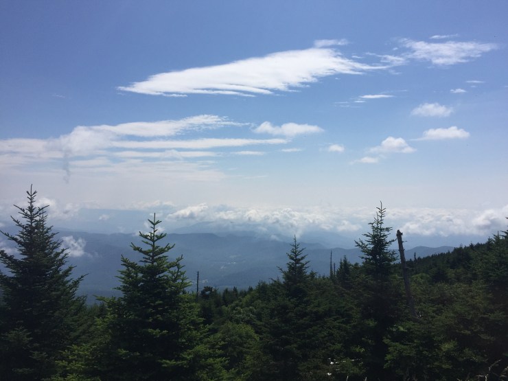
Next door was a 2-mile hike to Craggy Dome on the Craggy Pinnacle Trail and as the name suggests the landscape was rough and rugged. At the peak the views of the Parkway and the valley below are excellent. As a peak norm I crushed my favorite hiking treat (Snicker’s Almond) then continued north on the parkway.
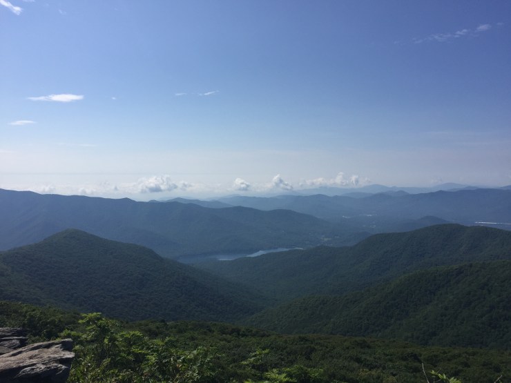
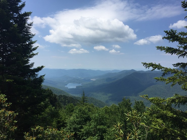
Next stop was the highest peak east of the Mississippi, Mount Mitchell. You can actually drive almost all the way to the top, which to me ruins all the fun but the views were incredible. It’s a short hike up a paved path with a lot of foot traffic but I found an enjoyable route on the way back taking the Balsam Nature trail. I highly suggest taking that up and down unless you’re starting from the base of course. It was a lush and vibrant forest with bright green moss covering everything and along the way there were little plaques with interesting information about the area. It was very cool standing atop the East but it was almost noon and time to head back South.
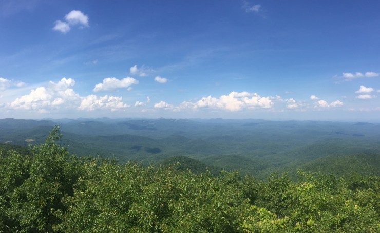
Now I was back in the home state to see its 2nd highest peak, Rabun Bald. I thought bald mountains had no trees but this one sure did. Luckily there is a viewing platform at the summit that provides an amazing 360-degree view. It’s only a 3-mile hike but was probably the toughest of the weekend because of the elevation change and I’ll note it’s not easy to find the trailhead. Search Beegum Gap for the best directions. The surrounding mountains were not as impressive as those in NC but man do those sights trigger happiness!
After 5 hikes and 4 summits I was ready to go home and pig out for the fourth of July. Thank you America for being so naturally great!